Multimedia Field Notes

The Blogcast

Vlogs, photos, and stories from the mountain, the jobsite, and the shop. Real work, real lessons, no filter.

Latest Posts

31 posts
Live · Today's Forecaster's Note

Writing today's note from live conditions…

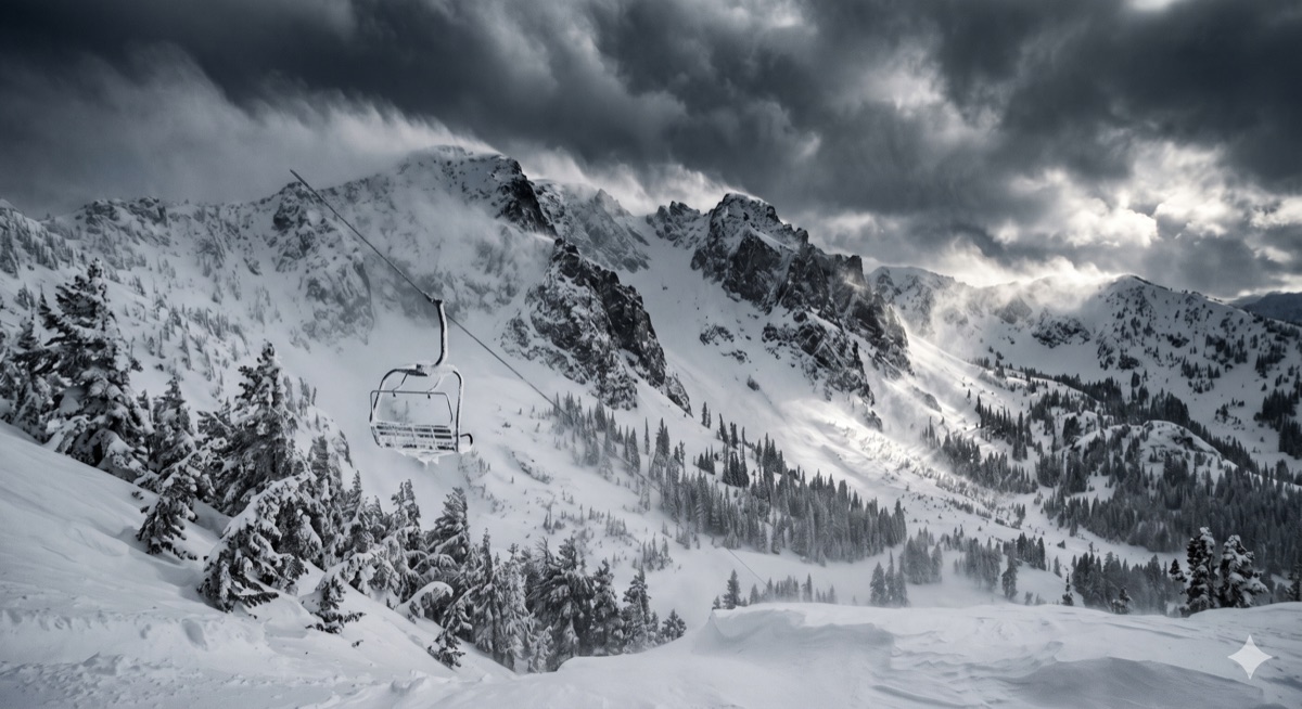
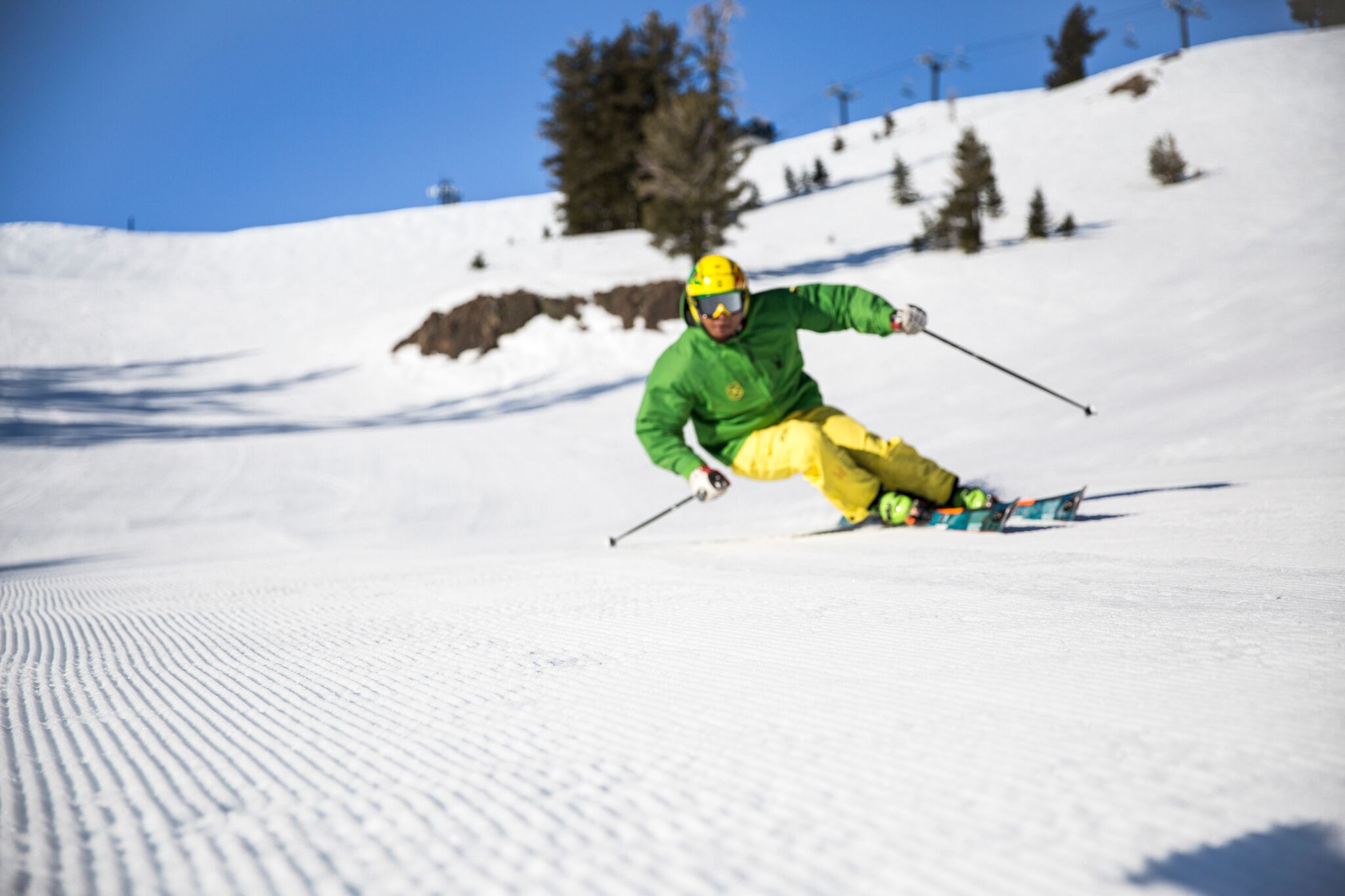
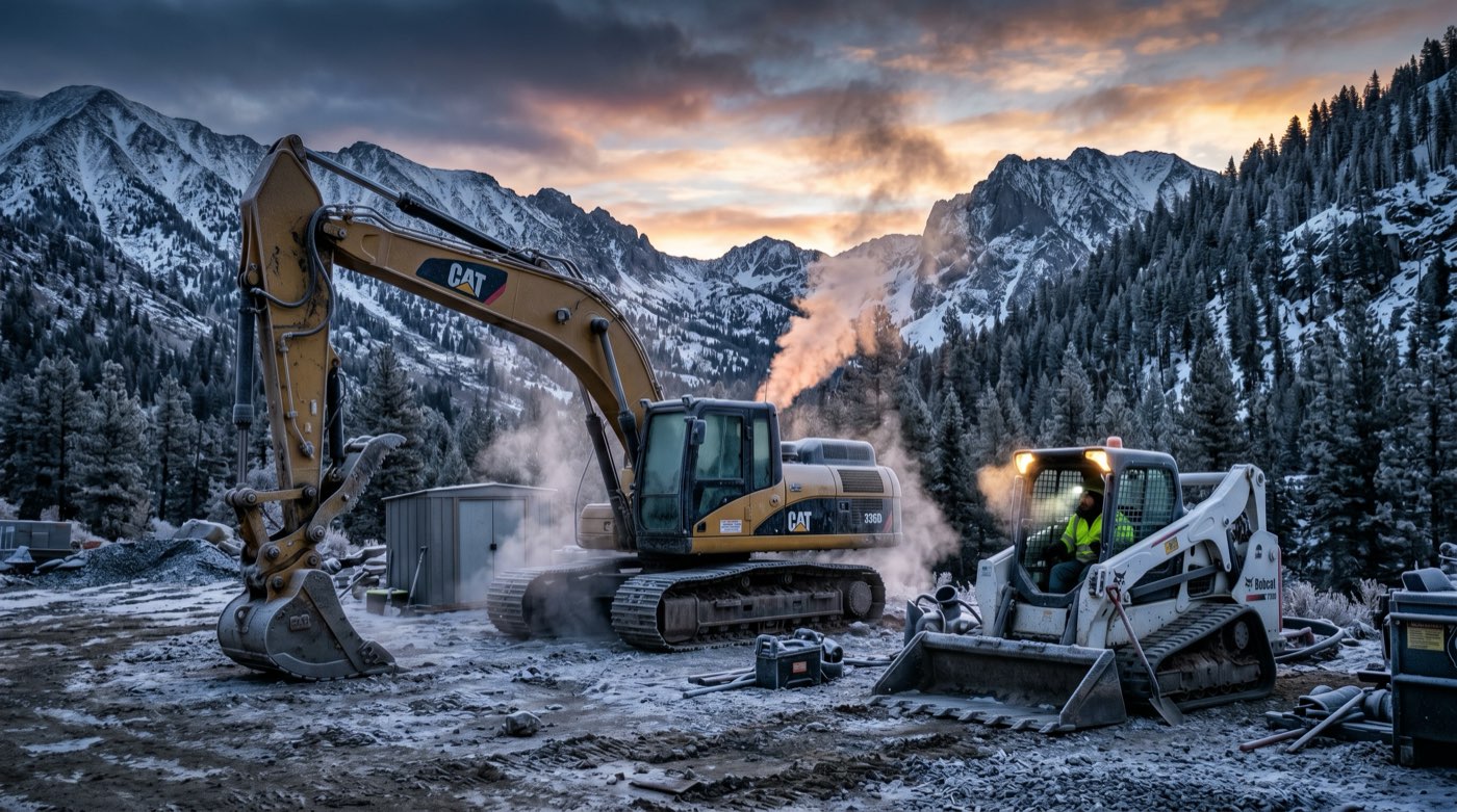
Hazy dawn over the Truckee basin under a full cirrus sheet, smoke pooled low along the river, a west wind building over the ridge by evening
15 min read
Upwind

FORECASTER’S NOTE · Sunday, September 20, 2026. KTRK read 35.6°F at 4:15 in haze, five miles: the first morning the smoke has pooled in the basin. Yesterday bottomed at 30.2, not the 26 to 28 I called and not the 42 the grid called; take eight off the grid low on a clear night. Today is GO, all systems: 75°F under a milky cirrus sheet, humidity 15% at one and two, calm until a west wind kicks up at six, 11 gusting 18, and for the first time since it lit, Truckee is upwind of Floriston. Floriston 622 acres, 45%, up from 8 in three calm days. Tonight a mid-level deck, low 40s, blankets off. Monday is the fire-watch day: 12% and gusts to 22. Circle the 25th: 700-millibar temperature falls 13 degrees in 48 hours, 48 mph over the crest, GFS 59 and a 39 gust, the pack 69 to 72. GFS alone writes 3.3 inches on October 1st and 2nd.

0 views
Read more

Forecaster’s Note · Sunday, September 20, 2026

KTRK read 35.6°F at 4:15 this morning, dewpoint 28, calm, and for the first time this stretch the remark is not clear. It is haze, five miles. Temperature and dewpoint are seven degrees apart, so that is not fog. That is smoke, settled into the bottom of the basin overnight the way cold air settles, and the airport is the first instrument to say so. The smoke model has the basin at PM2.5 of 5.4 and an AQI of 42 this minute, Good, and I believe the model about the afternoon and the airport about right now. If you can see it from the truck, it is there. Nobody needs a mask for five miles of visibility, but if you have a crew member with lungs that care, this is the morning to say so before they get out of the cab.

The number to hold next to that 35.6 is yesterday’s 32.0 at 4:35. Same minute, near enough, three and a half degrees warmer, and the difference is the cirrus I told you about last night. It came in on schedule. The airport still reports clear, and it will keep reporting clear, because an ASOS ceilometer tops out around twelve thousand feet and a cirrus sheet lives above twenty. The grid has high cloud at 100% from five this morning straight through the evening, and the sky over the ridge at first light is going to look like milk. So the blanket is on. It is a thin one. Yesterday the airport bottomed at 30.2 from 6:35 to 6:55, after a 32 at 4:35. Take the same slide off this morning’s 35.6 and you land at 33 to 34 at seven, frost on the windshield and the shaded pads, not a freeze. If you are the one who put blankets on yesterday’s pour, they held for nothing worse than that and you can pull them this morning. Sunrise is 6:46 and the coldest minute is still after it. The grid has the basin at 42.8 this minute and a low of 41 for the day. Seven warm at the airport, same as it was at this hour yesterday. Reno is 49.

Yesterday, scored honestly

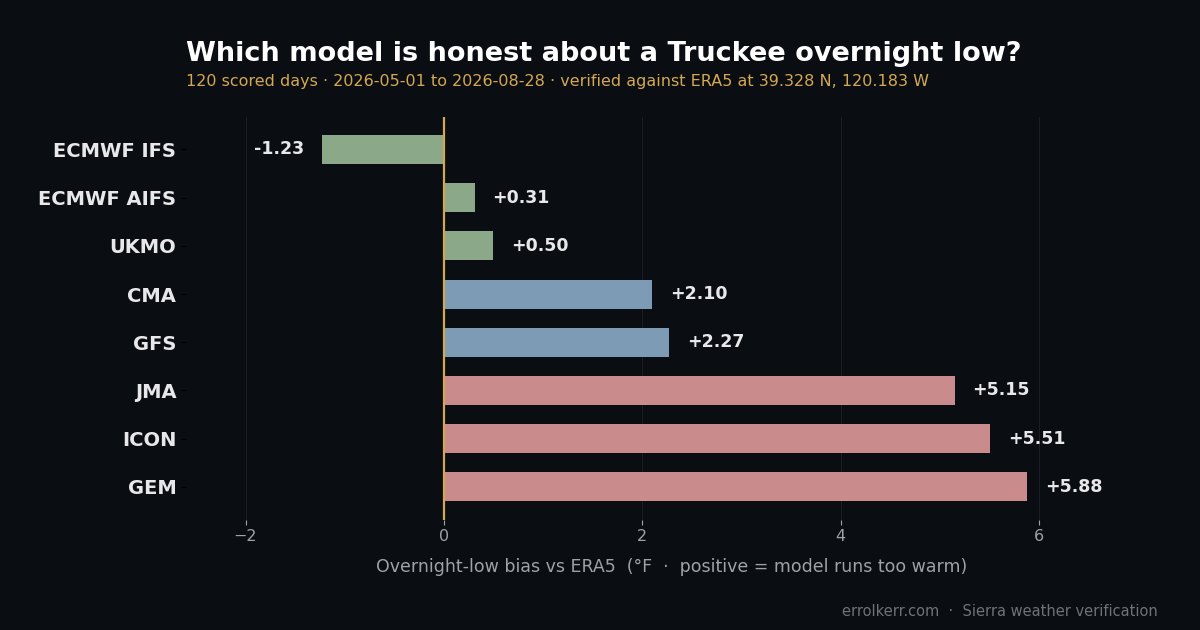
I called 26 to 28 at 7:15. The airport bottomed at 30.2. I was two to four degrees too cold, the grid was twelve too warm, and the honest read is that I overcorrected for Friday’s 24.8. The rule I gave you was take eight to ten off the grid low on a clear calm night. Take eight. Ten was Friday, and Friday had fog on the ground, which is the one thing that beats a clear sky for radiating. The high I called at 75 and the airport hit 75.2 at 3:48. Dead on for the second day. The wind I read at 7 and told you to rig for 20 because two of six gust models had a twenty-plus puff in the afternoon: the airport’s top number for the day was 12.7 sustained out of the southeast at two in the afternoon, no gust reported, and the 22 and the 26 never showed up. Rigging for 20 cost you a strap and nothing else, and I would do it again. The station scored the day 52 out of 100 against the midnight snapshot, and every point that came off came off the low. Over 59 station days now the low bias is 6.7°F warm, the high bias is zero, the wind bias is six tenths under. The grid knows the afternoon here. It does not know the night, and it is not learning, because the reason is the shape of the ground and not something a model tunes out.

Today: GO, all systems, and the turn at six

Full production day. Temperature: 41 at seven, 43 at eight, 52 at nine, 59 at ten, 66 at eleven, 72 at noon, 75 at one, 76 at two, 77 at three, 76 at four, 75 at five, 70 at six, 64 at seven, 61 at eight, 56 by eleven tonight. The pack on the high reads 72, 73, 74, 74, 74, 75, 76, 77°, AIFS on the bottom at 72 and the grid alone on top at 77; read 75 and take 77 if the cirrus thins. Reno hits 80. The sun is under a sheet all day, so UV drops to 5.3 from yesterday’s 6.7, and the afternoon will feel a degree softer than the number, which is the only thing the cirrus does for you between nine and five.

Humidity: 44% at seven and eight, 38 at nine, 29 at ten, 22 at eleven, 18 at noon, 15% at one and two, 16 at three, four and five, back to 25 at six and 31 by eight. Fifteen is the line and it sits on it for two hours. Dewpoint at the surface is 21 to 27°F through the afternoon. That is the fourth afternoon running with desert air on the forest floor, and the fuels are one day drier than they were yesterday, which was one day drier than the day before.

The wind is the story today and it comes late. Sustained on the grid: under 2 mph until ten, 3 at eleven, 4 at noon, 7 at one, 6 at two and three, 6 at four, 5 at five, gusts 10 at eleven and 8 to 9 through the middle of the day. Then at six in the evening it turns: 11 mph sustained out of the west-southwest, gusting 18, at six; gusts 16 at seven, 10 at eight, and it lies down by nine. The 700-millibar wind over the crest is southerly this morning at 7 to 13 mph, backs to west by two in the afternoon and drops to 3 to 6, so the evening puff is not coming down from above. It is the ridge going by. Pressure is 1013.6 mb this minute, down 3.7 on yesterday at this hour, and the 500-millibar heights go 5,830 meters today, 5,807 tomorrow, 5,797 Tuesday, the shortwave dent I flagged yesterday arriving a day earlier and a little deeper. The pack on the sustained wind reads 2, 3, 5, 5, 8, 8, 10, 11 with the grid at 11 on the top end. I take the p75, so read 10 sustained and 18 in the gusts for the six o’clock hour. Not a work problem. Strap the light stuff before you leave, because it blows after you are gone. Dust: the road powders by ten at 15% with a calm morning. Water at nine, one and four. UV 5.3, sun up 6:46, down 7:00, twelve hours fourteen.

Fire weather: upwind

Floriston is 622 acres at 45% containment. Wednesday morning it was 8. Friday morning 25. This morning 45. Three calm days and the number nearly doubled twice, which is exactly what the calm was for. It is still 10 miles down the canyon at a bearing of 61 degrees, and the geometry changes this evening. Every afternoon since it lit, the basin breeze has run out of the north-northeast or the southeast, light, and the canyon has been either upwind of town or beside it. Tonight at six the wind runs out of 237 degrees at 11, gusting 18. That points from town straight up the canyon toward the fire. For the first time since Wednesday, Truckee is upwind of Floriston and Floriston gets a push. Eighteen is not a big push. It is enough to test the 45% line on the northeast flank, and the crews down there know it is coming. What it means for you: the smoke comes back up the canyon toward town after the wind quits at nine and the drainage sets up. The smoke model has the basin at AQI 57 at six this evening, the peak, then 50 at nine and back to the mid-40s overnight. Moderate at the top, briefly, then Good. If the sunset is orange it is the sheet catching light off the canyon again.

The haze at the airport this morning is the same thing from the other end: last night was dead calm, the drainage flow carried what the fire made overnight down to the bottom of the basin, and it sat under the inversion until the sun works on it. Expect it to lift by nine. The smoke model missed it because the model is a regional grid and the airport is a point in a hole. Same lesson as the temperature.

The fire rule today is the same as yesterday with one addition. At 15% a spark that lands is a spark that grows, and until six there is no wind to carry it, so it grows where you are standing. Torch work, grinding, cutting, a hot exhaust in the cheatgrass: water can inside arm’s reach, fifteen minutes of eyes on the tail of the job after you shut down. The addition: do not leave a smouldering anything at five o’clock, because at six the wind shows up and finds it. Nobody is calling a no-burn day. I am telling you the air is critical for two hours this afternoon and the wind arrives after everyone has gone home.

One new fire on the board, and it is small: PLEASANT, 0.65 acres, 49 miles out, discovered yesterday, no containment figure yet. Nothing for the basin. Noted so you do not hear about it first from somebody else.

Tonight: a real deck, blankets off

Tonight is different from the last three, and it is different in your favour. The cirrus stays until about ten, and underneath it mid-level cloud fills to 100% at six this evening and holds between 70 and 100% all night, then 100% high and mid together from three in the morning through nine. That is not a sheet. That is a deck, the moisture on the front side of Monday’s shortwave, and a mid-level deck is the thing that actually shuts radiational cooling down. The 700 wind runs 3 to 6 mph all night, surface 3 to 5 out of the south, dewpoint 25°F at the surface, so the air is still dry and it will still try to radiate through the gaps. The pack on Monday morning’s low reads 43, 48, 48, 48, 49, 51, 52, 52, UKMO on the bottom at 43 for the third night, grid at 48.5. I have been taking eight off the grid on clear nights and four on cirrus nights. Under a mid deck I take five and hedge: the airport lands 40 to 44, no frost worth the name, and if the deck comes in thinner than painted, 37. Whatever you pour today does not need blankets tonight. First night since Wednesday I can say that.

Monday: the fire-watch day

Circle Monday, and circle it for the fire, not the work. 78°F on the grid, pack 70, 71, 74, 75, 75, 76, 78, 78 with ICON and AIFS on the bottom, read 75. Low 48 under the deck. The cloud burns off by mid-morning. Then the two numbers that matter: humidity bottoms at 12% in the afternoon, the driest air of this entire run, and the west wind comes in earlier and harder than today, 16 mph sustained out of 262, gusting 22, mid-afternoon into the evening. Twelve percent with a 22 gust out of the west is not a red flag by the Weather Service’s numbers, which want sustained 25 or gusts 35 with the humidity under 15. It is the closest this stretch comes, and it is pointed up the canyon at a fire that is 45% contained. If Floriston is going to make a run at the line, Monday afternoon is when. Watch the containment number Tuesday morning and watch the sky to the east-northeast after three.

Monday is also the shortwave, and for the record the precipitation pack reads GEM seven hundredths, AIFS three and a half, ECMWF one, UKMO under one, and GFS, ICON, Météo-France and JMA dry. The engine’s headline chance on the crew page reads 57%, the high side of the four models that publish a probability at all; the single best-match run says 9. Read the amounts, not the odds: seven hundredths at the top of the pack is cloud, not rain, and nothing that touches a grade. A milky, gusty, bone-dry Monday afternoon. Full work day. Keep the water can closer.

Tuesday through Thursday: the ridge rebuilds, then the front edge

Tuesday 78, Wednesday 78, the heights fill back to 5,836 meters Wednesday, wind under 12 both days, humidity 17 and 19%. The pack on Tuesday reads 70, 73, 75, 77, 77, 77, 78, 79 with UKMO alone at 70 and the crowd at 77; read 77. Lows 47 and 48 on the grid, so the real airport number is 40 to 42 on clear nights and I do not think Tuesday or Wednesday night is a frost. Reno 83, 81, 84. Two clean, warm, dry days. The best two of the week for anything that needs to be done before the pattern changes, and it changes Thursday.

Thursday the 24th is the front edge. The high slips to 72, humidity 22%, and the wind picks up ahead of the trough: 17 sustained out of the south-southwest, gusting 24, with the 700-millibar wind over the crest at 42 mph by afternoon. The pack on Thursday’s high reads 72, 74, 75, 76, 76, 76, 78, GFS alone on the bottom. Thursday is a work day with a breeze. Get the tarps and the light sheeting strapped Thursday morning, because Friday is not a breeze.

Circle the 25th

I have moved this day on and off the board three times in a week, and I am done moving it. Friday the 25th is a real trough. The 500-millibar heights go 5,823 meters Thursday, 5,755 Friday, 5,756 Saturday, seventy meters in a day. The 700-millibar temperature over the crest falls from 49.5°F Wednesday to 47 Thursday to 36.7°F Friday, thirteen degrees in forty-eight hours, which is the signature of a cold front and not a dent. The 700 wind runs 48 mph on Friday out of the southwest, the strongest of the whole sixteen-day run. At the surface the grid gives Friday a high of 59, a low of 38, and gusts to 39 mph out of 222 degrees. That is the GFS, and on temperature it is the outlier: the pack on Friday’s high reads 59, 63, 69, 70, 70, 71, 72, GFS and JMA cold, the other five at 69 to 72. The pack on the sustained wind reads 6, 8, 8, 11, 13, 14, 16, GFS on top again. So read it this way: on the wind, ink. On the temperature, pencil. The heights and the 700 temperature are the grid’s own and every model that reaches the 25th carries the trough; they disagree about how far down the mountain the cold air gets. Friday is a wind day either way, gusts 30 to 39, and the humidity comes up to 33% on the GFS and 25 on the crowd, which takes the critical part off the table. Tarps down, sheeting strapped, crane on a tag line or parked, dust control is a losing fight and you do it anyway. All eight models have Friday dry. No rain. A cold, windy, dry front, the kind that tests every unfinished box on every fire in the range, and Floriston at whatever containment it has by then.

Saturday the 26th is the morning after: the grid low is 36, JMA 38, and the other four say 45 to 53, so the frost either comes back hard or does not come back at all, depending on which contractor you hire. If GFS is right about the cold on Friday, it is right about Saturday morning too and the blankets come back out. Highs 71 Saturday, 70 Sunday, the pack tight at 70 to 72 both days. Old as-built on the Saturday low, pothole on the highs.

Past the 27th: one contractor left, and he brought a hose

Past ten days the pack thins to three models and one of them has a story. GFS carries a second trough on the 29th: heights 5,722, 700 temperature 34, gusts 27, and humidity on the 28th and 29th at 9 and 6%, which is the lowest number I have ever printed here. It printed it on the 18th too, with a 26 low. ECMWF has the 29th at 73 and does not see it. Yesterday I told you ECMWF wrote a quarter inch on the 30th; this morning ECMWF has the 30th dry, 74 degrees, and the quarter inch is gone. That is what one model at eleven days looks like, and it is why I said notice it and do not move for it.

Then the one worth reading twice. GFS puts 1.22 inches on October 1st and 2.09 inches on October 2nd. Three point three inches. High of 67 then 56, lows 54 and 53, humidity 93% on the 2nd, wind swinging around to the northeast. That is not a shower. That is a cutoff low parked over the state pulling moisture up from the south, and it would be the first real rain on this basin since these notes started. ECMWF has both days dry at 70 and 67. AIFS has them dry at 74 and 78. Three models reach October 2nd and one of them wrote three inches. Old as-built, drawn by one contractor, twelve days out. I would not move a pour for it and I would not schedule one on it either. What I would do is look at every open trench and every unfinished grade on the 28th and ask what three inches would do to it, because if the number is still there on the 25th it stops being a curiosity.

Behind it, the grid’s own October 3rd trough is still there for the third run in a row: heights 5,736, the 700 wind at 57 mph, surface gusts 44, high 68, low 43. Three runs is not nothing. It has been the most consistent feature past ten days for three mornings, and now GFS has hung three inches of rain on the front of it. Circle October 3rd in pencil, same as yesterday, and press a little harder.

Confidence

Today is a locate. This morning bottoming at 33 to 34 is a locate; the haze lifting by nine is a pothole. The six o’clock wind is a locate on the timing and a pothole on the 18. Tonight’s deck holding the low in the 40s is a pothole, because I have not had a mid deck to calibrate against yet this fall. Monday’s 12% and 22 is a locate. Tuesday and Wednesday are a locate. Thursday’s breeze is a locate. The 25th is a locate on the trough and the wind, a pothole on the temperature, and I will tell you which contractor won by Wednesday. The 26th onward is an old as-built, and the three inches on October 1st and 2nd is an old as-built with one signature on it.

The board

No NWS watches, warnings or advisories for the Truckee zone or the point. Two fires inside a hundred miles: FLORISTON, 10 miles out, 622 acres, 45% contained, four days in, and tonight is its first upwind push; PLEASANT, 0.65 acres, 49 miles, new yesterday. Air quality 42 and Good, peaking at 57 at six this evening. Haze at the airport at first light, five miles.

The call: GO for the Truckee basin. Pull the blankets this morning, it is 33 to 34 at seven and not worse. Water the road at nine, one and four. Two hours at 15% this afternoon with no wind, then a west wind at six that arrives after you leave: strap the light stuff and put out anything that smoulders before five. Tonight you are off blanket duty for the first time since Wednesday. Monday is the fire-watch afternoon, 12% and gusting 22, straight up the canyon. Tuesday and Wednesday are the two best days of the week. Thursday strap for Friday. Friday the 25th is a wind day, 30 to 39, and possibly a cold one. And somebody at GFS has three inches of rain on October 1st and 2nd. Use the week. It is the last plain one on the board.
Hard-frost dawn over the Truckee basin under a fat Sierra ridge, a thin sheet of cirrus arriving from the west, wildfire smoke faint in the Truckee River canyon
13 min read
The Blanket

FORECASTER’S NOTE · Saturday, September 19, 2026. Yesterday’s 30.2°F at 4:15 kept falling to 24.8°F at 7:18, thirty-four minutes after sunrise: a hard freeze, and the coldest minute in this basin is after first light. Same shape this morning, 32.0 at 4:35, plan on 26 to 28 at seven. Today is GO, all systems: 75°F, dead calm, and humidity 14% from three to six, under the critical line with no wind to carry it. Floriston 622 acres, 25%. Tonight a cirrus sheet puts a lid on the cold pool: 36 to 40, blankets one more night. The 25th is back in pencil at a 30 gust, ECMWF writes a quarter inch on the 30th, and circle October 3rd in pencil: the grid’s own first fall system.

0 views
Read more

Forecaster’s Note · Saturday, September 19, 2026

Yesterday I wrote 30.2°F at 4:15, called it the first freeze, and hit publish. The airport kept falling. 28.4 at 6:15, 26.6 at 6:35, 28.4 at 6:50, and then 24.8°F at 7:18 in fog, thirty-four minutes after sunrise. That is not a frost. That is a hard freeze, seven degrees under what I told you at write time and ten under the 35 the grid was carrying at midnight. UKMO had 28 and was the only model on the board that was even in the neighbourhood. If you had a charged hose on a pump yesterday morning, you already know. If you had a fresh pour under blankets, the blankets earned their keep between six and eight, which is exactly the window when everyone is standing around the truck drinking coffee and assuming the worst of it is over.

So here is the lesson, and it is the whole reason this note exists. The coldest minute in this basin is after first light, not before it. The sun comes over the ridge at 6:45, the ground has been radiating all night, the air right at the surface is at its densest, and there is a half hour where the sun is up and the temperature is still going down. Yesterday that half hour took it from 28 to 25. When you check the frost at five and it looks survivable, check it again at seven.

This morning is the same setup and it is doing the same thing. KTRK read 32.0°F at 4:35, dewpoint 30.2, calm, clear, ten miles. It touched 32 at 3:55 too. Yesterday at 4:35 the airport read 30.2 and bottomed at 24.8. Today it reads 32 at the same minute with the same dead-calm sky over it, so plan on 26 to 28 at the airport around 7:15, and plan on the low pads at the jobsite being a degree or two under that. The grid, for the record, has the basin at 43.7 this minute and a low of 41.9 for the day. It is eleven degrees warm at the airport right now, and I would not bet on it being right at seven either. Reno is 50, eighteen degrees warmer than Truckee on the same clock.

Today: GO, all systems, and the driest air of the month

Full production day. Clear until mid-afternoon, then a sheet of cirrus rolls in over the ridge around four, which matters tonight and not today. Temperature: 42 at seven, 45 at eight, 54 at nine, 60 at ten, 66 at eleven, 70 at noon, 72 at one, 73 at two, 75 at three and four, 74 at five, 72 at six, 65 at seven, 59 at eight, 53 by eleven tonight. Reno hits 79. The pack on the high reads 72, 73, 74, 74, 74, 75, 75, 75°, three degrees of spread with JMA on the bottom at 71.5 and GFS on top; read 75 and do not think about it further.

Humidity is the number today, and it crosses a line I drew for myself. 54% at seven, 42 at nine, 33 at ten, 24 at eleven, 19% at noon, 17 at one, 16 at two, and 14% from three through six, back to 23 by eight tonight. Fourteen is under fifteen, and under fifteen is where I said the word critical goes. So it goes here. The fuels around this basin are drier this afternoon than they were on Wednesday morning when Floriston lit, and drier than they were yesterday when I told you 19 deserved a mention. Dewpoint at the surface is 22 to 24°F through the afternoon. That is desert air sitting on a pine forest.

What keeps it from being a red flag is the wind, and there is none. Sustained on the grid: 3 mph at seven, 1 at nine, 3 at ten and eleven, 2 at noon, 7 at one, 4 at two, 3 at three, 4 at four, 6 at five, 5 at six, then it lies down. The direction tells you it is not real wind: north-northeast at ten and eleven, southeast at noon and one, back to northeast from three on. That is the basin breathing, up-slope by day and whatever the terrain hands it, not a gradient. The 700-millibar wind over the crest is 9 mph at eight this morning, 4 at noon, 1 mph at two, 2 at four. One mile an hour. There is nothing above you to mix down. The pack on the sustained wind reads 2, 3, 5, 6, 7, 7, 7, 8 with the grid at 7.

One flag, because it is the honest read of the board: the gust pack reads 8, 11, 16, 16, 22, 26 across the six models that publish one, GFS at 8 on the bottom, ECMWF at 22 and ICON at 26 on top. The hourly grid never gets over 8. Two of six say a twenty-plus puff shows up somewhere this afternoon and four say it does not, and neither the 700 wind nor the pressure trend supports the two. I read 8 and rig for 20: strap the light stuff before one, same as every day, and if the 26 shows up at three it finds nothing to move. Anything over the hook works all day. Dust is the enemy, not wind. At 14% with a calm morning the haul road powders by ten. Water at nine, again at one, again at four if you are still moving trucks. UV index 6.7, sun up 6:45, down 7:02, twelve hours seventeen. Pressure is 1017.1 mb this minute, down 2.4 on yesterday at this hour: the top of the ridge went over last night and what is left is flat, which is the whole week.

Fire weather, and what the calm bought Floriston

Floriston is 622 acres at 25% containment as of CAL FIRE’s update at 9:40 last night. Yesterday morning it read 640 and 8%. The acreage got mapped properly and came down 18, and containment tripled on the calm day I said the crews needed, which is the best line on this page. It is still 9.6 miles down the canyon at a bearing of 61 degrees. This afternoon’s breeze runs north-northeast at 4 to 6 mph from three to six, inside the arc that carries the canyon to town, same as yesterday afternoon and lighter. Yesterday I told you 10 out of the north-northeast and the airport reported 13.9 sustained out of 340 at 4:50 and 5:48, so the turnaround came on time and a little harder than called, and it came in out of the north-northwest instead. That is why the sunset stayed clean: a wind out of 340 runs past the mouth of the canyon, not up it. Today’s breeze is out of 41 to 53 degrees, closer to the canyon’s bearing and half the speed, so the smoke model shrugs at it. The smoke model has the basin at PM2.5 of 5.2, AQI 44 this morning, up to 51 at six tonight and that is the peak. Good on the scale all day. If the sunset goes orange again it is high cirrus catching light off the canyon, not a wall coming up it.

The rule for today’s crews, written plainly: at 14% humidity a spark that lands is a spark that grows, and there is no wind to blow it out or to carry it, which means it grows where it landed and you will be standing next to it. Torch work, grinding, cutting, a hot exhaust in cheatgrass: keep the water can inside arm’s reach and put eyes on the tail of the job for fifteen minutes after you shut down. Nobody is calling this a no-burn day. I am telling you the air is as dry as it gets and the only thing between you and a bad afternoon is you.

Tonight: the blanket

This is the call that matters for whoever is pouring today. High cloud goes to 100% at eleven tonight and stays there until nine tomorrow morning. Not a deck, a cirrus sheet, the leading edge of some mid-level moisture riding over the ridge ahead of Monday. It is thin. It does not rain, it does not fog, and it is enough to put a lid on the radiational cooling that has beaten the grid by six and then ten on the last two nights.

The pack on Sunday morning’s low reads 38, 42, 45, 45, 46, 47, 48, 49, UKMO at 38 on the bottom again, grid at 45.6. The 700 wind runs 5 to 6 mph all night, surface 2 to 4, dewpoint 17 to 19°F, which is bone dry air and dry air radiates hard, cirrus or no cirrus. So I am not going to tell you the frost is off. I am telling you it is a different night: under the sheet the airport lands 36 to 40, frost on the shaded side of the low pads and on the windshield, no hard freeze. If the cirrus comes in late, or thinner than the grid paints it, take that number down to 32. Blankets on today’s concrete are cheap insurance and I would put them on for the third night running. After tonight you are done with them for a week.

Sunday through Wednesday: the ridge, with company

Sunday 78°F, pack 72, 75, 75, 75, 76, 77, 77, 78, tight. Humidity 13% at three. The difference from today is the wind: a westerly kicks up at three, 11 mph out of 259 at three, 10 at four, 10 at five and six, gusts 12, 12, 13, 14, and 15 at seven in the evening. Mid-level cloud fills in through the afternoon. That west wind blows from town toward the fire, not the other way, so Sunday afternoon Truckee is upwind of Floriston for the first time in three days, and Floriston gets its first real push since Wednesday. Watch the containment number Monday morning. The smoke model puts the basin at AQI 67 to 71 from six to ten Sunday evening, Moderate, on regional transport rather than the canyon. Sunday night is a cloud night, low 48, warmest of the stretch.

Monday the 21st is the stray. The 500-millibar heights go 5,849 meters this afternoon, 5,838 Sunday, 5,799 Monday, a fifty-meter dent in the ridge from a shortwave sliding over the top, then 5,808 Tuesday and 5,843 Wednesday as it fills back in. Monday reads 79 on the grid with mid cloud from two in the morning through ten and a low of 48.5. The precipitation pack: ECMWF 29% and eight thousandths of an inch, GEM 15% and seven hundredths, AIFS three hundredths, UKMO one hundredth, and GFS, ICON, Météo-France and JMA all dry. The engine’s own headline number for Monday is the high side of that pack, 29%, and it is one model. Seven hundredths at the top of the pack is not a wetting rain and does not hold a grade. What Monday brings is cloud and a humid-feeling afternoon at 13% that is not actually humid. Not a work problem. Not a fire-weather break either.

Tuesday the 22nd 81, Wednesday the 23rd 79, the pack on Tuesday 73, 74, 76, 76, 77, 78, 78, 81 with GFS alone at 81 and the crowd at 76 to 78; read 78 and take 81 if it comes. Reno 83, 82, 83, 87 Sunday through Wednesday. Humidity 13 to 15% every afternoon through Wednesday, gusts under 12 through Tuesday. Five afternoons under fifteen with a fire ten miles out that is a quarter contained. The crews down there have a week to finish the box.

The 25th, in pencil again

I owe you the straight version of this. Wednesday I told you to circle the 25th for a 36 mph gust. Thursday I uncircled it, the trough had backed up four days. This morning it is back, smaller. The heights on the 24th, 25th, 26th read 5,838, 5,797, 5,787, a real dent, and the 700-millibar wind over the crest goes 26 mph Thursday afternoon, 33 mph Friday the 25th, 30 on Saturday, out of the south-southwest. The grid’s surface gust on the 25th is 18.6. The gust pack reads 19, 24, 30, 30 across the four models that go that far, GFS low, ECMWF and GEM at 30. I take the p75 on wind, so read 30 for Friday the 25th, a breeze day and not a wind day. Tarps and light sheeting get strapped, the hook works with a tag line, nobody sends the crane home.

The two contractors have swapped handwriting a third time. ECMWF breaks the ridge on the 26th: 64 with a low of 46, then 67 on the 27th and back to 74 by the 28th. GFS holds it: 72, 77, 82 on the 28th, and 82 on September 28th would be the warmest day of the whole run. JMA has lost its mind entirely with 58 on the 27th and 28th and a low of 36, which is a trough nobody else is carrying that deep. Precipitation on the 25th is ECMWF four hundredths and ICON two hundredths, everyone else dry. Old as-built on the temperatures, pothole on the wind.

The 30th, and October 3rd: the first real one

Two things past the ten-day mark, and I am reading them the way you read a plan set from a different decade. ECMWF puts 0.24 inches on the 30th with a high of 65 and 14% chance. That is the first quarter-inch any model has written on this basin since I started these notes. GFS has the 30th at 75 and bone dry, AIFS 69 and dry. One model, one run, eleven days out. Do not move anything for it. Notice it.

Then the grid’s own trough, and this one it carries itself: 5,823 meters on October 2nd, 5,732 on the 3rd, 5,696 on the 4th. That is a 150-meter drop in two days, the 700-millibar temperature falls from 49°F to 39, the 700 wind runs 37 mph on the 2nd and 35 on the 3rd, and the surface gust on the 3rd is 24 with a high of 70 and a low of 41.5. That is the shape of the first fall system: cold, windy, and the grid has it dry, which at fourteen days out means nothing. Circle October 3rd in pencil. It is an old as-built, but it is the first one that has held its shape across two runs, and it is what the 30th would be the front edge of if ECMWF is right about the 30th.

The backcheck

Yesterday scored 55 out of 100 against the airport, and the number is the cold pool and nothing else. High called at 70 by the midnight snapshot, airport 69.8 at 3:47, dead on. Low called at 35, airport 24.8 at 7:18, ten warm, and I wrote about it above. Wind called at 10 sustained, airport 14, the turnaround at 4:50 in the afternoon out of the north-northwest, four over and on time. Precipitation: none called, none fell. The station’s crew status came back CAUTION on the freeze where the snapshot said GO, and that is a fair grade: a 24.8 morning is a caution if you have water in anything. Over 58 station days the low bias is 6.3°F warm, the high bias is two tenths, the wind bias is a tenth. The grid knows what the afternoon does in this basin. It does not know what the night does, and I keep telling you to take six off the low, and yesterday six was not enough by four. On a clear calm night in this basin, take eight to ten off the grid low and you will be closer. On a cirrus night like tonight, take four.

Confidence: today is a locate, and it is the cleanest one of the week. This morning’s freeze bottoming around 26 to 28 at seven is a locate. Tonight’s blanket is a pothole: the cirrus is a locate, how much it holds is not. Sunday through Wednesday is a locate on the temperatures and the humidity. Monday’s shortwave is a pothole. The 25th is a pothole on the wind and an old as-built on what comes behind it. The 30th and October 3rd are an old as-built drawn by two contractors who have not spoken to each other.

The board

No NWS watches, warnings or advisories for the Truckee zone or the point. One fire inside a hundred miles: FLORISTON, 9.6 miles out, 622 acres, 25% contained, three days in, and the next three days are its calm-then-westerly window. BONETTI dropped off the current-incident feed overnight. Air quality 44 and Good, peaking at 51 this evening.

The call: GO for the Truckee basin. Check the frost again at seven, not just at five. Water the road at nine, one and four. Keep the water can inside reach of anything that throws a spark, because it is 14% out there this afternoon and there is no wind to help you either way. Strap the light stuff before one and expect nothing to move. Blankets on tonight’s concrete one more time; the cirrus buys you a warmer night, not a warm one. Then a week of 78 to 81 and dry, a breeze on the 25th, and the first real system pencilled in for October 3rd. Use the week.

Frosty clear dawn over the Truckee basin under a building Sierra ridge, thin wildfire smoke in the Truckee River canyon to the northeast
10 min read
Turnaround

FORECASTER’S NOTE · Friday, September 18, 2026. The airport read 30.2°F at 4:15 with fog and mist, first freeze of the fall, on the night it was called. Today is GO, all systems: 69°F, dead calm until two, humidity 19%, then the wind turns around to north-northeast and Truckee is downwind of Floriston for the first time. Smoky evening, AQI 62 to 66 after six. Frost again tonight, lighter. A fat ridge to 81 by Wednesday at twelve percent. Uncircle the 25th. The trough backed up four days: circle the 29th, in pencil.

0 views
Read more

Forecaster’s Note · Friday, September 18, 2026

The airport read 30.2°F at 4:15 this morning with fog and mist at 100% humidity, which is frost forming on everything that holds still. First freeze of the fall at Truckee Tahoe, right on the night I said it would be. It touched 32 at five minutes to one and sat there or under it for three and a half hours. The grid had 36 on it; the pack last night ran 28 to 41 with UKMO alone at 28, and I told you the airport would beat 36 and that whether it beat 28 depended on the smoke. It beat 36 by six and did not get to 28. UKMO, wrong by ten the morning before, was the closest model on the board by a mile. That is the cold pool doing what it does on a calm night: the 700-millibar wind died to 7, the surface never got above 3, and the basin drained itself into the airport. If you had blankets on yesterday’s pour, you are fine. If you left a hose charged on a pump, go look at it before you start it.

Reno was 44.9°F at the same minute, fifteen degrees warmer, three thousand feet lower, no bowl to pool in. The grid has the basin at 36.3, humidity 59, dead calm, pressure 1019.5 mb and up another four on this hour yesterday. That is the ridge arriving, and it is the whole week.

Today: the turnaround

GO. All systems. Full production day and the calmest one you will get this month. Temperature: 34 at seven, 39 at eight, 46 at nine, 53 at ten, 59 at eleven, 63 at noon, 66 at one, 69 from two through four, 68 at five, 66 at six, 61 at seven, 56 at eight, 50 by eleven tonight. Reno hits 74. Humidity is the number today: 62% at seven, 50 at nine, 40 at ten, 30% at eleven, 25% at noon, 23 at one, and 20% at two, 19% at three, 20% at four and five, back to 27 by seven tonight. That is under twenty for the first time this stretch and it deserves the mention. Not critical, not fifteen, but the fuels that carried Floriston on Wednesday are drier today than they were Wednesday, and they will be drier tomorrow.

Wind is where yesterday’s note said it would be. Calm through one o’clock, 1 to 4 mph and wandering. Then at two it turns around: north-northeast, out of 7 to 20 degrees, 7 mph at two, 10 at three and four, 9 at five, 10 at six, gusts 9, 12, 13, 11, 13 and a 14 at seven in the evening before it lies down again at nine. The Floriston Fire sits at a bearing of 61 degrees from the basin, ten miles down the river. A wind out of the north-northeast at ten is inside the arc that carries whatever is still smouldering down there up the canyon to town, and this is the first afternoon since it started that we are downwind of it. It is a light wind. It will not push the fire anywhere it wants to go, and that is the good half: the crews down there have their calm day, 20% humidity and a gust of 13, which is the day you get line around 640 acres if you are going to.

The pack on today’s high reads 68, 68, 69, 69, 70, 70, 71, 72°, four degrees of spread, grid at 69, JMA and UKMO low, Météo-France high. Read 69. On the sustained wind the pack reads 2, 5, 6, 7, 7, 8, 8, 10 with the grid at 10 on top of it, and after two days of the airport beating the grid on wind I would still call this a calm day, because the 700-millibar wind over the crest is 8 mph at eight this morning, 7 at two, 13 at nine tonight. There is nothing up there to mix down. Anything over the hook works all day. Anything with a tarp on it works all day. Dust is your problem, not wind: at 19% humidity with a calm morning the haul road will powder by ten, so water it at nine and again at one, and the afternoon breeze out of the northeast will carry it toward whichever neighbour is southwest of you. UV index 6.7. Sun up 6:44, down 7:03, twelve hours nineteen.

Smoke, and the number to watch

PM2.5 at the basin is 15.2 this morning, up from 8.7 yesterday and 4.9 the day before, AQI 45. That is the overnight drainage bringing last night’s smoke up the river under the inversion, and it is still Good on the scale. The smoke model runs it down to 5 by noon as the boundary layer lifts, then back up through the afternoon breeze to an AQI of 62 to 66 from six to ten tonight, Moderate, before the drainage flips again overnight. Tomorrow morning reads 8 to 9. So: a clear working day with a smoky evening. If you have anyone on the crew who carries an inhaler, the window they care about is after five, and it is a window, not a wall. Nobody is stopping work over an AQI of 62. I am telling you the shape of it so nobody is surprised when the sunset goes orange.

Tonight: frost again, lighter

The pack on Saturday morning’s low reads 35, 40, 42, 43, 44, 45, 45, 47, UKMO at 35 again, grid at 42. The setup is the same as last night: 700-millibar wind 6 to 8 all night, surface 2 to 4, clear, humidity 45 to 56. Same pool, warmer air to start with. Last night the airport beat the grid by six. Take the same six off 42 and you get 36 at the airport, which is frost on the low pads and the shaded side of the pour, and no freeze at the station. If you have concrete from today, blankets are cheap and I would put them on. If you have nothing curing, the only thing tonight costs you is a windshield to scrape at six.

Saturday through Wednesday: the ridge, and twelve percent

The 500-millibar heights go 5,817 meters this afternoon, 5,851 Saturday, which is the top of the ridge and the same number I gave you yesterday, then 5,817, 5,796, 5,821, and 5,850 again Wednesday the 23rd. A flat, fat September ridge with two humps on it and nothing underneath to bother it. Saturday 75°F on the grid, pack 72, 74, 74, 75, 75, 75, 78, 78, GFS and Météo-France on top; read 75 and take 78 if it comes. Humidity bottoms at 13% at four Saturday afternoon, gust 8, and the 700 wind is 3 mph. Three. That is as still as the free atmosphere gets. Reno 79. Sunday 77, Monday 77, Tuesday the 22nd 80, Wednesday the 23rd 81, pack on Wednesday 77, 78, 79, 80, 80, 81, 81, tight. Lows 48 to 51. Humidity 12 to 15% every afternoon Saturday through Wednesday. Gusts under 11 through Tuesday.

Five afternoons in a row at twelve to fifteen percent, a fire ten miles out with heat in it, and no wind to carry it. That last clause is the one that matters. Fuel and humidity are two legs of the triangle and the ridge gives you both; the third leg is what comes after the ridge, and that is where the models have been arguing for three days. Below.

One flag on the 21st: ICON puts 15% and six hundredths on it, GEM 14%, everything else dry. That is a stray shortwave nobody else carries and not enough to wet the ground. Put it in the same drawer as GFS’s showers on the 27th and 28th from yesterday, which are gone from every model now.

Uncircle the 25th

Yesterday I told you to circle the 25th: grid gust 36, three models carrying it, the 700 wind at 39 and 43. That day is gone. Overnight the heights on the 24th through 26th went from 5,815, 5,713, 5,680 to 5,818, 5,815, 5,793. The trough that was going to drop through on the 25th now barely dents the ridge, and the grid gust on the 25th went from 36 to 17. The 24th reads 18. On the sustained wind the pack for the 24th is 5, 7, 9, 10, 13, 15, and for the 25th 5, 6, 8, 12, 13. The 700 wind runs 20 to 24 on the 24th and 19 to 22 on the 25th, which is a breezy pair of afternoons with humidity climbing back to 20 and 22%, not a Red Flag shape. I flagged it as a pothole yesterday and said three models carrying the wind was what moved it up from an old as-built. Three models dropped it in one cycle. That is what an eight-day wind forecast is worth, and I told you it was eight days out; I am not going to pretend the circle was a locate. It was not. The 24th and 25th are breezy, tarps strapped, nothing more.

Circle the 29th, in pencil

The trough did not disappear. It backed up four days and got deeper. The 500 heights read 5,808 on the 28th, then 5,689 on the 29th, 5,688 on the 30th, and that is a lower number than yesterday’s 5,646 was on the 28th, so the grid has a colder, later system now. The 700-millibar wind goes 43 mph at ten the night of the 28th, 39 at two on the 29th, 31 the night of the 30th. Grid gust on the 29th: 32. Grid high on the 29th 62, low 29; the 30th 53 and 26; the 1st 59 and 26. Humidity comes up to 39% on the 29th behind the wind and drops back to 17 on the 1st. Dry the whole way through. A 32 gust after eleven days at twelve percent is still the shape to respect, and 26 for a low is a hard freeze, not a frost. But read the next paragraph before you plan around it.

The two contractors have swapped handwriting again. Yesterday GFS broke the ridge early and ECMWF held it late. This morning ECMWF breaks it on the 28th, 62 with a low of 40, and then rebounds to 70 and 71 on the 29th and 30th with a 6 mph wind. GFS holds the 28th at 75 and breaks it on the 29th and 30th, 62 then 53, low of 29 then 26, the 32 gust, and rebuilds to 65 by the 2nd. The AI model holds the ridge through the 29th, 74 to 79, and only dips to 65 on the 30th, lows of 47 to 53. So the pack on the 29th’s high reads 62, 70, 74 and on the 30th 53, 65, 71: eighteen degrees on one afternoon between two models that have flipped which one is cold twice in two days. What they now agree on is that a trough comes through somewhere between the 28th and the 30th, and that it is dry. What they do not agree on is which day, how cold, and whether there is a 32 mph wind or a 6 mph wind in it. Circle the 29th, in pencil, and pull the window to the 28th through the 1st. Anything that wants dry ground and still air has ten days of it starting now. Anything that wants a hard freeze not to happen to it wants to be done by the 28th.

The backcheck

Yesterday scored 94 out of 100 against the airport, the best score of the week. High called at 62, airport 64.4 at 2:49, two under. Low called at 39 by the midnight snapshot, airport 35.6 at 11:35 last night, three warm. Wind called at 14 sustained, airport 14, dead on, though the gust I called at 25 came in at 29 twice, at 9:50 and 12:47. Dry call right, GO call right. Graded against KTRK station obs, not the model grid, so this grades harder than Field Intel, which sits at 95.2% over 84 days against the grid. The rolling low bias against the station is +5.4°F over 57 nights, and that number moved up a full degree overnight for a reason worth knowing: the station record had been cutting off at five in the evening, so six nights in the book were missing their coldest hour, and last night’s note quoted a bias fitted on lows that were two to five degrees warm. It is fixed and the archive is corrected. The basin is a degree colder at night than I had been telling you. Take that into the frost call above.

Confidence: today is a locate, and a clean one. Tonight’s frost is a locate on whether, a pothole on how deep. The ridge through the 23rd is a locate. The 24th and 25th are a pothole, downgraded from a wind day to a breeze. The 28th through the 1st is an old as-built, two contractors, two handwritings, and they traded pens overnight. I will believe the 29th when it is inside five days and the pack on the wind is under ten mph of spread.

The board

No NWS alerts for the basin. Two fires: FLORISTON, 10 miles out, 640 acres, 8% contained as of CAL FIRE’s update at ten to six last night, two days in, on the calm day it needed; BONETTI, 46 miles out, size unreported, twelve days in, nothing to smell. Westbound I-80 at the state line was closed yesterday; the CHP and Caltrans tell you whether it is open this morning, not this note, and the NV Energy line through the fire is still the reason your generator is fuelled.

The call: GO for the Truckee basin. Best working day of the week. Water the road at nine and one, work the hook all day, strap the light stuff before the two o’clock breeze, expect a smoky sunset, blankets on today’s pour, scrape the windshield at six. Ten dry days from here. Put them to use.

Clear cold dawn over the Truckee basin behind a dry Sierra trough, wildfire smoke down the Truckee River canyon to the northeast
9 min read
Downwind

FORECASTER’S NOTE · Thursday, September 17, 2026. The Floriston Fire is 610 acres at 4%, ten miles northeast of town, lit at ten yesterday morning on the trough wind. Westbound I-80 is closed at the state line. Today is a GO for the basin at 62°F, southwest gusting 25, humidity 32%, and the fire is downwind of Truckee on every wind on the board today. Friday afternoon the wind turns around. Tonight is the frost. Then 80 by Saturday, humidity 12%, and a 36 mph wind day on the 25th. Circle it.

0 views
Read more

Forecaster’s Note · Thursday, September 17, 2026

The Floriston Fire started at 10:01 yesterday morning at I-80 and Floriston Way, nine miles northeast of Truckee, and by dark it was 610 acres at 4% containment. That is the trough wind from yesterday’s note doing exactly what a trough wind does. The airport read 18 sustained out of 210 with humidity at 21% at 2:47 in the afternoon and a 24 mph gust an hour before that. Southwest wind, a fire on the west side of the highway, and the Truckee River canyon pointed northeast toward Verdi like a flue. CAL FIRE logged “wind driven pushing east” and long-range spotting by 11:23. It went 20 acres to 300 in four hours. Westbound I-80 is closed at the Nevada state line with no estimated reopening, an evacuation warning is out for zone NCO-E379, west of the interstate to Boca Road, and the two campgrounds down there were cleared. Unified command is CAL FIRE Nevada-Yuba-Placer and the Tahoe National Forest, twenty engines, two dozers, five crews, two helicopters as of the last update, with more ordered.

If your work is on that corridor, you are not going through the state line westbound today and you are checking with the incident before you mobilise anything east of Boca. The Truckee Donner PUD said it plainly: the fire does not threaten the town, but NV Energy’s transmission line runs through it, and if they de-energise it for the fire, Truckee goes dark with no notice. Fuel the generators today. Charge the batteries. Do not leave a dewatering pump on shore power overnight without a plan for the morning it is not there.

Where the smoke goes, and when it comes back

Here is the thing to understand about the geometry. The fire sits at a bearing of 61 degrees from the basin, east-northeast, ten miles out and a thousand feet lower. Today the wind is southwest again, 12 to 14 sustained gusting 25 from nine in the morning through five. That blows the smoke away from us and down the canyon toward Verdi and Reno, and it blows the fire the same direction, which is the bad half of the sentence. Truckee is upwind of Floriston on every hour of today’s board. The airport called itself “Cloudy” at 3:55 and 4:15 this morning with no temperature in the report, under a grid that reads zero cloud. I do not have a sensor that tells the difference between cloud and smoke at four in the morning, but I know which one was ten miles away last night, and the overnight drainage down the canyon goes the other way. AQI is 49, PM2.5 at 8.7, up from 4.9 yesterday. Moderate, breathable, and a number to watch rather than a number to act on.

Friday afternoon the wind turns around. The ridge slides in, the gradient dies, and from two to six the surface wind goes to north-northeast at 6 to 9 mph, which is the up-canyon breeze, which is from the fire toward town. Saturday morning it is east at 2 to 3. That is a light wind carrying whatever is still smouldering on the far side of the state line up the river to the basin, and it is the first time since it started that Truckee will be downwind of it. Friday afternoon and Saturday morning are your smoke windows. If you have anyone on a crew who watches the air quality for a reason, that is when they watch it. The upside is the same calm that brings the smoke up-canyon is the calm the crews on the fire need to get line around it. A 610-acre fire at 4% with a 25 mph gust on it today is a different animal from the same fire at dead calm and 28% humidity Friday. Friday is the day they catch it if they are going to.

Right now, and last night’s call

The grid has the basin at 40.9°F, 65% humidity, a 2 mph breath out of the northwest, clear, pressure 1015.4 mb and up four on this hour yesterday. That rise is the ridge coming. The airport bottomed at 41.0°F at two in the morning and again at three, and never went lower. Yesterday I wrote that with the 700-millibar wind at 38 all night the basin would not pool, that the airport would read the grid number or a little under, “call it 38, and not 30.” It read 41 against a grid low of 40. First morning in three the airport did not beat the coldest model. UKMO had 31 on it and was ten degrees wrong, because UKMO does not know what a 38 mph wind at 10,000 feet does to a cold pool. The windMax rule held again: no pool on the windy nights, a pool on the calm ones. Reno was 51.5°F at the same minute.

Today: the cool day, the last of the wind

Temperature: 40 at seven, 46 at eight, 54 at nine, 57 at ten, 61 at noon, 62 from one through three, 58 at six, 50 by eight. Coolest day of the stretch. Humidity: 66% at seven, 51 at nine, 43 at ten, 34% at noon, 32% from one through three, 37 at six, 52 by ten tonight. Better moisture than yesterday’s 24. Wind: the gust track reads 8 AM 21, 9 AM 24, 10 AM 25, 11 AM 23, noon 19, 1 PM 18, 3 PM 17, 5 PM 16, 7 PM 10. Sustained 12 to 14 out of the southwest from nine through five, and the morning is the windy end of it this time, not the afternoon. The 8 AM gust is out of the northeast at 21 before the southwest takes over at nine. Reno hits 73, Truckee eleven under it again.

The 500-millibar heights are at 5,747 meters this afternoon, two meters off yesterday’s bottom, and the 700-millibar wind over the crest goes 39 mph at eight this morning, 20 at two, 12 at ten tonight, 7 at dawn. That is the trough leaving and the door shutting. Whatever gets to the ground gets there before noon. Tag lines on anything over the hook until about two, then it is a normal day. Water the haul road by eight, not nine; the wind is already there at nine. UV index 6.6. Sun up 6:43, down 7:05, twelve hours twenty-two, losing three minutes a day.

The pack on today, and tonight

Here is the full pack on today’s high: 61, 61, 61, 62, 63, 63, 64, 64°. Three degrees of spread, AIFS and UKMO at 61, JMA at 64, grid at 62. Read 62. On the sustained wind the pack reads 5, 5, 9, 10, 11, 11, 11, 14, grid at 14 at the top of it and the airport beat the grid on wind two days running, so rig for 14 and a 25 gust. Same rule as yesterday. Stop being clever about it.

Tonight is the frost. The pack on Friday morning’s low reads 28, 34, 36, 38, 38, 39, 40, 41, UKMO at 28, grid at 36. The 700-millibar wind is 7 at dawn and the surface holds 1 to 3 all night under a clear sky at 52% humidity. That is the pool setup in full, the one I said would arrive tonight, and it has. The airport will beat 36. Whether it beats 28 depends on whether the smoke sits over the basin, because a smoke layer holds heat in the way a cloud does, and that is the only thing on the board tonight that argues for warmer. I would not bet on it. Concrete poured today gets blankets tonight. Hoses off the pumps. Anything holding water that cannot be drained gets drained by four. First hard frost of the season on the low pads, most likely.

Friday through the 24th: the ridge, and eleven percent

Friday 69°F, pack 68, 68, 68, 68, 70, 70, 71, 71, the tightest pack of the week. Calm, gust 13, humidity bottoming at 28%. The 500 heights jump to 5,819 meters Friday and 5,847 Saturday, which is a September ridge with its shoulders back. Saturday 81 on the grid, pack 72, 73, 74, 74, 75, 75, 76, 81 with GFS out at 81 alone; read 75 and be pleased with 78. Humidity 12%, calm, gust 9. Sunday 78, Monday 77, Tuesday the 22nd 77, Wednesday 80, Thursday the 24th 77. Humidity 14 to 17 every afternoon Sunday through Thursday, lows 45 to 49, gusts under 13 through Tuesday. The 22nd, which I marked yesterday on ECMWF and ICON both carrying a 30 mph gust: both came down overnight, 22 and 23 now, with UKMO at 27 and GFS at 10. Downgrade it from a pothole to a breezy Tuesday. Do not downgrade what comes after it.

Six days at eleven to seventeen percent under a ridge, with a 610-acre fire ten miles out that will still have heat in it. The fuels were already at their driest of the year. What they are waiting for is wind, and the wind shows up on the 24th and 25th.

Circle the 25th

The 500 heights fall off a cliff: 5,815 on the 24th, 5,713 on the 25th, 5,680 on the 26th, 5,646 on the 28th. That is a real trough, deeper than yesterday’s, and the wind ahead of it is the story. Thursday the 24th: grid gust 23, GEM at 35, ECMWF 26, GFS 23, humidity 17%. Friday the 25th: grid gust 36, the 700-millibar wind 39 mph at two and 43 at ten that night, ECMWF 35, GFS 36, GEM 28, humidity 20% and cloud. Saturday the 26th: humidity 9%, the lowest number on the sixteen-day board, behind the axis. A 36 mph gust at the end of a week at twelve percent, with a fire already on the ground in the canyon, is the Red Flag shape, and this time three models are carrying the wind instead of two. It is eight days out. Circle the 25th. Anything that wants a week of dry ground and still air gets done by the 24th; anything that wants a tarp on it does not want to be outside on the 25th.

On the temperature the models are still arguing the way they were, just about different days. The pack on the 25th’s high reads 59, 71, 75, 76, 79: GEM at 59, GFS at 71, ECMWF at 76, JMA at 79, twenty degrees on one afternoon. GFS breaks the ridge on the 25th and 26th, 71 then 62, low of 35 on the 27th, dry, and rebuilds to 85 by the 30th. ECMWF holds it, 76 on the 25th and 76 on the 26th, then breaks late, 63 on the 30th with a 45 mph gust and a trace. GFS puts a 28% chance of showers on the 27th and 24% on the 28th; ECMWF reads 2 to 9 and dry. So: same two contractors, same two handwritings, GFS early and dry, ECMWF late and windy. The one thing they now agree on, which they did not yesterday, is that the 25th is a wind day. Take the agreement and leave the rest. The window is still the 25th through the 29th.

The backcheck

Yesterday scored 82 out of 100 against the airport. High called at 68, airport 72, four under, which is the trough day running warmer than the grid on the down-slope side. Low called at 41, airport 32 at 3:55, nine warm; that is the reading the score took, twenty minutes before the wind arrived and it read 43. Wind two under, dry call right, GO call right. Graded against KTRK station obs, not the model grid, so this grades harder than Field Intel, which is at 95.2% over 83 days against the grid. The rolling low bias against the station is +4.1°F over 56 nights. Two honest scores, two truth sources, and the difference is still the basin. Yesterday’s wind call, 14 to 15 sustained, came in at 18 again. Two days running the airport has beaten the grid by four on a trough afternoon. I am moving the grid’s wind number up a notch in my head on any day the 700 wind is over 30, and I am telling you so you can do the same.

Confidence: today is a locate. Tonight’s frost is a locate on whether and a pothole on how deep, with the smoke as the unknown. The ridge through the 24th is a locate. The 25th wind is a pothole now that three models carry it, up from an old as-built yesterday. The temperature on the 25th onward is an old as-built with two contractors’ handwriting on it, and neither has changed pens.

The board

No NWS alerts for the basin. Two fires: FLORISTON, 10 miles out, 610 acres, 4% contained, one day in, the one this note is about; BONETTI, 46 miles out, size unreported, eleven days in, nothing to smell. The Floriston number is NIFC’s as of six last night; the morning update will move it, and the direction it moves depends on the wind this note just described.

The call: GO for the Truckee basin. Full production day with the wind on the front half. Water the road by eight, tag lines until two, strap the light stuff before you leave, blankets tonight, generators fuelled, and if your job is on the Floriston corridor, the incident and the CHP tell you whether you are working, not this note.

Clear windy dawn over the Truckee basin as a dry Sierra trough crosses the crest, mid-September
7 min read
Mixed Out

FORECASTER’S NOTE · Wednesday, September 16, 2026. Today is a GO with a breeze: 67°F, southwest gusting 21 from ten through four, humidity down to 24%. The airport hit 32°F at 3:55 and read 43 twenty minutes later when the trough wind got to the ground. Axis crosses tonight, Thursday 62, Friday morning is the frost, then 80 by Saturday and eleven percent humidity into next week. The two models swapped sides overnight on when the ridge breaks.

0 views
Read more

Forecaster’s Note · Wednesday, September 16, 2026

Today is a GO with a breeze on it: 67°F, southwest 14 to 15 sustained and gusting 21 from ten in the morning through four, humidity bottoming at 24%. This is the trough day I flagged yesterday, and it is arriving on schedule and dry. No NWS alerts for the basin, 0.00 across all eight models, clear sky all day, the axis crossing the crest tonight when nobody is on site. Twenty-four percent with a 21 gust is not a fire weather day. It is a tarp day and a dust day, and the dust goes east of the haul road from ten o’clock on. Water the road before ten, not at noon.

Right now: the cold pool mixed out on the clock

The grid has the basin at 42°F, 42% humidity, wind 3, clear, pressure 1011.3 mb and up two on this hour yesterday. The airport told a better story. KTRK read 32.0°F at 3:55, 80% humidity, a 5 mph breeze already stirring. At 4:15 it read 42.8°F with a 10 mph wind. Eleven degrees in twenty minutes. That is not the sun; the sun is not up for two and a half hours. That is the 700-millibar wind from the trough finally reaching the valley floor and stirring the cold pool out like a bucket of slurry. I wrote yesterday that the nights with no cold pool are the windy ones and that if the breeze held, the airport would read closer to 40 than 32. It did both. It pooled to 32 first and then the wind took it. If you were on a low pad at four you had frost; by five you did not. Reno was 50°F at the same minute and never pooled at all.

Yesterday the airport topped at 73.4°F from two through four with humidity at 14%, and the southwest breeze I called at 11 to 12 sustained came in at 18 sustained at two o’clock. Undercalled by six. The gust I called at 16 was closer to right than the sustained number was, which is the Sierra-crest smoothing problem again: the grid sees the basin as flatter than it is.

Today: the trough, dry and windy

Temperature: 40 at seven, 44 at eight, 56 at nine, 62 at ten, 65 at eleven, 66 at noon, 67 from one through three. Humidity: 47% at seven, 33 at nine, 26% at ten, 24 to 25% from noon through three, 28 at four, 35 at six, and it climbs to 60% by eleven tonight behind the axis. Wind: calm until eight, then the gust track: 8 AM 10, 9 AM 16, 10 AM 19, 11 AM 21, noon through 3 PM 21 to 22, 4 PM 20, 5 PM 19, 6 PM 16, 7 PM 10. Sustained 14 to 15 from ten through four out of the southwest. Reno hits 78 today; Truckee eleven under it, one more than the normal lapse because the trough is sitting on the crest and not on the Truckee Meadows.

The 500-millibar heights bottom at 5,749 meters this afternoon, which is the axis. The 700-millibar wind over the crest is 24 mph at two and 38 mph at ten tonight. Some of that gets to the ground on the ridgelines after dark. Anything light on a roof or a tailgate wants to be inside or strapped by six. Crane work: a 21 gust is a tag-line day, not a no-go, and the calm window is seven to nine in the morning if you have a pick that wants still air.

UV index 6.8. Sun up 6:42, down 7:07, twelve hours twenty-five. Air quality AQI 59, moderate, PM2.5 at 4.9, which is dust and not smoke.

The pack on today

Here is the full pack on today’s high: 66, 66, 67, 67, 68, 68, 69, 70°. Four degrees of spread, AIFS at 66, JMA warm at 70, grid at 67. Read 67. On the wind the sustained pack reads 4, 5, 6, 11, 12, 12, 15, 15 with the grid at 15 sitting at the top of it, which is the right end for a trough day after the airport beat the grid by six yesterday. Rig for 15 sustained and a 21 gust and stop being clever about it.

Tonight’s low: 34, 40, 40, 43, 44, 44, 45, 49, grid at 40, UKMO at 34. Here is the thing about tonight. The 700-millibar wind is 38 at ten and still 12 at dawn, and the surface holds 4 to 5 all night behind the axis. That is the no-pool setup. I would expect the airport to read the grid number or a little under it, call it 38, and not 30. First morning in three the airport does not beat the coldest model. Do not count on it, but that is the read.

Thursday: the cool day, then the ridge

Thursday 62°F, the coolest day of the stretch, southwest 14 sustained, gusting 21 again in the afternoon, humidity bottoming at 34%. Better moisture than today, same breeze. The pack on Thursday’s high is 60, 62, 62, 62, 63, 64, 65, 66. Tight. Nothing wet in any of them, and the ensemble probability is 5%. The 500 heights start back up Thursday at 5,767 and then jump: 5,832 Friday, 5,858 Saturday. The 700 wind goes from 20 Thursday afternoon to 6 Friday. That is the ridge sliding in overhead and shutting the door.

Thursday night into Friday morning is the frost. The pack on Friday’s low reads 30, 37, 37, 37, 38, 40, 40, 44, UKMO at 30, grid at 37, under a clear sky with the wind gone to nothing. That is the pool setup in full: calm, clear, dry, a fresh cold air mass behind the trough settling into the basin. The airport will beat 37. It may beat 30. Concrete going in Thursday gets blankets. Anything holding water that cannot be drained gets drained Thursday afternoon. Hoses off the pumps.

Friday 73, calm, gust 7, humidity 17%. The pack: 69, 69, 70, 71, 71, 71, 73, 73, grid at the top again. Read 71. Saturday 80 on the grid, pack 73, 73, 75, 76, 76, 76, 78, 80 with GFS out at 80 alone; read 76 and be happy with 78. Humidity 12%. Sunday 77, Monday 80, Tuesday the 22nd 81, Wednesday 81, Thursday the 24th 81. Humidity 11 to 15 every afternoon from Saturday through Wednesday, lows in the upper 40s to low 50s, gusts under 15. Six dry days at eleven percent under a ridge. Same thing I said yesterday: the fuels will be at their driest of the year by the middle of next week, and the only missing ingredient is wind. There is one day in there worth a mark: Tuesday the 22nd, ECMWF and ICON both put a 29 to 33 mph gust on it while GFS reads 15. Two models at 30 with humidity at 11 is a Red Flag shape. It is six days out; call it a pothole and look again Saturday.

The argument, and the two contractors swapped handwriting

Yesterday the European run broke the ridge on the 23rd and the American run held it to the 26th. Overnight they traded. ECMWF now holds the ridge through the 25th at 78 and breaks it on the 29th: 46 for a high, 0.29 inch, gusts to 36. GFS breaks it on the 25th at 67 and 62 on the 26th, dry, gusting 16 to 20, then rebuilds to 77 by the 29th. The 0.40 inch GFS had on the 26th yesterday is gone; it reads 0.00 today. So the two runs still agree that the pattern breaks in the back half of next week, still disagree by four days on when, and now they have swapped which one is cold and which one is wet. When the models trade positions overnight, neither of them knows. That is not a forecast, it is a coin they keep flipping. Circle the 25th through the 29th as a window. Anything that needs a week of dry ground gets done by the 24th. Do not schedule a pour against either run past the 24th.

The backcheck

Yesterday scored 51 out of 100 against the airport, the lowest of the month. High within 3°, dry call right, the low 8 degrees warm and the wind 7 mph under. Both of those are the basin, and both are the same lesson from two directions: the grid smooths the terrain. It does not see the cold pool that puts the airport at 28 on a calm night, and it does not see the gap wind that puts 18 sustained through the airport on a trough afternoon. Graded against KTRK station obs, not the model grid, so this grades harder than the Field Intel number, which is 95.2% over 82 days against the grid. The rolling low bias against the station is +3.4°F over 55 nights now that the verification record is keyed correctly. Two honest scores, two truth sources, and the difference is the basin.

Confidence: today and Thursday are a locate. Friday morning’s frost is a locate on whether and a pothole on how deep. The ridge through the 24th is a locate. The 22nd wind is a pothole. The 25th onward is an old as-built with two contractors’ handwriting on it, and they swapped pens overnight.

The board

No NWS alerts. Two fires in range and both unsized: CLEMENTINE, 50 miles out, size unreported, three days in; BONETTI, 46 miles out, size unreported, ten days in. Nothing to smell today with the wind out of the southwest; both sit north and east of the basin. Watch the morning air if the wind backs.

The call: GO. Full production day with a breeze. Water the road before ten, tag lines on anything over the hook after ten, strap the light stuff by six, blankets Thursday night.

Clear cold dawn over the Truckee basin ahead of a dry Sierra trough, mid-September
7 min read
The Argument

FORECASTER’S NOTE · Tuesday, September 15, 2026. Today is a GO — 73°F, humidity down to 12% by noon, a southwest breeze gusting 16 after lunch. The airport sat at 32°F from four o’clock until sunrise. The grid said 39. Trough brushes through Wednesday night, Friday morning is the frost, then 80 by Saturday. And at day nine the European and American runs are 22 degrees apart on the same afternoon.

0 views
Read more

Forecaster’s Note · Tuesday, September 15, 2026

Today is a GO — 73°F, humidity bottoming at 12% from noon to one, and a southwest breeze that shows up at noon and gusts 16 through the afternoon. Nothing on the board. No NWS alerts for the basin, 0.00 across all eight models today, CAPE flat at zero, clear sky from the time the sun clears the ridge. Yesterday was the quietest working day of the month; today is the same day with a little air moving after lunch. That breeze is the only thing that changes the plan, and it changes it for dust.
Right now: thirty-two at the airport, again

The grid has the basin at 39°F, feels like 34, 48% humidity, a leftover high deck at 82% cover that burns off by six, wind 1 mph, pressure 1009.1 mb and down three millibars on this hour yesterday. That slide is the trough leaning on the crest from the northwest. KTRK read 32.0°F from 3:55 until 4:15, 33.8 at 4:55, 80% humidity, calm, clear, ten miles. Seven degrees under the grid, which is the cold pool doing exactly what it did yesterday morning under exactly the same sky. Low ground had frost again. Anything left charged in a hose is stiff, and the first two hours of grade on a shaded pad are going to fight you. Reno was 47°F at the same minute. Fifteen degrees between two airports thirty miles apart is the basin talking, not the pattern.

Yesterday the airport topped at 71.6°F at ten to five with humidity at 17% and a 10 mph westerly at dinner. The grid called 74. Close enough to call it, and the cloud deck I told you to look up for showed as partly cloudy at the airport and nothing more.

Today: dry, warm, and a breeze at noon

Temperature: 39 at seven, 52 at nine, 60 at ten, 70 at eleven, 72 at noon, 73.3 at one and two. Humidity: 48% at seven, 37% at nine, 27% at ten, 15% at eleven, 12% at noon and one, 13 at two, 16 at four, and it does not get back over 20 until six tonight. Wind: nothing until eleven, an easterly puff of 9 in the ten o’clock hour, then it swings southwest and holds 11 to 12 sustained, gusting 14 to 16 from noon through six, and drops off by seven. Twelve percent with a 16 gust is not a Red Flag day. It is a dust day with a breeze that carries the dust downwind of the haul road, which means onto whoever is working east of it. Water before eleven, not at two. Reno hits 83 today; Truckee is ten under it, which is the normal lapse for the three thousand feet.

UV index 6.8. Sun up 6:42, down 7:08, twelve hours twenty-six of daylight. You lost three minutes since yesterday and you will keep losing them.

The pack on today

Here is the full pack on today’s high: 71, 72, 72, 73, 73, 74, 74, 74°. Four degrees of spread, AIFS cold at 71, JMA warm at 74, grid at 73 in the middle of the pile. Read 73 and stop being clever about it. On tonight’s low the pack reads 35, 40, 41, 44, 44, 45, 45, 48, grid at 41. UKMO at 35 is the outlier again, and it has earned the benefit of the doubt: it was the only model within ten degrees of the airport on the last two mornings. There is a wrinkle tonight, though. A southerly breeze of 4 to 8 holds most of the night ahead of the trough, and the nights this summer with no cold pool at all were the windiest ones. If that breeze holds, the airport reads closer to 40 than 32 tomorrow morning. If it lies down at two, it is frost again. Plan for frost and be pleased if you are wrong.

Wednesday and Thursday: the trough brushes through

The 500-millibar heights read 5,791 meters this afternoon, slip to 5,760 Wednesday and 5,754 Thursday, then rebuild hard: 5,829 Friday, 5,861 Saturday. The 700-millibar wind over the crest is 15 mph today, 22 to 24 Wednesday afternoon, and 45 mph Wednesday night between nine and eleven as the axis crosses. That is the whole event: a dry shortwave passing overnight when nobody is on site.

Wednesday 67°F, southwest 13 sustained from nine in the morning, gusting 18 to 20 from nine through five, humidity bottoming at 25%. Clear all day. Twenty-five and twenty is not a fire weather day either, but it is a tarp day, and anything on a crane hook over 18 wants a tag line. Wednesday night the humidity climbs to 80% by eleven behind the axis, which is the first real moisture recovery in a week, and it will not rain out of it. Thursday 64, the coolest day of the stretch, gusting 24, humidity 24%. The pack on Thursday’s high is 60, 62, 63, 64, 64, 64, 64, 65: AIFS cold at 60 and, same as yesterday, it is the only model with anything wet, 0.067 inch Thursday against ECMWF and CMA at 0.008 and five zeros. The ensemble probability is 6%. That is not a plan-around. Check the radar Thursday morning and go to work.

Friday morning is the frost morning. Thursday night’s pack bottoms at 31, 38, 38, 38, 38, 39, 40, 42, UKMO at 31, grid at 38, under a clear sky with the wind gone. The airport will beat the coldest number in that list. If you have concrete going in Thursday, blankets. If you have anything with water in it that cannot be drained, drain it Thursday afternoon.

The ridge, and the argument

Friday 71, calm, humidity 13%. The grid says 77, and the grid is GFS alone at the top of a pack that reads 69, 70, 70, 71, 71, 71, 72, 77. Read 71. Saturday 75, same story, pack 73, 73, 73, 74, 75, 75, 76, 81 with GFS out at 81 by itself. Humidity 12%, gust 9. Sunday 77, Monday 79, Tuesday the 22nd 80, humidity 11 to 14, calm. Six dry days in a row at a fifteen-percent afternoon with a ridge overhead. The fuels are going to be as dry as they get all year by the middle of next week, and the only thing missing for a Red Flag is wind. Keep that in your head, because the wind is what comes next.

Here is the argument. On Wednesday the 23rd the pack on the high reads 62, 70, 72, 73, 84: the European run at 62, the American run at 84, 22 degrees apart on the same afternoon. On the 24th it is 52 against 84, thirty-two degrees. ECMWF digs a trough into the ridge on the 23rd and takes the basin to the low 60s with a 38 low. GFS holds the ridge through the 24th at 84 with humidity at 9%, then crashes it on the 26th: 49 for a high, 0.40 inch, gusts to 33. Both runs break the pattern in the back half of next week. They disagree by three days on when, and by whether the break comes with rain or just cold. Circle the 23rd through the 26th as a window, not a day. That is an old as-built, and I would not schedule a pour against either model yet. What I would do is get anything that needs a week of dry ground done by the 22nd, because after that the models stop agreeing and the fuels will be at their driest when the wind arrives to break the ridge.

The backcheck

Yesterday scored 61 out of 100 against the airport: high within 1°, dry call right, wind within 2 mph, the low 5 degrees warm, and the crew call missed. I said GO; the station graded the morning CAUTION on the 28°F it read at 4:35. That is the cold pool landing in the scorecard, and it is the right grade: a foreman who walked onto a low shaded pad at seven yesterday found frost I did not call. The rolling low bias against the station is now +5.2°F over 42 nights, which is why I keep telling you the airport beats the coldest model. The grid-scored Field Intel number is 95.2% over 81 days. Two honest scores, two truth sources; the difference between them is the basin.

Confidence: today and tomorrow are a locate. Thursday’s trace and Friday’s frost are a pothole; you know where they are, you do not know the depth. The 23rd onward is an old as-built with two contractors’ handwriting on it.

The board

No NWS alerts. One fire in range: CLEMENTINE, 49 miles out, size still unreported, containment still unreported, two days in. Nothing to smell. Air quality AQI 41.

The call: GO. Full production day. Let the low ground thaw until nine, water the road before eleven, and get the long dry-ground work scheduled before the 22nd.

Frost-cold clear dawn over the Truckee basin, mid-September
6 min read
Twenty-Eight

FORECASTER’S NOTE · Monday, September 14, 2026. Today is a GO — 74°F, calm, humidity down to 12% by four. The airport read 28°F at 4:35 this morning. The grid said 36. First hard frost of the season on low ground. Nothing on the board, 0.00 across all eight models, a weak trough Wednesday and Thursday, then 82 by Saturday. And a correction to the scorecard that has been coming since June.

0 views
Read more

Forecaster’s Note · Monday, September 14, 2026

Today is a GO — 74°F, calm all day, humidity bottoming at 12% at four. There is nothing on the board. No NWS alerts for the basin, 0.00 across all eight models on rain, CAPE flat at zero, and the wind never gets past a 9 mph gust. It is the quietest working day of the month. The only thing to manage is the morning, and the morning was cold.
Right now: twenty-eight at the airport

The grid has the basin at 36°F, feels like 30, 50% humidity, clear, wind 1 mph, pressure 1012.4 mb and up two and a half millibars on this hour yesterday. That is the ridge rebuilding behind Saturday’s wind. KTRK read 28°F and 74% at 4:35, calm, ten miles visibility, clear. Eight degrees colder than the grid under the same sky, which is the basin cold pool at full strength: no wind to mix it out, a long clear night, and the drainage settling onto the flats by the river. The airport bounced between 28 and 32 from one in the morning until the sun got up. If your site is on low ground, that was a hard frost, and anything left wet in a line last night is stiff this morning. First light at 6:41, sun down at 7:10, twelve hours twenty-nine of daylight.

Yesterday the airport topped at 69.8°F with a gust to 30 mph, the tail of the advisory wind. Saturday’s peak gust at KTRK was 35.8 mph. The office called 55 below 7,000 feet, the grid called 31, and the airport, which sits where the wind funnels out of the canyon, split the difference and leaned toward the grid. I told you to rig for 55. I would tell you the same thing again, because the cost of being wrong the other way is a roof panel in the Truckee River.

Today: calm, dry, a high deck in the afternoon

Temperature: 35 at seven, 48 at nine, 60 at eleven, 69 at one, 73.8 at four. Humidity: 55% at seven, 32% at ten, 19% at noon, 13% at two, 12% at four, and it does not climb back through 20 until eight tonight. Wind: nothing. An easterly puff of 9 in the ten o’clock hour, then 3 to 5 sustained all afternoon, backing west by evening. Twelve percent with no wind is not a Red Flag day, it is a dust day. Water the haul road before the sub hits the site and again at two.

The one thing worth looking up for is the cloud. The grid goes overcast from two through seven, high thin stuff running ahead of the weak trough that comes through midweek. It will take the edge off the afternoon sun and it will keep tonight a few degrees warmer than last night. It will not rain. The 700-millibar humidity is 24% at two; there is nothing in it.

The pack on today

Here is the full pack on today’s high: 70, 71, 71, 73, 73, 73, 74, 75°. Five degrees of spread, JMA cold at 70, UKMO warm at 75, the grid sitting at 74 near the top. Read the middle: 73. On tonight’s low the pack is 36, 39, 43, 43, 43, 45, 46, 49. UKMO at 36 is the outlier and it is the one to believe on a low site, because the models are describing the grid point and the grid point does not know about the cold pool. The airport will beat the coldest model again tonight. It did by seven degrees last night.

The week: a brush of trough, then a ridge

The 500-millibar heights read 5,803 meters this afternoon, off a Saturday bottom of 5,778. They slip to 5,785 Wednesday and 5,749 Thursday morning, which is the trough brushing the crest, then rebuild hard: 5,845 Friday, 5,856 Saturday. The 700-millibar wind tells the same story: 5 mph today, 31 mph over the crest Wednesday morning, 46 Thursday morning, back to 5 by Friday.

Tuesday 72°F, humidity 16%, gust 17. Same as today with a breeze. Wednesday 69, gust 23, humidity 19%. Thursday 65, the coolest day of the stretch, gust 26, humidity 25%, and the pack on the high is 59 to 67: ECMWF AIFS is the cold one at 59 and it is also the only model with any rain, 0.075 inch Thursday against seven zeros. One model out of eight with less than a tenth is not a plan-around. It is a note to check the radar Thursday morning. Friday 75, calm. Saturday 82, humidity 10%, calm. Then a run of upper 70s with the models fanning out to 70 to 83 by the 23rd, GFS hot and ECMWF cool, which is the usual argument at day ten and worth nothing until it is day five.

The frost mornings this week: tonight the pack low bottoms at 36, Wednesday night 36, Thursday night 31 on UKMO with the pack at 31 to 43, Friday morning behind the trough is the cold one. If you have concrete going in Thursday, plan the blankets. The airport will read colder than any of those numbers on a calm clear night.

The backcheck, and a correction

Yesterday scored 95 out of 100: the high within 1°, the low within 3, the dry call right, the wind within a mile an hour. Good day. Now the correction, because this scorecard is only worth reading if it is honest about itself. The verification record has been keying evening forecast snapshots to the wrong day since June. The engine stamped each day’s forecast with the UTC date, and after five in the afternoon Pacific the UTC date is tomorrow. So a visit to the page at 5:24 PM on the 13th saved the 13th’s forecast under the 14th, and the shared record kept the first snapshot it received. When I audited it this morning, 69 of 93 stored snapshots were the previous day’s forecast filed under the next day, and 67 of 92 scores were grading a forecast against the wrong day’s weather. The station actuals were always right; only the forecast side was misfiled.

That is fixed as of this morning. Every date key is the Pacific calendar day now, the server rejects a snapshot whose timestamp does not match its key, and the misfiled ones have been pulled from the shared record rather than rescored, because an evening snapshot of a day that is already mostly over is not a forecast and grading it would flatter the number. The rolling accuracy figure on the weather page is going to move, and it will be running on a shorter record for a while. That is the correct direction. A scorecard that has been quietly grading the wrong day is worse than a short one.

The board

No NWS alerts. One fire in range: CLEMENTINE, 49 miles out, discovered yesterday morning, size unreported, containment unreported. Nothing to smell yet. Air quality is AQI 44.

The call: GO. Full production day. Let the low sites thaw until nine before you grade, water the road twice, and keep the blankets in the truck for Thursday night.

Clear dawn over the Truckee basin ahead of a Sierra wind event, September
10 min read
Fifty-Five

FORECASTER’S NOTE · Friday, September 11, 2026. Today is a GO — 78°F, humidity bottoming at 14%, southwest wind at nine gusting to 25 by four. Hot work done by ten. NWS Reno posted the Wind Advisory for Saturday overnight: gusts to 55. The circle is official. Sunday is 12% humidity, Monday morning is the frost, and week two flipped back: the rain is gone.

0 views
Read more

Forecaster’s Note · Friday, September 11, 2026

Today is a GO — 78°F, the driest afternoon of the week at 14% humidity, and a southwest wind that shows up at nine and gusts to 25 by four. A full working day with two adjustments: hot work is done by ten, not eleven, because the humidity falls an hour earlier than it did yesterday, and whatever is not strapped down at quitting time tonight is going to leave the site tomorrow.

Because the other thing that happened overnight is the one I have been telling you to expect all week. NWS Reno posted a Wind Advisory for the Greater Lake Tahoe Area at 3:21 this morning: southwest 25 to 35 mph sustained, gusts up to 55 mph below 7,000 feet, ridgetops gusting over 80, from 11 AM Saturday to 2 AM Sunday. The circle on the 12th is no longer my circle. It is the forecast office’s.

Right now

The grid has the basin at 52.7°F, 50% humidity, clear, wind under 2 mph, pressure 1011.0 mb and falling. That is nearly four millibars lower than this hour yesterday, which is the trough announcing itself. The airport is telling a different story: KTRK read 46°F and 87% at five o’clock. Six and a half degrees colder and a lot wetter than the grid, under a clear calm sky. That is the basin cold pool doing exactly what it does, and it is why the two accuracy numbers on this site disagree on overnight lows. If you were on a low site at first light this morning, it was the airport’s number you felt. First light at 6:38, sun down at 7:15. Twelve hours thirty-seven of daylight.

The setup: trough bottoms Sunday, wind peaks Saturday night

The 500-millibar heights read 5,852 meters this afternoon, down from 5,913 yesterday afternoon. 5,824 Saturday, 5,787 Sunday afternoon, which is the bottom. About 125 meters in forty-eight hours. The trough is on schedule and still bone dry.

The 700-millibar wind over the crest is the clock. It runs 24 to 28 mph through today. Saturday it is 39 mph by 9 AM, 48 by three, and peaks at 56 mph at 8 PM Saturday. Read that last number twice. The wind aloft peaks after dark, and NWS Reno’s own text says the same: strongest winds expected Saturday evening. This is not an afternoon wind that quits at dinner. It runs to two in the morning.

One correction to yesterday. I said the mid-level dry slot would bottom out this morning at 16 to 21 percent. It did not. The 700 mb humidity is sitting at 31 to 37% this morning and does not get properly dry until Sunday, when it hits 8%. The surface did not care: today’s surface humidity is drier than yesterday’s anyway, because the afternoon mixing is stronger. Aloft was wrong by a day. On the ground the call holds.

Today: dry by ten, breezy by noon, Lake Wind Advisory after two

Humidity: 44% at seven, 26% at nine, 21% at ten, 17% at noon, 15% at two, 14% at three, and it does not get back above 20 until six. Yesterday the afternoon floor was 21. Today it is 14. That is the driest working afternoon of the week, and it is why hot work moves up an hour. Grinding, cutting, welding: finished by ten, water on the area, somebody watches it for thirty minutes.

Temperature: 52 at seven, 69 at nine, 73 at ten, 77 by noon, 77.7 at two. Seventeen degrees between seven and nine, then flat. Reno hits 86 on 12% humidity. UV 7.1.

Wind: calm through eight. At nine it flips southwest and goes to 9 sustained gusting 17 in one hour, then 12 over 18 at ten, 15 over 21 at noon, 16 over 23 at two, 16 over 25 at four, 13 over 23 at six. It backs off after seven tonight. NWS has a Lake Wind Advisory on Tahoe from 2 to 8 PM, gusts 30 to 35 on the water, one- to three-foot waves. Same wind, twelve hundred feet lower with nothing in the way. For us it is a day that moves visqueen, insulation board, empty drums and the unstrapped corner of every tarp. Treat this afternoon as the strap-down, because tomorrow there is no such thing as a loose item that stays.

Do the arithmetic on fire weather for a second. Four hours at 14 to 17% humidity with gusts 21 to 25. The Reno office’s Red Flag math, in round numbers, wants 15% with sustained 20 or gusts past 35 for a few hours. We are under on the wind and right on the humidity line. No product is posted for Truckee today and none should be. But it is one gust short of the formula, and the fuels do not know the difference. Water, extinguisher within reach, and no spark-producing work after ten.

Tonight the high cloud rolls in ahead of the trough — 77% at eight, overcast by nine — and the low holds in the low 50s on the grid. The cloud deck will take the edge off the cold pool tonight, so tomorrow morning is the one mild start in the next four.

Saturday: fifty-five

Here is the full advisory, because you should read what the office wrote and not my paraphrase: southwest winds 25 to 35 mph with gusts up to 55 mph below 7,000 feet and ridgetop winds gusting over 80 mph at times. Gusty winds will blow around unsecured objects. Tree limbs could be blown down and a few power outages may result. Winds will increase Saturday morning and afternoon, with the strongest winds expected Saturday evening. Eleven in the morning until two Sunday morning.

Now the grid. It says Saturday is 71°F, minimum humidity 16% at one, sustained 16, gusts 26 at eight in the morning, 27 to 28 through lunch, 30 to 31 from three to five, and 30 again at nine at night. Its daily maximum gust is 31. Yesterday the same grid said 41. The day before it said 50. It has been walking the number down for three runs while the forecast office walked it up to 55. The two cannot both be right, and this is not a close call: the grid is a 25-kilometer box that averages the crest into the basin; the office has the terrain, the climatology and the last twenty wind events in their back pocket. The office wins. When a model and the WFO disagree by a factor of two on wind, plan for the WFO.

The ensemble pack on Saturday’s gust agrees with the office more than the grid does: 35, 38, 39, 43, 49, 71. The three-quarter mark is 49. ICON is out at 71 alone again and I still do not believe it, but 55 sits right between the p75 and the outlier, which is exactly where a good forecaster puts a number. Rig for 55. That means: nothing on site Saturday that is not bolted, buried or in a locked trailer. Forms braced for lateral load, not just plumb. Scaffold planks off and stacked. Portable toilets tied off or laid down. Signs and barricades flat. Anything under pines is a limb hazard, which the advisory spells out. And a few power outages may result is the office’s phrase, so charge what needs charging Friday night and fuel the generator.

Fire weather Saturday is a zone story. The Fire Weather Watch NWS Reno posted is for the Sierra Front — Carson, Douglas, Storey, southern Washoe, Alpine, northern Mono — on 13% humidity and gusts to 45, 55 to 65 along 395. Truckee’s zone got the Wind Advisory instead of the Watch, and the difference is humidity. Our grid minimum Saturday is 16 to 20 and the eight-model pack runs 18 to 26, which is above the 15 line the fire product keys on. So it is, officially, a wind day and not a fire day. I am not going to split that hair on a jobsite. No hot work Saturday. A 55-mph gust on cured fuels does not check the humidity before it carries an ember.

Reno Saturday: High Wind Watch, gusts to 55, 60 to 70 along I-580, US-395 and the east slopes of the Carson Range. The grid says Reno gusts 24. Same lesson as above, bigger gap. Anybody with a crew or a load on 395 Saturday afternoon needs to know the number is 70, not 24.

Sunday: twelve percent, and the wind quits at dusk

Sunday the 13th is 67°F, the coolest afternoon since the sixth. The leftover wind is 14 sustained, gusts 20 to 22 from nine to four, then it drops off a cliff: 8 at six, 4 at seven, 2 at eight, 1 mph by nine at night. Minimum humidity 12% at one and two o’clock, and the air aloft finally gets its dry slot at 8%. That is the post-frontal Sierra: cool, brilliant, and drier than any afternoon of the summer. Sunday is a working day if you are working it, but it is the same discipline as today: hot work early, water on the cut, walk the area before you leave.

Sunday morning: grid low 40.6, Palisades 40.6, with a 5 to 6 mph south wind still stirring the basin overnight. That wind is what keeps it from being a hard frost. The pool does not fully set up while the air is moving. Low spots, yes; most sites, close but not quite.

Monday morning is the frost

Yesterday I had Sunday as the frost morning. The trough slowed by half a day, so it is Monday the 14th. Sunday night the wind goes to 1 mph at nine and stays there, pressure climbs to 1016, sky clear. Grid low 37.0, Palisades 39.2, model pack 35, 36, 37, 42, 42, 42, 43, 45. Apply this morning’s lesson: the airport was six and a half degrees under the grid on a calm clear night. Take 37, subtract the pool, and any low site in this valley is in the upper 20s Monday at first light. Cover anything that cares Sunday night. Hoses drained. Nothing left in the lines. Concrete that went in Friday is fine; concrete you were thinking about Monday morning wants a blanket or an afternoon pour.

Monday through Thursday after that: 77, 76, 82, 83°F with humidity minimums of 10, 11, 8, 10 and gusts under 11. Exactly what I wrote yesterday. Calm single-digit humidity is a smolder problem, not a run problem: the spark that dies on a 30% afternoon sits in duff for two hours and lights after you have left. Same rule, four days running. It is not optional.

Week two flipped back

Yesterday I told you I would wait for a third run before believing either of the first two. Here is the third run. The rain is gone. Eight models, sixteen days, and the wettest number in the entire file is 0.004 inches from ECMWF’s AI run on the 17th. The 0.87 inches ECMWF printed on the 22nd yesterday is 0.00 today. GFS’s 0.35 on the 23rd is 0.00. Everything is zero. I said the models had noticed a pattern change and were arguing about it. They have stopped arguing. Dry through the 26th. Keep the water trucks scheduled.

Temperature is still a fight, and a bigger one than yesterday. GFS has the 23rd through the 26th at 82, 86, 87, 85. ECMWF has 73 and 75 for the same days. The AI run has 62 to 70. Spreads of fifteen to twenty degrees ten days out. That is not a forecast, that is three different Septembers. The honest read: cooler than the first week of the month, dry, and I will not tell you whether the 24th is a shorts day or a hoodie day until the pack closes under eight degrees.

The backcheck

Yesterday scored 94. Called 80.6°F, came in at 81.3. Called the low at 56.1, came in at 50.9, five degrees colder than the call, and that is the grid talking, not the airport. Zero precipitation called, and the archive logged 0.4 millimeters on it. Under the one-millimeter threshold, so the day stays dry on the books, but it is the kind of trace that has been the page’s one recurring blind spot all summer. Noted, not alarmed. That is 77 days at 95% overall, clear days 60 of 61 at 96.9%, rain still under-warned 5 of 8.

The cold pool showed its hand again this morning: grid 52.7, station 46. On Monday morning that gap is the difference between a frost advisory and a shrug, and the station is the one that will be right. The live note at the top of this page grades against the station. I quote the grid. Neither is broken; read both.

Where the models land

Today’s high: 75, 76, 77, 77, 77, 77, 77, 79°. Five models on 77, four degrees end to end. I told you yesterday six models sat on 77 for today. Five held. That is the tightest pack of the month and it is for the day you are standing in. Saturday: 70, 71, 71, 72, 73, 73, 74, 75°. Five degrees. Sunday: 65, 66, 67, 67, 68, 69, 70, 70°. Five degrees. Three days in a row under six degrees of spread on the high is as good as this file gets.

Sunday’s low collapsed: yesterday the pack ran 36 to 56, twenty degrees. Today it is 41, 41, 43, 44, 46, 48, 48, 50. Ten degrees, and the cold tail is gone because the wind stays up Sunday night. The argument moved to Monday: 35, 36, 37, 42, 42, 42, 43, 45. GFS, UKMO and CMA say frost; ECMWF, ICON, JMA and GEM say low 40s. The grid is with the cold three at 37.0 and so am I, for the same reason as always: calm, clear, post-frontal, first real cold airmass of the fall. The warm models have been warm on lows all summer.

Saturday’s gust: 35, 38, 39, 43, 49, 71, p75 at 49, grid at 31, office at 55. I covered this above. Rig for 55.

Confidence

Today: locate. Four degrees on the high, five models on one number, hourly wind and humidity ramps consistent across three runs.

Saturday: locate on the event, pothole on the peak. There is a Wind Advisory on it. The question is whether the biggest gust on your site is 45 or 60, and you prepare for 55 either way. Evening is the peak, not afternoon. Plan the day as if the site is closed from eleven on.

Sunday: locate. Cool, dry, wind fading at dusk. Every model has it.

Monday frost: pothole. Split pack, but the physics and the cold pool both lean cold. Cover material; be glad if you did not need to.

Week two dry: pothole. Two of three runs dry and the wet one has fully retracted. Week two temperature: old as-built. Twenty-degree spreads. Do not schedule a heat-sensitive or cold-sensitive task off anything past the 20th yet.

Live conditions and the GO/NO-GO call update all day on the crew weather page. Full model detail on the weather engine. Both free, no ads, no sign-in.

Short version: today is a GO at 78°F, humidity 14%, southwest wind from nine gusting to 25 by four. Hot work done by ten. Strap everything before you leave tonight. Saturday has a Wind Advisory: 25 to 35 sustained, gusts to 55, 11 AM to 2 AM, strongest after dark. Rig for 55, not the grid’s 31. No hot work. Sunday is 12% humidity with the wind quitting at dusk. Monday morning is the frost, upper 20s on low sites. And week two flipped back: the rain is gone from all eight models, the temperature is a twenty-degree argument, and the water trucks stay on the schedule.

Clear morning over the Truckee basin ahead of a dry Sierra trough, September
10 min read
Seven Percent

FORECASTER’S NOTE · Thursday, September 10, 2026. Today is a GO — 81°F, humidity bottoming at 21%, a west wind at eleven gusting to 23 by five. Saturday backed off to 22% and gusts to 41 but keeps its circle. Sunday is a frost morning, then 7% humidity. And week two flipped: the 90s are gone and there is rain in the file.

0 views
Read more

Forecaster’s Note · Thursday, September 10, 2026

Today is a GO — 81°F, humidity bottoming at 21%, and a west wind that shows up at eleven and gusts to 23 by late afternoon. Five degrees cooler than yesterday, a little breezier, still a full working day. The one change to your routine: anything that was flapping-loose-but-fine yesterday afternoon is going to move today after lunch.

Two bigger things happened overnight in the file, and neither one is today. Saturday backed off a notch. Week two flipped completely. Take them in order.

Right now

The basin is at 52.7°F, 43% humidity, wind 2 mph out of the north-northwest, 17% high cloud, pressure 1015.5 mb and falling — down three millibars from this time yesterday, which is the first sign the ridge is done. First light at 6:37, gone at 7:16. Twelve hours thirty-nine of daylight.

Morning humidity is 43, up three from yesterday’s 40 and still well short of the 60s you had at the start of the week. The basin is recovering a little overnight, not a lot. That is the pattern now until something wet shows up, and nothing wet shows up for twelve days.

The setup: the ridge peaked yesterday, the trough arrives Friday night

The 500-millibar heights read 5,932 meters this morning, down from yesterday’s 5,951 peak. They are 5,886 by this evening, 5,841 Friday afternoon, and 5,799 Saturday afternoon. About 130 meters in sixty hours. Same trough I have been writing about since Monday, on the same schedule, still dry.

The mid-level wind tells you when it actually gets here. The flow at 700 millibars, right over the crest, is 10 mph right now. It is 39 mph at four o’clock Friday morning, holds in the high twenties through Friday, and peaks at 51 mph Saturday afternoon. And the humidity at that level bottoms out Friday morning between seven and nine at 16 to 21 percent. That is the dry slot, and it arrives a full day ahead of the surface wind. So Friday is drier than it looks and Saturday is windier than it feels at breakfast.

Yesterday’s run had the 700 mb wind at 64 on Saturday. Today’s run has it at 51. That thirteen-mph cut at altitude is the whole reason the surface gust number below came down. Same trough, slightly less aggressive.

Today: calm morning, working breeze after eleven

Humidity does the same mid-morning fall it did yesterday: 42% now, 35% at nine, 26% at ten, 21% at eleven. Then it stops. It sits 23 to 26 all afternoon and never gets down to yesterday’s 15. A slightly less hostile afternoon for hot work than yesterday — same discipline, a little more margin.

Temperature: 53 now, 65 at nine, 75 at ten, 81 by eleven and it just holds there through two. Twenty-eight degrees in six hours, flat-topped from eleven on. Reno hits 90. UV 7.2.

Wind is the change. Dead calm through ten. At 11 AM it flips west and goes to 10 sustained in a single hour — gusts 13 at eleven, 17 at one, 20 at three, 23 at five, and it stays over 20 until nine tonight. That is not a problem wind. It is a wind that moves visqueen, empty buckets, insulation board, and the corner of any tarp that is not tied on all four sides. If you did not strap it yesterday, strap it before lunch.

There is 30 J/kg of CAPE in the column between one and three. That is nothing. It is worth exactly what I said yesterday: one glance at the sky over the crest, not a plan.

Fire weather: no watch, and Saturday came down a step

Nothing is posted for Truckee. I told you yesterday to expect NWS Reno to put a Fire Weather Watch on Saturday within a day or two. As of this morning they have not. What did post overnight: Elko put a Fire Weather Watch on central and eastern Nevada for Saturday, 11 AM to 8 PM. That is the same trough, drawn where the office downstream of us expects it to be worst. It tells you the dry passage is real and being taken seriously. It does not tell you Reno agrees it clears their criteria in our zone. California is still all heat — twelve Extreme Heat Warnings, four Heat Advisories, zero fire-weather products.

Saturday the 12th today: 71°F, minimum humidity 22%, 23 mph sustained, gusts to 41. Yesterday was 16% and 50. Humidity came up six points and the gust dropped nine. That is a real step down, not noise, and it lines up with the weaker mid-level wind above.

Do not un-circle it. Twenty-two percent with 40-mph gusts is still a dry, windy afternoon on fully cured fuels, and the hour-by-hour ramp is the same shape: 13 at eight, 23 at nine, 27 at ten, 30 by eleven, 36 at two, 39 at four. Everything I said about Saturday stands with the volume turned down one notch: no hot work Saturday, strap everything Friday afternoon, nothing parked in tall grass. What changes is the framing. Yesterday it was a fire-day-with-a-capital-F. Today it is a hard wind day with fire discipline on top, and if this trend holds one more run I will say Red Flag territory is off the table. One more run. Not this one.

Here is the piece that moved the most. Yesterday I made a point of Truckee out-gusting Reno on Saturday, 50 to 45. Today’s run says Reno gusts 45 on Friday, when we gust 26, and 35 on Saturday, when we gust 41. So the valley gets its wind a day before we get ours. That is the more normal arrangement, and it is one more sign this trough is behaving conventionally rather than like something special.

Friday the 11th: 76°F, minimum humidity 16%, sustained 17, gusts 26. Note the humidity. Friday is drier than Saturday now. Sixteen percent with a steady 17-mph westerly is the driest working afternoon this week, and it is the one everybody will treat as the calm day before the wind. It is your strap-down afternoon, and hot work should be finished by eleven on Friday the same as today.

Sunday: seven percent

Sunday the 13th is the number that made me sit up this morning. The wind quits — 9 mph sustained, a few leftover gusts to 29 early and then nothing — and the afternoon minimum humidity is 7%. Seven. Monday 9%, Tuesday 10%, Wednesday 10%, Thursday the 17th 10%. Five straight days of single-digit-adjacent humidity behind the trough.

Without wind, single-digit humidity is not a Red Flag day. It is something quieter and easier to get wrong: it is the condition where a spark that would have died on a 30% afternoon smolders in duff for two hours and lights up after you are gone. The walk-the-cut-area-before-you-leave rule is not optional Sunday through Thursday. Water on any grinding location. Extinguisher within reach, not in the truck.

And Sunday morning is the frost. Grid low 35.6°F, Palisades 36.1, humidity recovering all the way to 93% overnight under calm air, which is a textbook radiational cooling night. Carry the basin correction and the low spots on any site in this valley are going to be in the high twenties. Cover anything that cares. Monday morning is 37 and the same story.

Week two flipped

This is the part I want to be plain about, because I wrote the opposite yesterday.

Yesterday’s run had the 19th through the 23rd at 77, 84, 88, 90, 90°F with humidity minimums of 9 to 11 percent. A second summer. I told you the shape was hot and dry. Today’s run has the same five days at 78, 75, 77, 79, 78 with humidity minimums of 23 to 27 percent. The 90s are gone. All of them. The file now has nothing above 83°F anywhere in it, and yesterday’s 84 may turn out to be the last mid-80s afternoon of the year in this basin.

And there is rain in it now. Yesterday the wettest number in eight models and sixteen days was 0.016 inches. This morning: ECMWF puts 0.87 inches on Tuesday the 22nd and another 0.21 on the 23rd, 1.2 inches over the week. GFS puts 0.35 on the 23rd. ECMWF’s AI run and GEM have a few hundredths scattered around the 16th through the 24th. ICON, JMA and CMA are still at a flat zero. So the pack on the back half of the file reads: three dry, two trace, one at a third of an inch, one at over an inch. That is not a forecast. That is the models noticing there is a pattern change out there and disagreeing about everything except that it exists.

What to do with it: nothing yet, except stop planning around a hot dry back half of September. If you have fill that needs moisture for density and you were going to keep trucking water through the 25th, there is now a real chance the sky does some of that work around the 22nd. If you have a pour or a sensitive grade scheduled for the 22nd or 23rd, pencil it, do not ink it. I will have a much better read by Monday.

The backcheck

Yesterday scored 100 out of 100. Called 85.4°F, came in at 84.3. Called the low at 51.6, came in at 51.5, which is about as close as this thing gets. Zero precipitation called, zero fell. That is 76 days scored at 95% overall, clear days running 96.9% across 60.

Standing caveat, same as every day this month: sixty of those seventy-six are clear days, and the one documented weakness is rain, under-warned at 80%. The miss mode is a sub-millimeter forecast at low probability that rains anyway. For the first time in two weeks that weakness is about to be relevant again, because the file has rain in it and the near-term probabilities on those days are 6 to 13 percent — exactly the band where this page has historically been wrong. When we get to the 20th, weight the wetter models, not the page’s own percentage.

The two-score reminder: the live note at the top of this page grades against KTRK, the airport station, and I quote the grid. On a clear still night they can disagree by ten degrees or more on the low, because the station sits in the cold puddle and the grid averages the valley. Neither is broken. Sunday morning is exactly the kind of night where the station number will be the honest one.

Where the models land

Today’s high: 80, 80, 81, 81, 82, 82, 83, 84°. Four degrees. Tomorrow: 76, 77, 77, 77, 77, 77, 77, 78°. Two degrees, six models on 77. That is the tightest pack I have seen this month. Saturday: 68, 70, 71, 72, 72, 73, 74, 74°. Six degrees, and the ten-degree argument from yesterday collapsed to six overnight, which is what should happen as a feature gets closer. Sunday: 66, 67, 67, 68, 69, 70, 72, 73°. Seven.

Sunday’s low is still the fight: 36, 39, 42, 45, 47, 48, 49, 56°. Twenty degrees. GFS says frost, GEM says 56 and a light jacket. The grid is with GFS at 35.6 and so am I — calm, clear, 93% overnight humidity, first cold airmass of the fall. That is a frost recipe, and the warm models are the ones that have been running warm on lows all summer.

Saturday’s gust pack: 33, 37, 41, 43, 50, 69. The 75th percentile sits at 50. My grid reads 41, below the three-quarter mark, so the same rule as yesterday applies: rig for 50, not 41. ICON is out at 69 by itself and I do not believe it, but I also do not need to. On a strap-down call you take the high end of the pack and stop being clever about it. Ten minutes of over-strapping Friday afternoon against chasing plywood down the access road Saturday.

Confidence

Today: locate. Four degrees on the high, hourly wind ramp consistent across runs, nothing to argue with.

Friday: locate. Two degrees. Six models on one number. Schedule against it like a marked line.

Saturday: pothole on the wind magnitude, locate on the shape. Every model has a dry, windy, cooler afternoon. The gust pack runs 33 to 69 and the deterministic number moved nine mph in one run. You know the area; you do not know exactly where the pipe is. Plan for the high side.

Sunday and Monday: locate on the dryness, pothole on the frost. Single-digit humidity behind the trough is in every model. The overnight low is a twenty-degree coin flip in the ensemble, but the physics favor the cold side, so cover material and be pleased if you did not need to.

Week two: old as-built, and a different as-built than yesterday’s. When five days of forecast highs drop eleven to thirteen degrees between two consecutive runs, the right response is not to believe the new one. It is to stop believing either and wait for the third. The only thing I will carry forward from today’s run is the direction of the change: cooler, wetter, and the second summer is off the board.

Live conditions and the GO/NO-GO call update all day on the crew weather page. Full model detail on the weather engine. Both free, no ads, no sign-in.

Short version: today is a GO at 81°F, humidity 21%, west wind arriving at eleven and gusting to 23 by five. Hot work before eleven, strap what moves before lunch. Friday is the driest afternoon of the week at 16% and your strap-down day. Saturday backed off to 22% and gusts to 41 but keeps its circle: no hot work, rig for 50. Sunday is a frost morning followed by 7% humidity and five dry calm days where a smolder is the risk, not a run. And week two flipped: the 90s are gone, ECMWF has nearly an inch on the 22nd, and I will believe it when a third run agrees.

Clear hot high-pressure afternoon over the Truckee basin, Sierra Nevada, early September
9 min read
Fifty

FORECASTER’S NOTE · Wednesday, September 9, 2026. Full GO and the hottest day left until the 21st — 86°F, gusts under 16, humidity bottoming at 15%. Saturday the 12th held its circle and got windier: 16% humidity, gusts to 50 mph, a bone-dry trough — and Truckee out-gusting Reno.

0 views
Read more

Forecaster’s Note · Wednesday, September 9, 2026

Today is a full GO and it is the hot one — 86°F, humidity bottoming at 15%, and gusts that never clear 16 mph. Dead calm air, cured fuels, and the top of the ridge all landing on the same afternoon. Dig it, pour it, grade it. Just do not put a grinder to steel at three o’clock without a plan.

And the circle I moved onto Saturday yesterday held. It also got windier.

Right now

The basin is at 49.1°F, 40% humidity, wind at 1 mph out of the north, and 16% cloud cover that will be gone by sunrise. Pressure 1018.8 mb. First light at 6:36, you lose it at 7:18 tonight — that is twelve hours and forty-two minutes of daylight, down about two and a half minutes a day now.

Note the morning humidity. Yesterday you woke up to 63%. This morning it is 40%. The basin did not recover overnight the way it did the last three nights, and that matters more than the afternoon number does, because a dry start means a drier bottom.

The setup: the ridge peaks today, then drops two hundred meters

The 500-millibar heights over this basin read 5,951 meters right now. That is the peak. That is as strong as this ridge gets, and it is a legitimately impressive number for the second week of September — it is why Reno hits 91°F today and why the entire southern half of California is sitting under twelve Extreme Heat Warnings and ten Heat Advisories as of this morning.

Then it comes apart. Thursday evening the heights are down to 5,898. Friday afternoon 5,836. By Saturday evening they are at 5,752. That is 199 meters of height loss in three days, and that is not a ridge relaxing. That is a trough digging into the back of it.

Here is the number that decides what kind of day Saturday is: the wind at 700 millibars — roughly ten thousand feet, right over the crest — goes from 5 mph this afternoon to 64 mph Saturday evening, all of it out of the southwest. And the humidity at that same level runs 22 to 30 percent through the whole passage. Sixty-four mph of mid-level flow with dry air behind it, aimed at a crest, in September.

A wet trough is a work delay. A dry trough is a fire day. I said that yesterday and today’s run said it louder.

Today: the humidity falls out from under you between nine and eleven

You are at 40% in the dark. At 9 AM you are at 35%. By 10 you are at 26%. By 11 you are at 21%. It bottoms at 15% at 3 PM and does not climb back over 20 until seven in the evening.

That is a fourteen-point drop inside two hours mid-morning. If you are running hot work and you plan around the afternoon number, you are already behind — the air is done drying by eleven, not by two.

Temperature runs the opposite ramp and runs it hard: 49°F now, 60°F at nine, 69°F at ten, 76°F at eleven, 81°F at noon, topping at 86°F around three. That is a thirty-seven degree swing in nine hours. Layers come off before the coffee is cold. UV index 7.0 at 5,820 feet with no cloud in the column, which is a real burn by lunch, not a footnote.

Wind is a non-event. It sits under 5 mph until mid-afternoon and peaks at 12 mph sustained with gusts to 15 around 5 PM. Nothing lightweight moves today. If you have tarps, forms, insulation board, visqueen, anything that needs still air to set or stay put — today and tomorrow are the last two calm days before Saturday takes them away from you.

Fire weather: today is discipline, Saturday is the conversation

Nothing is posted. No watch, no warning, no advisory anywhere in the Truckee zone, and zero fire-weather products active statewide in California this morning. The only thing California has posted is heat. Clean board on our side of it.

15% humidity with gusts under 16 mph is spark discipline, not a stand-down. The fuels are as cured as they get. A spark that lands in 15% air at three in the afternoon has everything it needs to take — what it does not have is anything to carry it. That is the entire difference. So: get the grinding, cutting, welding and chain work done in the morning while the air is still in the thirties, keep water and an extinguisher inside arm’s reach after eleven, and walk the cut area before you pull off site. Same as any hot dry September day up here.

Saturday the 12th is the one to plan around, and it deepened overnight. Yesterday I gave you 11% humidity and gusts to 41. Today’s run reads 16% humidity, 22 mph sustained, and gusts to 50 mph. The humidity call backed off five points and the wind call went up nine. Take the trade. Sixteen percent is still deep into Red Flag territory, and fifty is the number that moves material, spreads dust, and turns a spark into a problem three ridges over.

Here is a detail worth carrying: Truckee is windier than Reno on Saturday — 50 mph up here against 45 down there. That almost never happens. Reno is usually the windy one. When the basin out-gusts the valley it means the flow is coming over the crest rather than up it, and the crest is exactly where it accelerates. Palisades runs the same 50.

My call for Saturday, three days out: no hot work. No grinding, no cutting, no welding. Nothing parked in tall cured grass. Anything that can be dragged, lifted or tipped gets strapped Friday afternoon before you leave, because Saturday morning is too late and you will be doing it in twenty knots. If you are not already scheduled Saturday, do not add it. And expect NWS Reno to post a Fire Weather Watch today or tomorrow if this run holds — that is the normal twenty-four to seventy-two hour lead.

The backcheck

Yesterday scored 100 out of 100. Called 78.7°F, came in at 77.9. Called the low at 43.4, came in at 44.8. Called zero precipitation and zero fell. That is 75 days scored at 94.8% overall, and clear days — which is what these all are — are running 96.8% across 59 of them.

Standing caveat, and it is the honest one: this record is built almost entirely on clear days. Fifty-nine of seventy-five. The one condition this page has a documented weakness on is rain, which it under-warns at 80% — the miss mode is a sub-one-millimeter forecast at 15 to 30 percent probability that rains anyway. There is no rain in this file to miss, so that weakness is not in play this week. But do not read 94.8% as a claim about a pattern change, because it has not had to forecast one in a while.

The other thing to know about that number: it is scored against the gridded analysis, and this site publishes a second one that is not. The live note at the top of this page grades yesterday at 76, not 100, and says so in its own words — it scores against KTRK, the airport station, where I am quoting the grid. Neither is broken and I am not going to rescore either one to make them match. On clear calm nights the two disagree by up to thirteen degrees on the overnight low, because this basin drains cold air and puddles it at the airport where a gridded model averaged across a mountain valley cannot see a puddle. The station number grades harder. That is the point of keeping it.

Practical version, unchanged: if the page says 40 on a clear still night, the low spot on your site is in the low thirties. And if you want the pessimistic read on how well this thing forecasts, take the station number, not mine.

The rest of the week

Thursday the 10th: 83°F, humidity 21%, gusts to 20. Still a good day. A little breeze arrives in the afternoon and there is a whiff of instability on it — 30 J/kg of CAPE around 2 PM, which is not enough to build anything and is worth exactly one glance at the sky, not a plan.

Friday the 11th: 78°F, humidity 20%, gusts to 23. Breezy and dry. Workable. This is your strap-down afternoon.

Saturday the 12th: the one above. 70°F, 16%, gusts 50. Sixteen degrees cooler than today.

Sunday the 13th is the whiplash. The wind vanishes completely — gusts to 7 mph, the calmest day in the entire sixteen-day file — and the grid puts the overnight low at 35.9°F. Carry the basin correction and that is a frost morning on the low ground, the third of the season. Cover anything that cares. Humidity still only recovers to 13%.

Monday the 14th and Tuesday the 15th: mid-seventies, and the humidity minimums go to 11% and 10%. Tuesday brings gusts back to 25. Single-digit-adjacent humidity with wind on it is the same combination as Saturday in a smaller size, so treat Tuesday as a soft repeat.

Past that, the ridge rebuilds and it means it. The 19th through the 23rd runs 77, 84, 88, 90, 90°F with humidity minimums of 9, 10, 10, 9, 11 percent. That is a second summer arriving in the third week of September with the fuels already cured and no moisture anywhere in the file to slow it down. Circle nothing specific yet — that far out is a shape, not a schedule — but know that the shape is hot and dry.

Where the models land

The full pack on today’s high: 82, 83, 83, 83, 84, 84, 85, 86°. Four degrees, eight models. Tomorrow: 79, 81, 82, 82, 82, 83, 83, 84°. Five degrees. Friday: 76, 76, 77, 77, 78, 79, 79, 80°. Four degrees. Three days in a row inside five, which is as settled as this basin gets.

Then Saturday: 64, 66, 70, 70, 70, 70, 72, 74°. Ten degrees, with the British model down at 64 and the French model up at 74, and a four-model cluster sitting right on 70 in between. Nobody agrees on how cold the airmass behind that trough actually is.

The overnight lows are the real argument. Sunday morning: 29, 36, 39, 39, 39, 49, 51°. That is a twenty-two degree spread on the one number that decides whether you cover material. UKMO says hard freeze, GEM says shirtsleeves. That is not error bars on a forecast. That is two different mornings, both signed.

On Saturday’s wind, the sustained pack runs 6 to 23 mph, the 75th percentile sits at 22, and my grid reads 22. Dead on the three-quarter mark, not lowballing it and not the high outlier either. When the deterministic run and the ensemble p75 agree that closely on a wind day, take the number at face value and rig for the gusts, because gusts are what actually move material.

On that gust number, this page will show you two: the live note at the top of the Blogcast reads 44 and I have been writing 50. Both are honest. Mine is the single deterministic grid; the live note blends all eight models, which pulls the peak down the way an average always does. Rig for 50 and be pleased if you get 44. On a strap-down call you take the high number and stop being clever about it — the cost of over-strapping is ten minutes, and the cost of under-strapping is chasing plywood down the access road.

On precipitation there is functionally nothing to argue about. Eight models, sixteen days: five of them produce a flat 0.00 inches and three produce a trace on Thursday. The single wettest number anywhere in the file is 0.016 inches. That is not rain. That is a rounding artifact with ambition.

Confidence

Today and tomorrow: locate. Four and five degrees of spread, ridge in control, nothing on either side of it. Schedule against these two the way you would against a marked line.

Friday: locate. Four degrees. The trough timing can still slide a few hours but the shape of the day is set.

Saturday: pothole on the temperature, locate on the fire weather. Ten degrees of spread on the high says the airmass is unsettled business. But every model has the gradient, every model has it dry, and the humidity is in the teens across the board. You do not need to know the temperature to know it is a fire day.

Sunday and past it: old as-built. A twenty-two degree spread on the overnight low is a coin flip in a hard hat. The only two things I will carry past Saturday are the dry signal and the ridge rebuild, and both of those are unanimous.

Live conditions and the GO/NO-GO call update all day on the crew weather page. Full model detail on the weather engine. Both free, no ads, no sign-in.

Short version: today is a full GO and the hottest day left until the 21st — 86°F, gusts under 16, and humidity bottoming at 15%. Get hot work done before eleven, because the air is finished drying by then. Saturday the 12th held its circle and got windier: 16% humidity, gusts to 50 mph, a bone-dry trough, and Truckee out-gusting Reno. Strap Friday afternoon, plan no hot work Saturday, and expect a Fire Weather Watch to post today or tomorrow. Sunday is a frost morning. And there is still no rain in this forecast — eight models, sixteen days, a wettest-case 0.016 inches — so any fill that needs moisture for density is getting it off a truck.

Clear high-pressure morning over the Truckee basin, Sierra Nevada, early September
8 min read
Eleven and Forty-One

FORECASTER’S NOTE · Tuesday, September 8, 2026. Today is the cleanest work day of the week — 79°F, gusts to 11, nine models inside two degrees. But I moved the circle off Friday and onto Saturday the 12th: 11% humidity, gusts to 41 mph, a dry trough. Worse than what I called yesterday.

0 views
Read more

Forecaster’s Note · Tuesday, September 8, 2026

Today is a full GO — 79°F, gusts to 11 mph, nine models inside two degrees of each other. There is nothing in the atmosphere between now and dark that will argue with a schedule. Dig it, pour it, grade it, backfill it.

But I moved the circle, and you need to know that before you plan the weekend.

The circle moved from Friday to Saturday, and it got worse

Yesterday I told you to circle Friday the 11th — 13% humidity paired with gusts to 26, the only Red Flag combination in ten days. That call is now wrong in both directions, and the correction runs the same way it usually does when a trough is still six days out: the event slid later and it deepened.

Friday the 11th now reads 18% humidity and gusts to 22 mph. That is a breezy dry day. It is not an event. You can work it.

Saturday the 12th is the day. Minimum humidity 11%, sustained wind 24 mph, gusts to 41 mph, and the high falling nineteen degrees off Wednesday’s peak. That is not a wind day with some dry air in it. That is the dry-trough pattern this basin runs every September, and it is the single most dangerous fuel-and-wind combination in the whole sixteen-day file.

A day slipping twenty-four hours at six days out is normal model behavior and I am not apologizing for it. What I will not do is leave yesterday’s number standing when today’s run disagrees with it. If you strapped for Friday, unstrap nothing — just understand the real load arrives Saturday.

Right now

The basin is sitting at 41.2°F, 63% humidity, wind at 2 mph, and not a single cloud in the column. Pressure 1015.3 mb and rising. First light was 6:35, you lose it at 7:20 tonight. It is a cold, still, completely clear September morning and it is going to turn into a hot one.

The setup: a ridge that peaks tomorrow and then falls apart

The 500-millibar heights over this basin were 5,762 meters Sunday morning. They are 5,875 right now. By tomorrow morning they hit 5,954, which is a serious late-season ridge for the second week of September — that is the number that makes Reno 92°F tomorrow.

Then it collapses. Thursday it starts sliding, and by Saturday midday it is back down to 5,799. A hundred and fifty-five meters of height loss in three days is a trough digging in behind the ridge, and the wind on Saturday is that trough scraping across the crest. Here is the part that matters for fire: every model has this trough arriving completely dry. Nine models, sixteen days, 0.00 inches. You get the pressure gradient and the wind with none of the moisture that normally rides along with it.

A wet trough is a work delay. A dry trough is a fire day. This one is dry.

Today: watch the humidity fall out from under you

The basin drops forty-seven points of humidity between right now and quitting time. You are at 63% in the dark. By 10 AM you are at 34%. By 11 you are at 24%. It bottoms at 16% from about 3 PM to 5 PM and does not climb back above 20 until after seven.

Temperature runs the same ramp in the other direction: 41°F now, 63°F by 10, 75°F by noon, topping out at 78.6°F around three. UV index 7.2 at a mile-plus of elevation, which is a real sunburn on a clear day, not a footnote.

Wind never becomes a factor. It peaks at 9 mph sustained with gusts to 11 in the mid-afternoon and that is the whole story. Nothing lightweight is going anywhere today. If you have tarps, forms, insulation board or anything that needs a calm day to set, this is that day — and it is the last one like it until Sunday.

Fire weather: today is discipline, Saturday is a stand-down conversation

Nothing is posted this morning. No watch, no warning, no advisory anywhere in the Truckee zone, and zero fire-related products active statewide in California. Clean board.

Today at 16% with gusts under 12 is normal early-September spark discipline. Grinding, cutting, welding, chain work — get it done in the morning while the humidity is still in the forties, keep water and an extinguisher inside arm’s reach after noon, and do a walk of the cut area before you leave. Fuels are cured. A spark that lands at 3 PM in 16% air has everything it needs. But there is no wind to carry it, and that is the difference between discipline and a stand-down.

Saturday has the wind. 11% humidity and 41 mph gusts is the combination that gets a Red Flag Warning written, and NWS Reno typically posts a Fire Weather Watch somewhere between twenty-four and seventy-two hours ahead of it. If that watch is going to appear, expect it Wednesday or Thursday. Reno is worse than we are — 9% humidity and 38 mph gusts down there on the same day.

My recommendation for Saturday, six days out and subject to change: no hot work, no grinding, no equipment parked in tall cured grass, and anything that can be dragged, lifted or tipped gets strapped Friday afternoon before you leave. If you are not scheduled Saturday, do not add it.

The backcheck, and which truth I am scoring against

Yesterday scored 97 out of 100. Called 72.3°F, came in at 70.4. That is 74 days scored at 94.7% overall, and this is the fourth straight clear day above 95.

But I owe you a note on the number itself, because this page publishes two accuracy figures and they do not always agree. That 97 is scored against the gridded analysis. The crew page scores against KTRK, the airport station. On a night like Sunday into Monday, those two disagree badly — the grid’s own record of that night says the low was 40.9°F, and KTRK recorded 30.2°F. Ten and a half degrees apart, same night, same basin.

Neither one is broken. That gap is the cold pool. On a clear, calm night this basin decouples from the air above it, drains cold, and puddles it at the airport, and a gridded model averaged across a mountain valley cannot see a puddle. It has been running around six degrees on average across the station archive, with a maximum near thirteen, and it goes to essentially zero on the windy nights when the pool mixes out. So when I tell you to read the overnight lows cold, that is not a hedge. It is a measured, repeatable, physically obvious feature of the hole you work in.

Practical version: if the number on the page says 40, and the night is clear and calm, the low spot on your site is going to be in the low thirties.

The rest of the week

Wednesday the 9th is the hot one. 86°F, humidity down to 17%, gusts to 17. That is the top of the ridge and the warmest day left in the file. Heat discipline, not fire discipline — water, shade, and do not schedule the trench-bottom work for two in the afternoon.

Thursday the 10th: 81°F, humidity 23%, gusts 16. The most forgiving day of the week on the fire side. Still full GO.

Friday the 11th: 78°F, humidity 18%, gusts to 22. Breezy. Strap the light stuff before you leave, because you are strapping it for Saturday anyway.

Saturday the 12th: the one described above.

Sunday the 13th is the strange one. The wind goes away completely — gusts to 9 mph, the calmest day in the run — but the humidity stays at 11% and the overnight low crashes to 34.7°F on the grid. Carry the basin correction and that is a frost morning on the low ground. Second one of the season.

Past that: 70 to 84°F through the 23rd, humidity minimums in the single digits and low teens the whole way, and still not one model producing measurable precipitation. Sixteen days, nine models, zero.

Where the models land

Here is the full pack on today’s high: 78, 78, 78, 78, 79, 79, 79, 79, 80°. Two degrees, nine models, everybody signing the same forecast. You do not get many of those.

Tomorrow: 82, 84, 84, 84, 84, 84, 85, 85, 86°. Four degrees. Still tight.

Then it fans out. Thursday four degrees, Friday five, and Saturday the high pack opens to 67 to 79° — twelve degrees, with one warm outlier arguing against a cluster in the high sixties. Sunday runs 64 to 78°, fourteen degrees. The overnight lows are worse: Saturday spreads sixteen degrees and Sunday spreads twenty-five, from 32 to 57. That is not one forecast with error bars on it. That is two different weather patterns, both signed and submitted.

On Saturday’s wind, the sustained pack runs 7 to 24 mph with a 75th percentile at 21, and my grid sits at 24 — at the top of its own pack rather than the bottom of it, which is not where this grid usually sits on a wind day. When the deterministic run is already the high member, take it at face value and rig for the gusts, which is the number that actually moves material anyway. 41 mph.

Confidence

Today and tomorrow: locate. Two degrees and four degrees of spread, ridge in control, no event on either side of it. Schedule against these two with the same confidence you would give a marked line.

Thursday and Friday: locate. Four and five degrees. The trough timing could still move a few hours but the shape of both days is settled.

Saturday: pothole on the temperature, locate on the wind. Twelve degrees of spread on the high says nobody knows how cold the airmass behind the trough actually is. But every model in the pack has the pressure gradient, every model has it dry, and the humidity is in the single digits and low teens across the board. You do not need to know the temperature to know it is a fire day.

Sunday and beyond: old as-built. Twenty-five degrees on the overnight low is a coin flip wearing a suit. The only thing I will carry past Saturday is the dry signal, and that one is unanimous.

Live conditions and the GO/NO-GO call update all day on the crew weather page. Full model detail on the weather engine. Both free, no ads, no sign-in.

Short version: today is the cleanest work day of the week — 79°F, gusts to 11, nine models inside two degrees. Humidity bottoms at 16%, which is morning-hot-work discipline and not a stand-down. Wednesday is the hot one at 86°F. I moved the circle off Friday and onto Saturday the 12th: 11% humidity, gusts to 41 mph, a completely dry trough. That is the Red Flag combination and it is worse than what I put on Friday yesterday. Strap Friday afternoon, plan no hot work Saturday, and expect a Fire Weather Watch to post Wednesday or Thursday if this holds. And there is still no rain anywhere in this forecast — nine models, sixteen days, 0.00 inches — so any fill that needs moisture for density is getting it off a truck.

Clear frost-cold dawn over the Truckee basin, Sierra Nevada, early September
8 min read
Thirty-Two

FORECASTER’S NOTE · Monday, September 7, 2026. KTRK hit 32.0°F at 1:55 this morning and the page said 36 — first frost of the season, and I told you yesterday not to bother with cover. Today makes up for it: 72°F, no wind, eight models inside two degrees. Then circle Friday the 11th.

0 views
Read more

Forecaster’s Note · Monday, September 7, 2026

Today is a full GO and it is the easiest forecast this page has published all month. 72°F, no wind worth the word, not a cloud in the column, and eight models inside two degrees of each other. Dig it, pour it, grade it, backfill it. Nothing in the atmosphere is going to argue with you before dark.

But I owe you the first paragraph on something else, because it happened while everybody was asleep and the page got it wrong.

Thirty-Two

KTRK recorded 32.0°F at 1:55 this morning, and again at 3:55. Humidity at the same minute: 100%. Air temperature and dew point on top of each other at the freezing mark is not a cold reading, it is frost. First one of the season in this basin.

The grid called 36°F. It verified 32. And yesterday I wrote, in this space, do not plan a frost cover you do not need.

That was wrong, and it was wrong for a reason I had already published two paragraphs above it. The argument was that the Lake Wind Advisory ran to 11 PM, mixing would run most of the way to midnight, and moving air does not stratify. The mechanism is right. The timing was not. The station went to 0 mph at 7:50 PM and never moved again all night. Not one observation above 4 mph between eight in the evening and four this morning. The advisory had four hours left on the clock and the wind was already gone.

So the basin decoupled at eight, had six clear calm hours to drain cold air off the slopes into the flat, and did exactly what this basin does. Four degrees below the grid, on the nose of the documented gap. If you had a concrete pour finishing yesterday, or anything sensitive sitting uncovered at grade overnight, check it before you build on it.

The lesson I am taking, and putting here so it is on the record: an advisory end time is a forecast, not an observation. When the ridge is already building in behind the front, the wind quits early, and quitting early is exactly what turns a mild night into a frost. I will read the pressure trend against the advisory clock from now on instead of trusting the clock.

Right Now

4:45 AM: 37°F, humidity 75%, wind 4 mph out of the north-northwest, gusting 4. Sky dead clear, zero cloud cover. Surface pressure 819 hPa, sea-level 1015 hPa and climbing. Feels like 32°F standing still.

That pressure number is the whole week in one reading. 1015 and rising after a frontal passage is a ridge building overhead, and a September ridge over the northern Sierra does three things in a fixed order: it kills the wind, it opens the diurnal range wide, and it collapses the afternoon humidity a little further every day. All three are already visible in the numbers below.

Today: Work The Whole Day

Sunrise 6:34, sunset 7:22. Twelve hours and forty-eight minutes of light, and you can use all of it.

The temperature climb is steep because the night was clear and the ground gave everything back. 36°F at seven, 43°F at eight, 51°F at nine, 57°F at ten, 64°F at eleven, 69°F at noon. That is 33 degrees in five hours. Layer for it, because the crew that dresses for the 7 AM number is stripping to t-shirts by ten and the crew that dresses for the afternoon is miserable through the whole morning window.

High 72°F at three o’clock. Here is the full eight-model pack on that high: 71, 71, 71, 71, 72, 72, 72, 73°F. Two degrees, end to end. That is the tightest agreement on a daytime high this page has ever put up. When the pack is that narrow it is because there is no weather to disagree about, and there is no weather to disagree about today.

Wind is a non-event. Max sustained 10 mph, peak gust 12 mph, mid-afternoon. Eight-model wind pack runs 3 to 10 mph with a p75 of 9. Crane work is open. Tarps stay where you put them. Dust control is a water truck problem, not a wind problem. If you have been waiting on a calm day to set trusses, fly panels, or run a laser across an open pad, this is the day and Tuesday is the backup.

Fire Weather: Dry, But Not Loaded

Humidity today falls 75% at dawn to 35% at eleven to 21% at noon, then sits at 20 to 22% from one o’clock through four. Twenty percent gets mentioned on this page every time. It is dry enough that cured grass takes a spark and carries it.

What it is not is a Red Flag setup, and the reason is the wind. Fire weather is a product of two numbers, not one. Twenty percent humidity under a 10 mph afternoon is a fire you can walk to with an extinguisher. The same 20% under 30 mph is a fire that is in the next drainage before you get the truck door open. Today has the humidity and does not have the wind, so this is normal September discipline, not a stand-down: spark arrestors on, grinding and cutting done over a wet pad or a mat, a charged extinguisher within arm’s reach of any hot work, and somebody walking the cut for thirty minutes after the last spark. Standard, not special.

No watches, warnings or advisories are active for Truckee or the greater Tahoe zone this morning. The board is clear in both states. That is two mornings in a row and the first back-to-back clear board since the last week of August.

The Week: One Day To Circle, One Day To Strap

The ridge runs the table through Thursday and then two problems show up back to back.

Tuesday the 8th — 79°F, and the driest air of the run. Minimum humidity 12%, holding 12 to 13% from one o’clock to five. That is critically low by any fire-weather definition. The saving grace is identical to today: gusts top out at 13 mph. Eight-model high pack is 77 to 79°F, another two-degree spread. So Tuesday is a hot dry calm day. Move hot work to the morning, before the humidity falls through 20% around eleven, and you have taken the whole risk off the table.

Wednesday the 9th and Thursday the 10th — 82°F both days, the warmest of the run, humidity recovering to 24% and 28%, gusts under 18. These are the two days to schedule anything that needs heat and cure time. Asphalt likes them. So does anything getting a coating.

Circle Friday the 11th. This is the one. Minimum humidity 13% at two o’clock, and unlike Tuesday it arrives with wind: sustained 15 to 16 mph with gusts to 26 from one until five. Low humidity plus a sustained afternoon wind is the actual Red Flag combination, and Friday is the only day in the next ten that has both at the same hour. My grid tops the gusts at 26. The eight-model wind p75 is 13 mph sustained against a grid max of 10, so my own run is sitting at the low end of the pack again. That is a documented tendency of this grid in this basin behind a ridge, and the correction goes one direction. Rig for the high end and plan for a Red Flag Warning to post Thursday. Do not wait for it to appear before you decide what hot work is happening Friday.

Saturday the 12th is the wind day. 72°F and gusts to 32 mph. Gust track off the hourly: 7 AM 19, 8 AM 25, 10 AM 28, noon 30, 2 PM 32, 4 PM 29, 6 PM 18. It builds through the morning, peaks mid-afternoon, and is gone by seven. Humidity that day recovers to 23%, which is better than Friday, so Saturday is a materials problem rather than a fire problem. Strap Friday night. Anything sheet, anything panel, anything on a stack that is not banded is going to move between ten and five.

Reno, and Why Your Lows Are Not Their Lows

Reno today: 80°F and 47°F. Truckee: 72°F and the 32 we already discussed. Eight degrees of separation on the high, fifteen on the low. Thursday they hit 89°F to our 82.

That daytime gap is just elevation. 5,820 feet against their 4,400 is about 1,400 feet of lapse rate and it produces six to eight degrees, every day, reliably. The overnight gap is not elevation and that is the part worth carrying. Fifteen degrees is far more than 1,400 feet can explain. The extra is the basin: cold air is heavy, Truckee sits in a bowl, and on a calm clear night that air pools in the flat and stays there. Reno sits in a wider valley with more air movement and never gets the same drainage.

Practical version: if you are pricing a job off Reno numbers, or a subcontractor is quoting you a schedule off a Reno forecast, their overnight is wrong by ten to fifteen degrees on the nights it matters most. Cure times, frost protection, cold-weather concrete provisions, equipment start-up. Every one of those runs off the low, and the low is where the two towns are furthest apart.

Precipitation: There Isn’t Any

Eight models, ten days, and the daily precipitation totals read 0.00 inches across the board. Probability of precipitation never exceeds 3% until the 19th, and the 19th and 20th only get to 7 and 13% at the very back of the run where nothing is trustworthy anyway.

The 127-member ensemble tells the same story with more resolution: the single wettest member in the entire pack, on the single wettest day, is 0.19 inches on the 13th. One member out of 127. The median across every day in the run is zero.

Nine days without measurable rain, on top of a dry August. That matters two ways on a job site. Fuels keep curing and the fire numbers above keep getting worse rather than better. And your soil moisture keeps dropping, which means compaction is going to fight you on anything that needs a moisture window. If you have a fill that needs water to hit density, budget the water truck. Nothing is coming out of the sky to help.

The Backcheck

I put the bad ones up, so here is yesterday in full.

High: called 63 to 65°F, KTRK verified 66.2. One to three degrees warm of the call. Small miss, warm side.

Wind timing: called 30 to 40 mph from nine in the morning until dark. Wrong, and by a lot. The station did not record a single gust above 20 mph until 3:48 PM, and did not top 25 until 6:47 PM. I told you to strap before nine and then gave up a clean seven-hour morning to wind that was not there.

Wind magnitude: called 40, verified 31.1 mph peak. I wrote “take 40” and graded my own confidence at pothole on the peak. It came in nine under the number and at the bottom of the six-model 30-to-47 range. Rigging for 40 was still the right call — you do not lose anything by strapping for a number that does not arrive — but the honest scoring is that the peak was a miss and the timing was a bigger one.

Precipitation: called zero, verified zero.

Humidity: called a 35% minimum, station recorded 27.9%. Seven points drier than called, which is the same direction as the overnight temperature error. Both errors say the same thing: the ridge was further along yesterday than the models had it.

And the overnight, covered at the top: called 43°F and warm of the grid, verified 32.0°F. That is the worst single miss on this page in two weeks and it was in the direction that costs somebody money.

Confidence

Today: locate. Two degrees of spread on the high across eight models, zero precipitation in all of them, no wind for anything to be uncertain about, and clear skies from a ridge that is already overhead rather than one that has to build. Believe every number in the Today section.

Tuesday: locate. Two-degree pack on the high, 12% humidity agreed across the run, gusts under 15. The dry is real.

Wednesday and Thursday: locate. Six degrees and four degrees of spread, no wind event, ridge holding. Schedule against these.

Friday the 11th: pothole, and take the wind high. Three degrees on the temperature, which is fine, but the wind pack runs 5 to 15 mph sustained and my grid is sitting at 10. I know what this grid does at the low end of a wind pack in this basin and it is the same thing it did all summer. Real enough to plan around. Rig for 26 to 30, not 20.

Saturday the 12th: pothole. Eight degrees on the high with two warm outliers pulling at 79 and 80 against a cluster at 72. The wind event is well supported; the temperature is not settled.

Sunday the 13th and beyond: old as-built. The high pack opens to 63 to 78°F — fifteen degrees. That is not a forecast, that is two models describing different weather and both of them signing it. Nothing past Saturday goes on a schedule you have to defend.

Overnight lows the rest of the week: pothole, and take the cold side. Grid lows run 43, 56, 57, 50 and 44°F Tuesday through Saturday. Even carrying the full basin correction, none of those reach freezing, so this morning was the only frost in the run. But every one of those nights is clear and most are calm, so read them four to eight degrees cold and dress the crew for the early start accordingly.

Live conditions and the GO/NO-GO call update all day on the crew weather page. Full model detail on the weather engine. Both free, no ads, no sign-in.

Short version: KTRK touched 32.0°F at 1:55 this morning and the page called 36, so check anything that was sitting uncovered at grade. Today is a full GO — 72°F, gusts to 12 mph, eight models inside two degrees, the cleanest work day of the month. Humidity bottoms at 20%, which is normal spark discipline and not a stand-down. Circle Friday the 11th: 13% humidity with gusts to 26 at the same hour is the real Red Flag combination and it is the only day in ten that has both. Strap Friday night for Saturday, gusts to 32 peaking at two. And there is no rain in this forecast at all — eight models, ten days, 0.00 inches — so if a fill needs moisture to hit density, that water is coming off a truck.

Wind-scoured Sierra Nevada ridgeline above Truckee, California, under clear early-September sky
7 min read
Before Nine

FORECASTER’S NOTE · Sunday, September 6, 2026. The advisory posted at 1:25 this morning, right on schedule. You have a dead-calm window until about eight and then it blows 30 to 40 mph until dark. Behind it, a ridge: 85°F by Wednesday and eight straight days at zero rain.

0 views
Read more

Forecaster’s Note · Sunday, September 6, 2026

Yesterday I closed with this: expect a Lake Wind Advisory to appear sometime today or tonight, and do not wait for it to plan around 40 mph. Reno issued it at 1:25 this morning. Southwest 15 to 25 with gusts to 35, from 11 AM to 11 PM, Donner and Boca and Prosser and Stampede named in the product.

So the event is settled and the only question left is the one you can actually do something about: what time does it start, and what number do you rig for. The answers are nine o’clock and forty. Everything else in this post is next week, and next week is a ridge.

Right Now: The Calmest Air You Will Feel Until Tuesday

Basin at 4:45 this morning: 43°F, humidity 67%, wind 4 mph gusting 7, sky dead clear, surface pressure 819 hPa. Reno at the same minute is 51°F and 58%. Eight degrees of separation on a clear calm night at 5,820 feet against their 4,400 is a small number for us, and it tells you the pool never really set up last night.

That is the wind’s doing, and it is worth understanding because it repeats tonight. This page runs about four degrees cold on the overnight low on the nights the basin decouples, and it does not run cold at all on the nights it cannot. Over the station record here, the three nights with no cold-pool gap at all were the three windiest nights, cleanly separated from every other night. Air that is moving does not stratify. Tonight the advisory does not expire until 11 PM, which means the mixing runs most of the way to midnight, which means tonight’s low probably verifies warm of the 43°F on the page rather than cold of it. Do not plan a frost cover you do not need.

Today: Work Before Nine, Strap Before Nine

High 64°F, low 43°F, minimum humidity 35%, UV index 7.2, sunrise 6:34, sunset 7:23. Eight models put today’s high between 63.2 and 64.7°F. A degree and a half. That is the tightest agreement anywhere in the next ten days and it is the last one this run gives you.

Now the hour-by-hour, because on a day like this the daily maximum is nearly useless and the timing is the entire forecast:

Six AM: 6 mph, gusting 17. Seven: 6, gusting 19. Eight: 4, gusting 26. Nine: 14, gusting 29. Noon through one: 19 sustained, gusting 30. It holds 27 to 30 through five, 23 at six, 20 at seven, and does not fall under 12 until ten tonight.

Read the shape rather than the numbers. You have a genuinely calm two and a half hours from first light to about eight-thirty, then a hard ramp, then nine hours of it. That is not a windy day. That is a clean morning with a wall behind it, and the difference matters to how you sequence.

Everything that has to be strapped, weighted, stacked or closed gets done before nine. Not at lunch. Sheet goods, insulation, empty buckets, cones, the porta-john, tarps over open trench, anything on a rack. Trench plate and pipe are fine. The two-hour window is also when to run a grinder or anything that throws sparks, because by noon you have a 30 mph gust and a 40% humidity, and by mid-afternoon 35%.

Then the number. My deterministic grid tops today at 30 mph and I am telling you to ignore it. Here are the six models that publish a gust for today: 30, 35, 37, 37, 39 and 47 mph. The seventy-fifth percentile is 39. The single grid I would otherwise headline is the lowest member in the pack. Reno’s product says 35. Forty is the number for the yard board, and if you have a boom pick scheduled this afternoon it needs a written stand-down before the first lift or it needs to move to tomorrow, which is calm.

Same physics as every time this argument comes up: a global model at this grid spacing smooths the Sierra crest, so it smooths the momentum coming over the crest, so it under-forecasts what lands in this basin behind a front. The ensemble catches what the single run does not. Take the higher number and stop being clever about it.

On water: all eight models have today at exactly 0.00 inches, and the daily probability at 1%. This is a dry wind event, same as I called it Friday and Saturday. Nothing to cover for rain, everything to cover for lift.

CAPE is zero from midnight to midnight. No cell, no dry lightning, no thunder anywhere in today’s column. On a wind day over cured fuel that is the number I check first and it is clean.

Call for today: GO, with a hard stop on lifting and on anything airborne after nine. Dig, pipe, compact, pour, backfill — all of it works. It is the light stuff and the crane that lose.

Monday and Tuesday: The Ridge Builds and the Air Dries Out

Behind tonight the wind quits and does not come back. Monday gusts 14. Tuesday 14. Wednesday 13. Three consecutive days of nothing, which after five days of advisories is the easiest working stretch this page has offered in two weeks.

The trade is heat and humidity. Monday 72°F. Tuesday 79°F. Wednesday 85°F. That is twenty-one degrees of climb in four days off a 64°F Sunday, and it is a textbook ridge amplification — heights building over the Great Basin, subsidence warming the column, no mechanism anywhere for lift. Reno goes 74, 80, 85, 88 over the same four days, and by Thursday they are at 90°F.

Minimum humidity follows it down: 35% today, 20% Monday, 16% Tuesday, 20% Wednesday.

Fire Weather: Tuesday Is the Honest One, Friday Is the Loud One

I have now had Tuesday the 8th at 16%, then 8%, then back to 16% in three consecutive mornings. Before anybody reads that oscillation as this page not knowing what it is doing, look at what actually happened to the pack.

Eight models on Tuesday’s minimum humidity this morning: 11, 13, 16, 16, 16, 17, 19 and 21%. Six of eight at or under 17. Three at or under 13. Nobody above 21.

Yesterday’s 8% was a single member shouting. Today’s 16% is eight models standing in a ten-point band, which is the tightest humidity agreement in this entire run. The headline number got less frightening and the confidence went up at the same time, and the second half is the part that should change your behavior. Tuesday is not a maybe anymore. Tuesday is dry, it is dry on every model, and it is dry on an 79°F afternoon.

Below 20% gets a mention. Below 15% is critical. Tuesday sits on the line with three members under it and no wind behind it — 14 mph gusts, which is nothing. That combination is an ignition problem, not a spread problem, and ignition is the half you control completely:

Spark arrestors checked Monday, not Tuesday. Nothing hot parked off the pad — the Martis and Glenshire flats are fully cured. Grinding, cutting and chain drag before ten, while the humidity is still in the thirties on its way down. Water on site and a charged extinguisher within reach of the work, not in the gang box. Same list as last Tuesday, and last Tuesday it held.

Now Friday the 11th, which is where the alarming number lives and where the confidence does not. My grid runs Friday at 10% minimum humidity with eleven straight hours at or under 27% and four hours at 10 to 11% over the middle of the afternoon, gusting 21, at 82°F. Reno’s side reads 6%.

That is a Red Flag shape if it verifies. Here is why I am not writing it in capital letters yet. Seven models on Friday’s minimum humidity: 10, 16, 16, 22, 24, 25 and 33%. A twenty-three point spread, and the 10 is one model alone at the bottom. The median is 22. That is exactly the shape Tuesday had yesterday, and yesterday’s Tuesday came back toward the middle overnight.

Put Friday the 11th on the board in pencil. A day with 20 mph gusts and single-digit humidity at 82°F is a genuine fire-weather day and it deserves to be planned, not reacted to. But one member is not a forecast, and if I lead with 10% today and it comes back to 22% Tuesday I have spent credibility I will need in October. Check back Wednesday morning — by then Friday is inside three days and the pack will have made up its mind.

The mercy in all of this, same as last week: overnight recovery. The basin dumps back into the sixties and seventies every single night in this run. The fuels get eight hours off every night. That is what separates a dry September week from a sustained offshore event, and it is why none of this is a five-alarm post.

Precipitation: Eight Models, Eight Days, Zero

There is no rain in this forecast. Not thin rain — no rain.

Eight models, today through Saturday the 12th: the largest daily total any single member produces on any single day is four hundredths of an inch, on Wednesday, from one model. Every other cell in that grid is 0.00. Daily probability tops out at 9% and averages 3.

The midweek moisture story I flagged Friday and Saturday — southerly flow drawing deep moisture north, the eastern Sierra from Tahoe south favored — is gone from my guidance. It did not verify into the runs. The ridge won. I said Saturday that two independent systems moving the same direction overnight was worth believing; it moved back, and the honest thing is to say so in the same place I said the first part.

First real signal is the 16th, ten days out, where the deterministic grid draws 0.77″ and a shower code out of nothing. Ten days is old as-built. I am recording it and nothing more.

Where the Models Fall Apart

Every forecast has a horizon and this one is unusually easy to see. Watch the eight-model high spread by day:

Today: 63 to 65°F. Monday: 70 to 73. Tuesday: 77 to 79. Wednesday: 76 to 85. Thursday: 79 to 85. Friday: 76 to 83. Saturday: 67 to 83. Sunday the 13th: 66 to 87.

Two degrees, three, two — then it opens to nine, and by a week out it is twenty-one degrees. The GFS is the warm member at every one of those far ranges and the ECMWF is the cold one, and they are not describing the same atmosphere by day eight.

So: schedule against Monday and Tuesday. Plan around Wednesday and Thursday. Do not put a crew commitment on Friday or the weekend off anything you read here today.

Confidence

Yesterday verified well and I want to put the numbers up because I put the bad ones up on Friday.

Called a high of 65°F. KTRK recorded 64.4. Called gusts 20 to 22 mph. The station peaked at 20.8. Called precipitation at zero. The station recorded zero. Called an advisory to post for today before it arrived. It posted at 1:25 AM.

The low was the only miss and it missed in the documented direction: called 39°F, verified 41°F. Two degrees cold, against a thirty-day average of four. The cloud deck that closed in at two capped the radiative loss, so the pool was shallower than the model wanted. Same mechanism as tonight, different cause.

Today: locate. A degree and a half of spread on the high, zero precipitation in all eight members, an advisory already posted, and hourly wind timing that four separate sources agree on.

Today’s wind magnitude: locate on the event, pothole on the peak — take 40. Six models from 30 to 47, office at 35, and a documented history of my own grid running low behind a front in this basin.

Monday and Tuesday: locate. Three degrees of spread on the highs, ten points on Tuesday’s humidity, no wind on either day. Believe these.

Tuesday’s fire numbers: locate. Six of eight under 17%. This is the most-agreed dry day this page has published.

Friday the 11th: pothole. I know this pattern and I know what a 10% grid with a 22% median usually does. Real enough to pencil, not real enough to staff around.

Anything past Friday: old as-built. Twenty-one degrees of spread on the 13th. That is not a forecast, it is two different models arguing.

Live conditions and the GO/NO-GO call update all day on the crew weather page. Full model detail on the weather engine. Both free, no ads, no sign-in.

Short version: the advisory posted at 1:25 this morning and runs 11 AM to 11 PM. You have dead-calm air until about eight-thirty — strap, stack and grind inside that window — and then 30 to 40 mph until dark, so the crane stands down or gets a written number before the first lift. It is dry: all eight models at 0.00, no CAPE, no lightning. Dig work is a full GO all day. Behind it the wind quits for three days and a ridge takes the basin from 64°F today to 85°F Wednesday, with minimum humidity falling 35 to 20 to 16%. Circle Tuesday the 8th — six of eight models under 17%, no wind behind it, so arrestors get checked Monday and hot work moves before ten. Pencil Friday the 11th and check it again Wednesday. And there is no rain in this forecast at all — eight models, eight days, zero.

Clear Sierra Nevada ridgeline above Truckee, California, on a calm early-September morning
7 min read
Eight Percent

FORECASTER’S NOTE · Saturday, September 5, 2026. First morning in five with nothing on the board — no advisory, no watch, in either state. Today is the clean one. Sunday is a dry 40 mph wind event. And Tuesday the 8th reads 8%.

0 views
Read more

Forecaster’s Note · Saturday, September 5, 2026

Reno’s three-thirty discussion this morning ends with two lines that have not both been there in five days: NV…None. CA…None. No advisory, no watch, no warning anywhere in this forecast area. After four consecutive Lake Wind Advisories on Donner, the board is clear.

Take today. I told you Thursday and again yesterday that Saturday was the only clean day in the holiday weekend, and it verified. Then go home and read the rest of this, because the two days that matter are Sunday afternoon and Tuesday the 8th, and Tuesday moved a long way overnight.

Right Now: Textbook Decoupling, and My Grid Is Reading It Cold

KTRK at 6:15 this morning: 41°F, dewpoint 35.6°F, relative humidity 81%, wind calm, sky clear. My grid at the same hour has the basin at 39°F with 74% humidity, dead calm, zero cloud, surface pressure 817 hPa.

Two degrees and seven points apart, and the sign is the one you should expect. Yesterday morning I wrote that the station and the model agree when it is raining and blowing, because a saturated well-mixed column forces everything toward wet-bulb. Last night was the exact opposite of that and the split came right back. Clear sky, no wind, cold air draining into the Martis flats and sitting there — the basin decoupled, and a gridded model that smooths this terrain into a bowl of averages cannot resolve a pool it does not know is forming.

This is not a one-morning curiosity. Over the last thirty verified days this page has run about 4°F cold on the overnight low. Not on the high — the high is dead level at a tenth of a degree. Just the low, just on the nights the pool can form. If you are reading a 39°F overnight number off this site in the fall, the honest translation is low forties in the open, and colder than either number in the bottom of an open trench.

Today: All Systems GO, and the Afternoon Overcast Is Not Rain

High 65°F, low 39°F, minimum humidity 38%, UV index 7.0, sunrise 6:33, sunset 7:25. Eight models put the high between 61 and 65°F — a four-degree spread, which is about as tight as this pack ever gets. All systems GO for outdoor work. Full dig day, no caveats worth the ink.

One thing to pre-empt, because it will look like weather and it is not. Cloud cover goes from zero at noon to 84% at one and 100% from two o’clock until nearly midnight. That is a mid-level deck riding in ahead of tomorrow’s front. It is not a shower threat. The crew page will show hourly probability climbing with that deck — 11% at noon, 14% at one, peaking at 16% around two — and that is the ensemble doing its job on a cloud deck. Read it next to the number that settles it: all eight models have today’s precipitation at exactly 0.00 inches, and the daily probability at 2%. A probability is not a quantity. Sixteen percent odds of something the models unanimously price at zero volume is a deck, not a shower. If the sky closes on you at two, keep pouring — it is a lid, not a bucket.

The deck does do one useful thing: it caps the humidity crash. Minimum humidity bottoms at 38% around three and is already climbing back through the forties by five. That is the last comfortable fuel-moisture number on this page for a week, and it is worth knowing that today is the day to run the grinder if you were going to run it at all.

Wind fills in on schedule — calm now, 15 mph gusts by eight, then a flat 14 mph sustained with 20 to 22 mph gusts from eleven straight through six. The eight-model seventy-fifth percentile is 30 mph and one member carries 38. Reno’s aviation section has south-southwest gusts of 20 to 25 knots — call it 23 to 29 mph — arriving early afternoon and shifting west-southwest late. The office and my grid are inside a few miles an hour of each other today, which is not something I have been able to write this week. Nothing here stops a lift. Standard housekeeping on tarps and sheet goods and you are done thinking about it.

UV 7.0 is the other number that changed. Yesterday it was 3.0 under a hundred percent overcast. Today it is high, on clear sky, at 5,820 feet, in the first week of September. That is a real sunburn on a crew that has spent four days in rain gear and has forgotten what the sun does up here.

Sunday: Circle the Afternoon. Wind, Not Water.

Sunday the 6th is the day in this weekend to plan around. High 64°F, low 40°F, minimum humidity 34% — and a cold front comes across.

Reno leads their discussion with it: southwest to west gusts increasing to 30 to 40 mph Sunday afternoon, with impacts to holiday travel and recreation, low-level wind shear and mountain-wave turbulence returning to all terminals, and blowing dust east of here. My grid tops out at 30 mph. The eight-model seventy-fifth percentile is 40 mph and the top member carries 51.

This is the same argument I lost four days running, and I am going to stop pretending my grid wins it. When the office says 30 to 40 and the ensemble upper quartile says 40, the number for the yard board is 40, and a boom pick tomorrow afternoon needs a written stand-down before the first lift. The physics is unchanged and unglamorous: a global model at this grid spacing smooths the Sierra crest, so it smooths the momentum coming over the crest, so it under-forecasts what lands in this basin behind a front. Nobody needs to be clever about it. Just take the higher number.

On rain, the office and I agree completely and the agreement is the useful part. Reno puts 30 to 60% shower chances north of a Susanville–Gerlach line with a 10 to 30% thunderstorm chance up there in the afternoon. Down here, all four models that publish a probability read 0, 0, 0 and 3%. Sunday in Truckee is a dry wind event. Strap it, weight it, and stop worrying about the sky.

If you have crew north of Susanville tomorrow, that is a genuinely different forecast and the thunderstorm mention is real. A September cell over cured fuel with a 35 mph gust behind it is the whole ballgame, and it is not our ballgame this time.

No product is posted for Sunday yet. Four of the last five days drew one, and this setup is stronger than any of the four. Expect a Lake Wind Advisory to appear sometime today or tonight, and do not wait for it to plan around 40 mph.

Monday: The Holiday Is the Easy One

Labor Day, the 7th. High 72°F, low 38°F, minimum humidity 18%, gusts 9 mph on my grid with a 22 mph ensemble upper quartile. Reno: Labor Day is favored to be dry with weaker, though still breezy, afternoon winds.

Model agreement Monday is the best anywhere in this run — eight models between 70 and 72°F on the high, and eight between 18 and 25% on the minimum humidity. Two degrees and seven points. When the pack lines up like that on day two behind a frontal passage, believe it.

18% gets a mention here and nothing more. It is dry, the fuels will notice, and the wind is not there to do anything with it. If you are working the holiday, this is a clean day with a fire-safety housekeeping item attached, which is the next section.

Fire Weather: Tuesday the 8th Reads Eight Percent

Yesterday I told you Tuesday would come in near 16% and back off short of critical. That was wrong and I am correcting it at the top rather than at the bottom. Overnight the guidance dried Tuesday out hard.

Truckee minimum humidity, hour by hour on the 8th: 25% at nine, 14% at ten, 10% at eleven, 8% at noon, 9% at one, 9% at two, 10% at three, 10% at four, 12% at five. That is eight consecutive hours at or under 14% with three straight hours in single digits over the noon hour, on a 78°F afternoon.

The pack is not unanimous but it is not close to comfortable either. Eight models on Tuesday’s minimum humidity: 8, 9, 12, 13, 17, 17, 17 and 28%. Four of eight below 15%. Only one above 20%. Reno’s side of the hill runs 6%.

Below 20% gets mentioned. Below 15% is critical. Truckee crosses into critical on Tuesday and it is the first time this page has had to write that sentence about Truckee itself rather than about the valleys east of us.

Now the part that decides how you should actually feel about it. The wind is not there. Tuesday gusts run 18 to 25 mph across six models, with a 24 mph upper quartile, and my grid has the afternoon peaking at 18. Reno’s fire weather section does not mention Tuesday at all — their concern is Sunday, and it is for Mono, southern Lyon and Mineral counties, well south and east of us, where 30 to 40 mph gusts land on top of humidity under 15% for two to five hours. That is where a critical product would go this weekend, and it is not here.

So the assessment stands where it has stood all week, with a bigger number under it: dry air without wind is an ignition problem, not a spread problem. Ignition is the half you control completely, and Tuesday is the day to prove it. Spark arrestors checked Monday, not Tuesday. No hot exhaust parked on cured grass, and in the Martis and Glenshire flats right now that means anywhere off the pad. Grinding, cutting, chain drag and anything that throws metal moves to first light, before ten, when the humidity is still in the twenties and climbing down rather than sitting at eight. Water on site and a charged extinguisher within reach of the work, not in the gang box.

Overnight recovery is the mercy. Reno has moderate-to-good recoveries of 50 to 70% Sunday night into Monday, and Truckee’s own overnight numbers behave the same way all week — the basin dumps back into the sixties every night. The fuels get eight hours off every single night in this run. That is what keeps a run of 8% afternoons from compounding the way a sustained offshore event would.

Further out, the same shape repeats without any wind behind it either: the 12th and 13th run 9% on the deterministic grid, with the model pack spread from 9 to 44%. I am flagging those and doing nothing else with them, for the reason in the next section.

Midweek: The Office and My Grid Just Changed Sides, and Landed Together

This is the most interesting thing in today’s guidance and it is a straight reversal of what I wrote yesterday.

Yesterday the fight was: Reno arguing for persistent Pacific Northwest troughing — cool, breezy, low shower chances — against my deterministic grid drawing a ridge and cooking the back half of next week. I told you to side with the office and discount my own warm-up.

Today they have converged, and they converged on moisture. Reno now writes that southerly flow aloft will draw deep moisture northward around midweek, increasing shower and thunderstorm chances Tuesday through Thursday, and — this is the part that matters to us — “the eastern Sierra from Tahoe southward is most favored for any rain and storms.” That is us, named.

My grid moved the same direction independently. Wednesday the 9th now carries a 23% probability with a drizzle weather code, all four probability-publishing models clustered at 22, 23, 24 and 25%, and two of the eight models producing measurable rain — 0.10″ and 0.20″. A week ago Wednesday was bone dry in every member.

Two independent systems moving the same way overnight is worth more than either one of them agreeing with itself. Something is coming north midweek. Take that as real.

What is not real yet is any detail about it. Reno says confidence remains low on exact timing and location, and my own numbers say the same thing louder: the eight-model high on Wednesday the 9th ranges from 65°F to 82°F. Seventeen degrees on one day at four days out. The lows spread 48 to 58. You cannot schedule against a seventeen-degree spread. Know that midweek has a moisture story in it, do not put a number on it yet, and check back Monday when the front has actually come through and the models are working from a fresh analysis instead of an argument.

Confidence

Yesterday scored 55 out of 100, and the precipitation call was graded a false alarm. I wrote an entire post around six hundredths of an inch. The station recorded 0.00.

I want to be precise about what went wrong, because the drizzle was genuinely there — KTRK reported light drizzle at 5:35 and I was not hallucinating a windshield. What I got wrong was the threshold, not the direction. There is a real difference between moisture falling out of the sky and a measurable accumulation on the ground, and on Sierra shower days that gap is where this page keeps losing points. Six hundredths was already a small number. The verified number was smaller than the gauge could see.

That is not an isolated day. Over the last thirty: 22 correct dry calls, 7 false alarms, 1 miss. The false alarm rate sits at 87%. Read this page as systematically wet on precipitation. When it says rain is coming, rain usually is — the miss rate is low and only one day in thirty got past us. When it tells you how much, cut it.

The low missed too, and in the direction I described at the top. Called 42°F, verified 48°F. Six degrees warm, against a thirty-day average of four. Cloud cover and a wind that never fully died meant no pool formed, and the grid does not know how to not make one.

The wind is the one worth sitting with. I told you to plan the afternoon around 40 mph. The verified maximum was 15. My grid said 20 and even that was five high. Four days of advisories and a genuine physical reason to distrust the model added up to a number that was nearly three times what the day delivered. I would give that same advice again for a boom pick and I want to be clear about why: the cost of planning 40 and getting 15 is an hour of strapping. The cost of planning 20 and getting 40 is a load on the ground. Asymmetric consequences justify an asymmetric forecast. But that is a deliberate safety margin, not accuracy, and it should not be filed as accuracy.

83 days verified, last thirty averaging 83 out of 100. High bias essentially zero. Wind bias plus 0.4 mph. The GO/NO-GO call is 30 for 30. The crew status call has not been wrong in a month, which is the number this page exists for.

Today: locate. Marked, exposed, verified. Four-degree spread on the high, zero precipitation in all eight members, office and grid agreeing on the wind for the first time this week, and no product posted in either state.

Sunday wind: locate on the event, pothole on the number — take 40. Everybody sees the front. The magnitude is the same argument I have lost every day this week, and I am conceding it in advance.

Sunday rain in Truckee: locate. It is dry. Zero, zero, zero and three percent. The water goes north of Susanville.

Monday: locate. Two degrees of spread on the high and seven points on the humidity. Best-agreed day in the run.

Tuesday humidity: locate. Tuesday wind: locate on its absence. Four of eight models below 15% and every one of them light on wind. That combination is unusual and it is the entire reason this reads as a mentionable rather than a warnable. If a gust signal appears in tonight’s or tomorrow’s runs, Tuesday changes character completely and I will lead with it Sunday morning.

Midweek moisture: pothole. I know the area. Two independent systems moved the same direction overnight and the office named the eastern Sierra from Tahoe south. That is enough to believe something arrives and nowhere near enough to say when or how much.

The 12th and 13th: old as-built. A seventeen-degree spread on the 9th does not get narrower by the 13th. Those 9% humidity numbers are one member talking.

Live conditions and the GO/NO-GO call update all day on the crew weather page. Full model detail on the weather engine. Both free, no ads, no sign-in.

Short version: the board is empty in both states for the first time in five days and today is the clean one — 65°F, 38% humidity, 22 mph gusts, full dig day. The overcast that closes in at two is a lid, not rain; every model has zero. Wear sunscreen, UV is back to 7. Sunday afternoon is a dry 40 mph wind event — strap and weight it today, write the stand-down number before the lift, and expect an advisory to post before it arrives. Monday is the easy holiday. Then circle Tuesday the 8th: eight percent minimum humidity, eight straight hours under fourteen, 78°F, and no wind behind it. All of that risk is on the equipment side and all of it is inside your control — arrestors checked Monday, hot work before ten, nothing hot parked on grass. And something moist is coming north midweek that neither the office nor my grid saw two days ago.

Drizzle over the Sierra Nevada ridgeline above Truckee, California, on an early-September morning
7 min read
Six Hundredths of an Inch

FORECASTER’S NOTE · Friday, September 4, 2026. It is already raining, so the 100% on the crew page is the least useful number on it. The one that matters is 0.06″. Fourth day of the Lake Wind Advisory, Reno has gusts my grid does not see, and the fire numbers start Monday.

0 views
Read more

Forecaster’s Note · Friday, September 4, 2026

The crew page is showing 100% probability of precipitation this morning and that is the least useful number on it, because the drizzle is already on the windshield. A probability forecast stops being a forecast the moment the thing happens. The number that actually matters today is 0.06 inches.

Yesterday I told you six of seven models loaded the volume onto Friday. They did, and Friday turned out to be worth six hundredths of an inch. That is the whole event. Read that as good news, sequence around a wet morning, and put your attention on the two things this day is genuinely carrying: a fourth consecutive Lake Wind Advisory, and the fact that this is the coldest day of the sixteen-day run before the humidity starts falling out from under us on Monday.

Right Now, and the Station Finally Agrees With the Grid

KTRK at 5:35 this morning: 48.2°F, dewpoint 42.8°F, relative humidity 81%, wind 8 mph out of the southwest, light drizzle. Twenty minutes earlier it was 50.0°F with a 22 mph gust. The grid at the same hour has the basin at 47.6°F and 83%.

Six tenths of a degree and two points of humidity apart. After three mornings of writing about how far the station and the model were diverging, they have converged, and the reason is the same reason they were splitting before: the column is saturated and mixed. Rain falling through a well-stirred boundary layer forces the air toward its wet-bulb temperature, and a wet-bulb is a number the model and the thermometer are both good at. When the basin decouples — clear sky, dead calm, cold air pooling in the Martis flats — the two disagree by a lot. When it is raining and blowing, they agree. Model-versus-station agreement is not a measure of how good the model is. It is a measure of how boring the atmosphere is.

Surface pressure is 818 hPa and the sky went to overcast between four and seven. This is a shortwave dragging a shower band along and just north of the I-80 corridor, exactly where Reno put it at 2:42 this morning.

Today: GO, and the Wet Half Is the First Half

High 57°F, low 43°F, minimum humidity 61%, UV index 3.0, sunrise 6:32, sunset 7:26. All systems GO for outdoor work. Nothing here stops a crew. Bring rain gear and plan the sequence.

The shape of the day is the inverse of yesterday’s. Yesterday the wet half was the back half; today it is the front. Hourly probability runs 21% at six, 20% at nine, 23% at ten, then falls off a cliff — 10% at noon, 8% at one, 4% at two, 3% by three. Cloud cover holds at 100% until two, breaks to 57% at three, 41% at four, 25% by six, and the basin is effectively clear by eight tonight. Reno’s aviation section has MVFR at KTRK through the morning with shower activity tapering after 15Z — eight o’clock our time — and mountain obscuration on the crest most of the day.

The instruction is the mirror image of yesterday’s: back-load the day. Anything needing dry ground or a clean subgrade waits until after one. The morning is for the work that does not care — pipe in the trench, shoring, hauling, layout, anything under cover. Six hundredths of an inch on a Sierra jobsite is a nuisance and a slick ladder, not a shutdown. Fifty-seven degrees with an 81% humidity and a southwest wind on you is the kind of cold that gets into people by ten o’clock. Dry socks in the truck.

No flatwork pour today. No final grade on fine-grained material until the afternoon at the earliest, and probably not then — minimum humidity only gets to 61%, which means the surface never really lets go of what it took on overnight. Compaction will fight you on anything silty. That is the honest cost of today, and it is a scheduling cost, not a safety one.

The Wind: My Grid Is Low and I Am Not Defending It

This is the fourth straight day of a posted Lake Wind AdvisoryCAZ071 through CAZ073, until 9 PM tonight, covering Donner, Stampede, Prosser and Boca. Same product, four days running. If you have a crew on or near water today, that is your governing document.

Here is where I disagree with my own page. My grid has today’s gusts topping out around 26 mph through the working afternoon with a 31 mph spike at daybreak. Reno has southwest to west gusts increasing to 30 to 40 mph this afternoon, with ridge gusts 45 to 65 mph all day. The eight-model ensemble behind this page splits the difference at a 34 mph seventy-fifth percentile.

Take the office number, not mine. This is a known and repeatable failure: a gridded model at this resolution cannot resolve what terrain does to a southwest flow across the Sierra crest and down into this basin. It smooths the ridgeline, so it smooths the momentum transport, so it under-forecasts the gust. Reno’s forecasters are looking at 30 to 35 knot winds at ten thousand feet and mountain-wave turbulence, and they are pricing in the mixing my grid is quietly ignoring. Plan for 40 mph in the open this afternoon and be pleasantly surprised.

What that means: second strap on tarps, silt fence and anything light and stacked, done this morning, not this afternoon. Sheet goods stay flat and weighted. A boom pick this afternoon needs a stand-down number written down in the yard before the first lift, and 40 mph is a defensible place to put it. The one mercy is that the wind dies hard tonight — gusts collapse from 21 mph at seven to 6 mph by nine.

Model agreement on the temperature is excellent by contrast: seven models put today’s high between 55 and 58°F. Three degrees. Trust the temperature. Argue about the gust, and when you argue, side with Reno.

Tonight: The First Clear Calm Night in a Week

Worth flagging on its own, because it is the setup this basin is famous for. Sky clears by eight, wind collapses by nine, and the Martis flats get their first real chance to decouple since last weekend. Published low is 43°F and the model spread runs 41 to 49°F.

On a night like this the low-lying ground — open trench bottoms, the flats, anywhere air can drain and sit — runs several degrees under whatever the basin average says. This is not a frost call. Forty-three is nowhere near it and I am not going to manufacture a scare out of a September night. But if you are staging anything temperature-sensitive, or you have a water line exposed in a trench, the bottom of that trench is the coldest place on the job at five in the morning and it always has been.

The Weekend: Saturday Is the Clean One, Sunday Is the Wildcard

Saturday the 5th is the day. High 66°F, low 41°F, minimum humidity 38%, gusts down to 21 mph, probability of anything falling out of the sky in the low teens. Reno’s own line is “drier and less windy weather prevails on Saturday.” No product posted, no wind worth planning around, dry ground by mid-morning. If you have a Saturday crew or a punch list, that is your window and it is the only clean day between here and Monday.

Sunday the 6th is where it gets interesting. High 64°F, minimum humidity 32% — and the wind comes back. My grid has gusts to 28 mph; the ensemble seventy-fifth percentile is 38 mph, the highest number anywhere in the ten-day run. Reno is explicit: gusty winds and shower and thunderstorm chances both return Sunday afternoon, renewing wind impacts on holiday travel.

On the rain, the office and I agree and the agreement is the useful part: 30 to 50% from Lassen County to the Oregon border, 20% or less down here. My ensemble has Truckee at 11%. Reno adds the caveat that matters — those numbers may go up or down depending on the depth and track of a compact upper cyclone that has not arrived yet. Circle Sunday afternoon for wind, not for water. And if you are working north of the basin, treat the thunderstorm mention as real; a September cell over dry fuel is a different conversation than a September cell over Truckee.

Reno also frames the whole holiday weekend as running 10 to 20 degrees below seasonal averages, highs in the 60s and 70s. That is a genuinely pleasant three days to be outside in and it is the last of them for a while.

Fire Weather: Nothing Until Monday. Then Circle Monday and Tuesday.

Today has 61% minimum humidity and measurable rain on the fuels. There is no fire weather conversation to have. Saturday at 38% and Sunday at 32% are both comfortably above my attention line.

Then it turns, and it turns on the holiday. Minimum relative humidity, Truckee, day by day: Monday 18%, Tuesday 16%, Wednesday 35%. Highs of 72, 72 and 68°F. Below 20% gets mentioned here. Below 15% is critical. Truckee does not cross into critical in this run — it gets close on Tuesday and backs off.

Reno on the same three days runs 19%, 8% and 25%. That 8% on Tuesday the 8th is the number in this entire forecast that would make me stop and read it twice, and it is on the Nevada side with an 82°F high behind it. The valleys east of us will very likely draw a fire product for Tuesday. We probably will not. Do not let the second half of that sentence erase the first — plenty of Ruppert work happens on the other side of the state line.

The saving grace on Monday and Tuesday is the same one I wrote about last week: the wind is not there. Gusts run 15 mph Monday and 23 mph Tuesday on my grid, with ensemble seventy-fifth percentiles of 23 and 29. That is a real distinction and it drives the whole assessment. Dry air without wind is an ignition problem, not a spread problem. The risk sits on the equipment side, which is the side you control completely: spark arrestors checked before the holiday, no hot exhaust parked against cured grass, grinding and cutting and chain drag moved to first light when the humidity is still in the fifties.

Six hundredths of an inch buys the fine fuels roughly a day and a half, not a week. By Monday afternoon that moisture is gone and the fuels are back where they were Wednesday. The rain does not save Monday. It barely reaches Saturday.

Further out there is a genuinely ugly pair — the 13th and 14th, with minimum humidity at 13% and 8% and highs near 82°F, and Reno at 7% and 91°F on the 14th. I am flagging those two days and doing nothing else with them, for a reason I will explain in the next section.

The Fight Over Next Week

There is a straight disagreement in the guidance right now and you should know about it, because it decides whether the back half of next week is a cool breezy shower pattern or the driest stretch since August.

Reno’s position: eastern Pacific troughing persists through the middle of next week — cooler than normal, breezy afternoons, low shower chances. They add that there is high uncertainty about remnant tropical moisture pushing north, and if it does, shower chances go up mid-week.

My deterministic grid’s position: a ridge builds. 77°F on the 10th, 78°F on the 11th, 81°F on the 13th, 86°F by the 15th, 88°F on the 17th. Warm, dry, done.

Those cannot both be right, and the model spread tells you which one to believe: on September 13th, the eight-model pack ranges from 59°F to 81°F on the high. Twenty-two degrees on one day. On the 10th it is 59 to 78. A twenty-two degree spread is not a forecast. It is a coin toss with a decimal point on it.

When the office is talking about a persistent trough and my single deterministic run is drawing a ridge, the office wins on principle — they are reading the ensemble means and the teleconnections, and I am reading one member that happens to be plotted on my page. Discount the mid-month warm-up until the spread closes. I will keep publishing those numbers because that is what the grid says, and I will keep telling you not to plan on them.

Confidence

How this page has actually been scoring. 82 days verified. Last 30 averaging 84 out of 100. High bias −0.1°F, wind bias +0.1 mph — both effectively unbiased. The GO/NO-GO call is 30 for 30 over the last thirty days. Precipitation is still the weak leg: 86% false alarm rate, 40% miss rate, with 23 correct dry calls, 6 false alarms and 1 miss in the last thirty.

Yesterday scored 52, and that is the worst day on this page in a month. I am putting it at the top of this section rather than burying it, because a verification record you only quote when it flatters you is worth nothing.

Two things went wrong and they went wrong for the same reason. The high verified at 59°F against a 60°F call — one degree, excellent. The low verified at 50°F against a 38°F call. Twelve degrees. And the archived overnight snapshot carried 0% probability of rain for a day that produced 0.02 inches, which the scorer correctly marked a miss.

The twelve-degree low is not a mystery, it is the thing I wrote about in this space yesterday morning and then failed to apply. Thursday night had 89% cloud cover and a wind that never dropped below 5 mph. A lid on top and a mixed column underneath means no radiational cooling and no cold pool, so the basin does not fall to its clear-night number. I described that mechanism correctly and the number underneath it was still 38°F. The verification record has now promoted the KTRK station to primary truth precisely because of this — the gridded analysis products run 2.9 to 7.1°F colder than the station on overnight lows. The correction is real, it is not a constant, and it is largest on exactly the nights the pool cannot form.

The precipitation miss is the more interesting one. The snapshot taken Wednesday evening had Thursday at 0%. By the time I wrote Thursday’s note at dawn, the ensemble had it at 94% and I published that. Thursday delivered two hundredths of an inch. So the machine was wrong at 5 PM, right by 6 AM, and the archive graded the 5 PM version. That is a thirteen-hour swing from zero to ninety-four on a shortwave, and it is a fair description of how much a September shortwave in the Sierra is worth at range.

Today, temperature: locate. Marked, exposed, verified. Seven models inside three degrees, and the rain is already falling, which pins the whole thermal profile.

Today, wind: locate on the day, pothole on the number. A posted advisory, a fourth consecutive day of the same pattern, and a clear physical reason my grid reads low. I am confident it blows. I am not confident whether that is 26 or 40, so plan the 40.

Today’s rain: locate, and it barely matters. It is falling now. Six hundredths of an inch, done by mid-morning.

Saturday: locate. Highest-confidence call on this page. Dry, warming, light wind, no product posted, office and models in full agreement.

Sunday wind: locate. Sunday rain: pothole. Everybody sees the wind. The rain depends on a compact upper cyclone whose depth and track are still open, and Reno says so in as many words.

Monday and Tuesday fire weather: locate on the humidity, locate on the absence of wind. Every model dries the air out on the holiday and none of them puts a wind signal behind it. That combination is unusual and it is the reason this reads as a mentionable rather than a warnable. If a gust signal shows up in this weekend’s runs, those two days change character entirely and I will say so here Sunday morning.

Next week’s pattern: old as-built. A forecast office arguing for a trough, my grid drawing a ridge, and a twenty-two degree model spread underneath the disagreement. Nobody knows. Anyone who tells you they know is quoting one member.

Live conditions and the GO/NO-GO call update all day on the crew weather page. Full model detail on the weather engine. Both free, no ads, no sign-in.

Short version: it is raining now and it is over by mid-morning, so back-load the day and put the dry-ground work after one. Strap the light stuff this morning and plan the afternoon around 40 mph, not the 26 on my own gauge — fourth day of the Lake Wind Advisory, and Reno is right about this one. Dry socks and rain gear, because 57°F at 81% humidity gets into people. Take Saturday, it is the only clean day in the weekend. Watch Sunday afternoon for wind. And put a mark on Monday the 7th and Tuesday the 8th — 18% and 16% humidity on fuels that will have forgotten this rain by then, with Reno at 8% on Tuesday. Dry air, no wind, all of the risk on the equipment side and all of it inside your control.

Overcast Sierra Nevada ridgeline above Truckee, California, ahead of an early-September shower band
7 min read
Six Say Friday

FORECASTER’S NOTE · Thursday, September 3, 2026. Everybody now agrees it rains — 94% today, 90% Friday. Nobody agrees on which day carries the volume. Front-load the dry-ground work, strap the light stuff at first light, and put a mark on Monday.

0 views
Read more

Forecaster’s Note · Thursday, September 3, 2026

Yesterday I told you Thursday and Friday were both suspect and that the office and the guidance did not agree on which one carried the water. Twenty-four hours later the question has sharpened into something more useful: everybody now agrees it rains. Nobody agrees on which day gets the volume.

Reno’s 1:04 AM discussion is unambiguous: showers creeping into northeast California at daybreak, greatest chances this afternoon and evening, 60 to 90% across the Tahoe Basin, totals 0.01 to 0.25″ with locally over half an inch on the high peaks. The eight-model ensemble behind this page is higher than the office — it puts today at 94% and tomorrow at 90%. On the probability question there is no argument left to have.

The Lake Wind Advisory is still posted, CAZ071 through CAZ073, until 11 PM tonight. Donner, Stampede, Prosser and Boca. Same product, third day.

Right Now, and the Station Is Warmer Than the Grid Again

KTRK at 4:35 this morning: 50.0°F, dewpoint 28.4°F, relative humidity 43%, wind 10 mph out of the south-southwest, cloudy. The grid at the same hour had the basin at 46.3°F and 59%.

The station is 3.7°F warmer and sixteen points drier than the model. That is a bigger gap than the last two mornings, and it goes the opposite direction from the cold-pool story I have been building here all week. Which is exactly what it should do. Cloud cover is 89% and the wind never dropped below 5 mph all night. A lid on top and a mixed column underneath means no radiational cooling and no cold air pooling in the Martis flats — so the basin does not undercut the grid, it overshoots it. The pool needs a clear calm night. It did not get one.

The humidity half is the more useful number. A 28.4°F dewpoint at 43% RH says the surface air over this basin is genuinely dry right now, drier than the grid thinks. Moisture has to arrive before rain falls out of it, and at 4:30 this morning it had not arrived. That does not argue against the rain — the forcing is upstream and on its way. It argues about when, and it is the reason I am telling you the front half of today is workable rather than telling you to expect a wet morning.

Today: GO, and Take the Morning

High 62°F, low 46°F, minimum humidity 38%, UV index 7.3, sunrise 6:31, sunset 7:28. All systems GO for outdoor work. Nothing on today’s board stops a crew, and the first half of the day is clean.

The shape of the day is what matters more than the daily number. The onset curve is flat through the working morning and then climbs hard: near nothing at noon, still low at four, lifting at five, and the crew page has rain arriving after 7 PM. Humidity does the same thing from the other side — 38% at noon, 42% at two, 57% at four, 73% at five, 88% by six. Fifty points of moisture in four hours. That is a moisture return you can feel on your skin before you see it on a gauge.

The instruction is simple: front-load the day. Anything that needs dry ground, a clean subgrade, or a surface that will not slick over gets done before three. Anything that can be finished wet goes to the back half. Reno’s aviation section expects MVFR to IFR at KTRK by noon with mountain obscuration — that is ceilings dropping onto the crest by the middle of the day, and it is the first visible sign the moisture arrived.

Wind runs all day and is the thing to manage. Gusts: 27 by six this morning, 28 at eight, 26 at ten, 28 at noon, 30 through the afternoon, peaking at 31 around five, then easing. Reno has widespread 30 to 40 mph across the region with 50 to 60 mph in the wind-prone US-395 corridors, which is not us. Dust control matters until the rain does it for you. Tarps, silt fence and anything light and stacked wants a second strap this morning, not this afternoon. A boom pick at 30 mph gusts is workable with a written stand-down number decided in the yard.

Model spread on today’s peak gust: MeteoFrance 28, GFS 31, UKMO 33, GEM 34, ECMWF 42, ICON 61 mph. ICON is the high model on gusts for the fourth day running and it has not been right once. It mixes momentum down harder in terrain than anything else in the pack, and in this basin that is a known overshoot. Discount the magnitude. Do not discount the day — a model that is wrong about how hard can still be right about when.

The seven-model cluster on today’s high runs 58 to 62°F. Four degrees across seven models. Trust the temperature. Argue about the gust.

The Rain: High Confidence It Happens, Low Confidence on the Day

Probability and accumulation are two different forecasts, and this is a week where they are telling you two different things. The probability is settled — 94% today, 90% tomorrow on the ensemble, 60 to 90% from Reno. The accumulation is not settled at all.

Here is the split, in inches.

Today: GFS 0.15″, MeteoFrance 0.03″, UKMO 0.02″, ECMWF 0.02″, GEM 0.00″, ICON 0.00″, JMA 0.00″. Tomorrow: ECMWF 0.29″, MeteoFrance 0.22″, GEM 0.18″, UKMO 0.17″, JMA 0.15″, ICON 0.07″, GFS 0.03″.

One model — GFS — puts real water on today. Six of seven load Friday instead. Yesterday that vote was three of four. It got stronger, not weaker, which is usually how a guidance signal behaves when it is right.

Read those two paragraphs together and the picture is coherent rather than contradictory: today is very likely to get wet, and tomorrow is very likely to get wetter. Reno’s own numbers say the same thing — showers today, lingering into Friday morning. High probability of something, most of the volume on the back end.

The one place I lean harder than my own grid is toward more rain, not less, and there is a documented reason. This page’s verification log has rain days under-warned four times out of five. The standing note on that pattern says the safe band is gone — days forecast at single-digit probability with a zero accumulation have produced measurable rain repeatedly since mid-August. When the quantity forecast on this page is wrong about rain, it is usually wrong on the dry side. Treat GEM’s and ICON’s and JMA’s 0.00″ for today as a floor, not a forecast.

On a jobsite the distinction mostly collapses anyway. A wet Thursday evening and a wet Friday morning are the same problem, and both are already inside the window.

What to actually do: rain gear on the truck before you leave the yard, not staged at the shop. No flatwork pour, no hydro-seed, no final grade on fine-grained material today or tomorrow. Friday’s minimum humidity is 51% and showers linger into the morning, so compaction is going to fight you on anything silty even if the gauge stays dry. And the counterweight, stated plainly, because a forecast that only warns is not worth reading: this page’s precipitation false-alarm rate is 86%. When it says rain, it is usually wrong about the amount. A quarter inch is a nuisance and a schedule problem, not a washout — this is a reason to carry gear and sequence the day, not a reason to send anybody home.

The Weekend: Dry, Warmer, and a Sunday Wildcard

Friday the 4th is the transition — high 55°F, low 42°F, showers thinning through the morning, gusts to 31. It is the coolest day of the run and the last wet one for a while.

Then it opens up. Saturday the 5th: 69°F, minimum humidity 31%, gusts down to 22. Sunday the 6th: 68°F, humidity 27%, gusts 22. Reno has winds relaxing to the usual afternoon zephyr, 20 to 25. Those are two clean, workable, warm days with no product on them and no wind worth planning around. If you have a Saturday crew or a punch list, that is the window.

The wildcard is Sunday afternoon. A low currently spinning over the Pacific Northwest sags south and Reno carries light shower and thunderstorm chances for northeast California and northern Washoe. The ensemble barely sees it for Truckee — 19%, no accumulation from any member. Given the under-warn record I just cited, treat a Sunday afternoon storm cell as possible rather than absent, particularly if you are working north of the basin.

Labor Day itself looks dry. Hurricane Marie — the tropical fork I have been tracking since Monday — is now expected to track further out to sea, and the holiday-weekend soaking scenario has largely fallen out of the guidance. Reno flags that if the northern low digs far enough south it could still pull tropical moisture up regardless, but nothing arrives before Tuesday at the earliest. Two days ago that system was the story. Today it is a footnote, and that is worth remembering the next time a named storm shows up eight days out.

Fire Weather: Nothing Today, Circle Monday Through Wednesday

Today is not a fire day. Thirty-eight percent minimum humidity, rain arriving on top of it, and fuels that get their first wetting since the last front. Nothing on the board.
Then it dries out hard. Minimum relative humidity, Truckee, day by day: Saturday 31%, Sunday 27%, Monday 18%, Tuesday 17%, Wednesday 18%. Highs on those last three: 72, 72, 69°F. Reno on the same three days runs 13, 9 and 12% — the Nevada side will almost certainly draw a fire product.

Circle Monday the 7th through Wednesday the 9th. Three consecutive days under twenty percent is the first sustained run below my attention line since the Red Flag Warning expired Tuesday. Below 20% gets mentioned. Below 15% is critical, and Truckee does not go there in this stretch — Reno does.

What those three days do not have is wind. Gusts collapse to 11 mph Monday, 23 Tuesday, 16 Wednesday. That distinction is the whole assessment: dry air without wind is an ignition problem, not a spread problem. The risk sits entirely on the equipment side and entirely inside your control. Spark arrestors checked. No exhaust parked against cured grass. Grinding, cutting and chain drag moved to first light, when humidity is still in the fifties and sixties. A quarter inch of rain tonight buys you roughly seventy-two hours on fine fuels — and Monday is exactly seventy-two hours out. The rain does not save Monday. It just delays the clock to it.

Further out, the sixteen-day run has minimum humidity at 11 to 13% from the 12th onward with highs climbing toward 90°F. I am flagging that and nothing more, because the spread out there is not a forecast. On September 14th, GFS has 87°F and ECMWF has 64°F. Twenty-three degrees apart on the same day. Anyone handing you a mid-month heat forecast right now is reading one model and calling it consensus.

Confidence

How this page has actually been scoring. 81 days verified, last 30 averaging 86 out of 100. High bias +0.4°F, low bias +0.8°F, wind bias −0.1 mph — all three effectively unbiased across the record. The GO/NO-GO call is 30 for 30 over the last thirty days. Precipitation remains the weak leg at 86% false alarm, 25% miss.

Yesterday scored 86. The high came in 5°F cooler than published — 61°F against a 66°F call — and the low came in 6°F warmer, 45°F against 39°F. Wind within one, no-rain call correct. Worth naming: I wrote yesterday that the cold air had been arriving earlier and deeper than the models had it and told you to treat 60°F as a ceiling rather than a target. It verified at 61°F. The warm-side low miss is the same standing pattern the learning log has flagged for three weeks — forecast overnight lows on this page run cold, and the correction is to add several degrees before writing any frost or cold-start language. I have not written frost language this week for that reason.

Today, temperature and wind: locate. Marked, exposed, verified. Seven models inside four degrees on the high, a posted advisory with explicit numbers, and every decision identical anywhere in the gust range.

That it rains: locate. Which day carries it: pothole. I know this setup cold — shortwave energy dropping in from the north, moisture into the Basin, showers peaking late in the day, quarter-inch class totals. The ensemble at 94% and 90% on back-to-back days is about as confident as a precipitation call on this page ever gets. What nobody has pinned is where the volume lands: the office weights this afternoon, six of seven models weight tomorrow. Prepare both days. Commit to neither.

The weekend: locate. Dry, warming, light wind, no product. Highest-confidence call on the page.

Sunday afternoon storms: old as-built. One office mentions it, my grid does not see it, and the feature responsible is still four days from arriving. Low ceiling on how much anyone knows.

Monday through Wednesday fire weather: locate on the humidity, pothole on the wind. Every model agrees the ridge builds and the air dries. None shows a wind signal, and wind is the variable that turns a careful day into a dangerous one. If a gust signal appears in this weekend’s runs, those three days change character entirely and I will say so here.

Mid-month heat: old as-built, and barely that. A 23°F model spread on a single day is not a forecast, it is a placeholder.

Live conditions and the GO/NO-GO call update all day on the crew weather page. Full model detail on the weather engine. Both free, no ads, no sign-in.

Short version: work the morning hard and get the dry-ground work done before three. Strap the light stuff at first light while the gusts are still in the twenties. Rain gear on the truck tonight for an evening and a Friday morning that are both live. Take Saturday and Sunday — they are the two clean days in this run. And put a mark on Monday the 7th, because three straight days under twenty percent humidity land on fuels that will have dried out again by the time you get there.

Sierra Nevada ridgeline above Truckee, California, under early-September skies
7 min read
The Fork Has a Name

FORECASTER’S NOTE · Wednesday, September 2, 2026. The tropical fork I flagged yesterday has a name now — Tropical Storm Marie. Today is a cold, windy, fully workable dig day. Thursday is the wet one. And the fire numbers that matter are all next week.

0 views
Read more

Forecaster’s Note · Wednesday, September 2, 2026

Yesterday I told you the second week of September was a genuine fork — a GFS ridge against an ECMWF tropical remnant — and to watch it Friday. It moved faster than that. Reno’s 1:19 AM discussion names the system: Tropical Storm Marie. The fork is still open, but it is no longer a shape in the model output. It is a storm with a track, and tracks get better fast.

The other thing that changed overnight is that the Red Flag Warning expired and nothing replaced it. There is no fire product on any zone in this forecast area this morning. What is still posted is the Lake Wind Advisory, and it got bigger: extended through 11 PM Thursday and expanded into Mono County, covering CAZ071 through CAZ073. Donner Lake, Stampede, Prosser and Boca are all named. Southwest 15 to 25, gusts to 30, one to three foot waves.

Right Now, and the Grid Nailed It

The airport station read 44.6°F at 4:15 this morning, dewpoint 32°F, relative humidity 61%, wind 7 mph, sky clear. The model grid had the basin at 44.6°F and 57% at the same minute.

Dead on the temperature. Four points on the humidity. That is the second morning running that the station and the grid agree, and it is the second morning running with wind in it — gusts never dropped below 18 mph overnight and touched 30 mph at two in the morning. This is the pattern I described yesterday holding up: the grid and the station converge on windy nights and diverge on still ones, because a mixed atmosphere never lets cold air pool in the Martis flats and the grid does not model that pool. Two data points is not proof. But it is the right two data points, and the mechanism is not complicated.

Note the dewpoint: 32°F. That is the number to carry into the weekend section below, because a dewpoint at freezing is the floor the overnight low can reach if the air ever stops moving.

Today: GO, Cold and Breezy, Take the Whole Day

High 60°F, low 42°F, zero precipitation, minimum humidity 38%, UV index 6.5, sunrise 6:30, sunset 7:30. Reno calls it “fall-like” and they are not wrong — meteorological fall started Monday and this is the coolest first week of September this basin has seen in a while. All systems GO for outdoor work.

Nothing on today’s board is a fire problem. The humidity ladder runs 62% at six, 59% at eight, 43% by ten, and bottoms at 39% around noon before recovering to 49% by six and 70% by ten tonight. Thirty-eight percent is the daily minimum and it is nowhere near a line I care about. Below 20% gets my attention, below 15% is critical, and we do not go there for five more days. Reno at 25% is drier than us and even Reno is not in trouble today.

The elevation gap is doing its usual work: Truckee 60°F, Reno 68°F — eight degrees and thirteen points of humidity bought by 3,000 vertical feet. That gap is why the fire products keep stopping at the crest.

Wind is the only thing to manage. Basin gusts: 23 mph by eight, 29 by ten, peaking at 31 around noon, holding near 30 through four, easing after six. Reno has the same picture — widespread 30 to 35, with 40 to 45 in the wind-prone US-395 corridors, which is not us. Dust control tightens after ten. Silt fence and tarps want a second strap. Anything light and stacked stays down. A boom pick is workable at 30 mph gusts but it deserves a written stand-down trigger, not a judgment call made at noon with a load in the air.

One item worth reading twice: the model spread on today’s peak gust is GFS 31, GEM 34, ECMWF 40, ICON 50 mph. ICON is the outlier again — same as yesterday, same reason, it mixes momentum down harder in terrain than the others. It has now been the high model on gusts three days running and it has not been right yet. Weight it accordingly, but do not zero it out; a model that is wrong about magnitude can still be right about which day is the windy one.

The models agree on the high to within two degrees today — ECMWF 58, ICON 59, GFS 60, GEM 60. That is as tight a same-day cluster as this page has produced in two weeks. Trust the temperature. Argue about the gust.

Thursday: The Wet One, and the Models Disagree on Which Day It Is

Thursday the 3rd: high 57°F, low 42°F, 63% chance of measurable rain, gusts to 40 mph mid-afternoon. That is the hardest gust in the entire sixteen-day run, and it lands on the same afternoon as the showers.

Reno is clear on the timing: shower chances start late Wednesday night, peak in coverage and probability Thursday afternoon and evening at 45 to 70%, confined to northeast California, the Tahoe Basin, and northern Washoe. Totals 0.02 to 0.25″, higher along the crest. Thunderstorm chances 10% or less, with a stray strike possible from forcing aloft. Aviation expects MVFR or IFR at KTRK with mountain obscuration as early as tonight.

Here is the honest uncertainty, and it is a timing problem rather than a yes-or-no problem. GFS puts 0.11″ on Thursday and 0.09″ on Friday. ECMWF puts 0.01″ on Thursday and 0.23″ on Friday. GEM and ICON both hold Thursday nearly dry and load Friday. Three of four models want Friday to be the wetter day; Reno wants Thursday. That is a real disagreement between the office and half the guidance, and I am not going to paper over it.

What it means for a schedule: plan both days wet and be pleasantly surprised by one of them. Rain gear on the truck tonight, not Thursday morning. Do not put a flatwork pour, a hydro-seed, or anything needing a clean dry subgrade on Thursday or Friday. Friday’s minimum humidity is 66% in the grid, which tells you the air stays saturated even if the rain gauge stays empty — compaction on fine-grained material is going to fight you either day.

And remember the receipts before you cancel anything: this page’s precipitation false-alarm rate is 86%. When it says rain, it is usually wrong. A 63% probability from a source with that record is a reason to bring gear, not a reason to stand down a crew.

The Frost Call: Reno Is Saying It Out Loud Now

Reno’s discussion: overnight lows start to flirt with near freezing tonight for Sierra communities, continuing through the weekend. My grid has the lows at 42, 42, 43, 39, 39 and 40°F tonight through Monday.

Two days ago I told you to add a five-degree warm correction to those numbers. Yesterday I walked that back, because the verification record says the standing overnight-low bias on this page is +1.1°F, not five. That correction still stands and I am not moving it again. But the shape of the risk has sharpened: Saturday and Sunday nights are the two to watch, at 39°F on the grid, post-frontal, clear air, and the wind finally quitting.

Add the dewpoint from this morning — 32°F — and you have the ingredients. Radiational cooling on a clear calm night takes the air down toward the dewpoint, and the Martis flats sit several degrees under the airport on any night that actually goes calm. 39°F on the grid with a 32°F dewpoint is a frost morning in the low spots. It is not a frost morning at the shop.

The instruction is unchanged and it is the right one: check the station at five and make the call each morning. Blankets staged, not deployed. Water lines and any exposed fresh concrete get covered Friday night regardless, because Saturday is the first morning with no wind in it.

Next Week: The Fire Numbers Everyone Should Be Looking At

Nobody is talking about next week because this week has rain in it. Look at it anyway.

Minimum relative humidity, Truckee, day by day: Saturday 34%, Sunday 25%, Monday 19%, Tuesday 13%. Highs climbing 67, 68, 71, 76°F across the same four days. That is a ridge building back over fuels that will have taken a quarter inch of rain and then dried out completely inside seventy-two hours — which is exactly how long fine fuels need.

Circle Tuesday the 8th. Thirteen percent humidity is below my critical line, and it is the driest number on this page in sixteen days. What Tuesday does not have is wind — gusts collapse to 15 mph, and low humidity without wind is a spark-ignition problem, not a fire-spread problem. That is a meaningful difference. It means the risk is entirely on the equipment side and entirely inside your control. Spark arrestors, exhaust contact with cured grass, grinding and cutting, chain drag. Hot work goes to first light, when humidity is still in the fifties.

Monday the 7th at 19% is the first day over the line and deserves the same treatment one notch softer. Reno at 11 to 13% both days will almost certainly draw a fire product on the Nevada side; whether it reaches our zone depends on whether any wind shows up with it, and right now none does.

The second-week fork has narrowed, and it narrowed toward hot and dry. Yesterday GFS built a ridge and ECMWF brought the tropics. Today ECMWF has switched sides: it now runs the 8th, 9th and 10th at 72, 80 and 85°F with humidity down to 14%, which is the ridge solution with the volume turned up. GFS has the same three days at 76, 73 and 77°F. Only GEM holds the wet story, and it holds it hard — 0.47″ on the 10th, the wettest single day anywhere in the run.

So the vote is now two for the ridge, one for the rain, and one model that does not reach that far. That is not a resolved forecast, and Reno says so plainly: “forecaster confidence remains very low.” Their number for late Sunday night is 15 to 20% for rain, and they flag that Marie’s moisture may show up as nothing but cloud cover. Labor Day weekend may or may not get soggy, and anyone telling you which is guessing.

Confidence

How this page has actually been scoring. 80 days verified, last 30 averaging 86 out of 100. High bias −0.1°F, low bias +1.1°F, wind bias +0.1 mph — all three effectively unbiased. The GO/NO-GO call is 30 for 30 over the last thirty days. Precipitation is still the weak leg at 86% false alarm, 25% miss. Yesterday scored 85: the high missed by 8°F on the warm side — I published 66°F and the front delivered 58°F — the low was within two, wind within three, and the no-rain call was correct. That miss is worth naming. The cold air arrived earlier and deeper than every model had it, which is the classic behavior of a dry frontal passage and a good reason to treat today’s 60°F as a ceiling rather than a target.

Today: locate. Marked, exposed, verified. Four models inside two degrees on the high, a posted advisory with explicit numbers, and a station reading that matches the grid to the tenth. The only open item is the peak gust, and every decision is the same at 31 or at 50.

Thursday and Friday: pothole. I know the setup cold — shortwave energy from a low to the north, moisture into the Basin, showers peaking in the afternoon. What nobody has pinned is which of the two days carries the water. Prepare both, commit to neither.

Saturday and Sunday nights, frost: pothole on the pattern, old as-built on any single morning. Cold is certain, clear is certain, the dewpoint supports it. Which morning actually reaches 32°F in the flats depends on whether the wind quits, and a four-day wind forecast does not answer that.

Monday and Tuesday, fire weather: locate on the humidity, old as-built on the wind. Four models agree the ridge builds and the air dries out. None of them has a credible wind signal yet, and wind is the variable that separates a careful day from a dangerous one. If a wind signal appears in Friday’s runs, Tuesday changes character entirely.

Marie and the holiday weekend: old as-built. Named system, real moisture, no agreement on track. Reno’s own confidence is “very low.” Two of four models have already jumped from the wet solution to the dry one in twenty-four hours, which tells you how little the guidance is anchored. Keep the weekend loose.

Live conditions and the GO/NO-GO call update all day on the crew weather page. Full model detail on the weather engine. Both free, no ads, no sign-in.

Short version: today is a good cold dig day — work it, manage the dust, strap the light stuff, and write the boom trigger before you leave the yard. Rain gear on the truck tonight for a Thursday and Friday that are both suspect. Cover water lines and fresh concrete Friday night for Saturday’s frost. And put a mark on Tuesday the 8th — 13% humidity on cured September fuel, no wind to spread it, and every ignition source riding on your trailer.

Wind-scoured late-summer Sierra Nevada ridgeline above Truckee, California, under clear skies
7 min read
70 to 80 on the Ridge

FORECASTER’S NOTE · Tuesday, September 1, 2026. The watch we circled on Saturday became a Red Flag Warning at eleven this morning. Truckee is not in the warning — Donner Lake is under a Lake Wind Advisory instead, and the ridge above you is forecast at 70 to 80 mph.

0 views
Read more

Forecaster’s Note · Tuesday, September 1, 2026

Saturday I told you to circle today. Sunday I said Reno was telling us where a Red Flag was going to land. Monday the watch posted. At 12:12 this morning the Reno office converted it: Red Flag Warning, 11 AM to 11 PM today, zones CAZ270 and CAZ278 on the California side, NVZ420 and NVZ458 on the Nevada side. The call verified end to end, four days out.

Now read the zone list again, because the useful part of a verified call is knowing exactly what it covers. Truckee is still not in the warning. What we got instead is a Lake Wind Advisory, 11 AM to 8 PM, covering CAZ071 and CAZ072 — the Greater Lake Tahoe Area, and Reno names Donner Lake specifically. That is the first alert of any kind on our zone in this stretch, and it is a wind product, not a fire product.

Right Now, and the Gap Ran the Other Way

The airport station read 55°F at 4:15 this morning, dewpoint 34°F, relative humidity 44%, wind 6 mph out of the southwest, sky clear. The model grid had the basin at 50°F and 40% at the same minute.

For two mornings running I told you the grid was about five degrees warm and thirty-some points dry before dawn. This morning it is five degrees cold and the humidity gap has collapsed to four points. That is not the grid getting better overnight. That is the pre-frontal southwest flow already working: the wind never went calm, so the cold air never pooled in the Martis flats, so there was no pool for the grid to miss. The station and the grid agree on windy nights and diverge on still ones. Know which kind of night you had before you trust either number.

The verification record backs this up and corrects something I said yesterday. Across 79 scored days the overnight-low bias on this page is +1.1°F, not five. Yesterday morning it ran three degrees cold on the low. The five-degree warm gap was a two-day clear-and-calm signature, not a standing bias, and I overstated it. Apply that correction to still nights only.

Today: GO, and It Is a Wind Day

High 66°F, low 45°F, zero precipitation, UV index 7.1, sunrise 6:29, sunset 7:31. That is roughly ten degrees below normal for the first of September and it is the coolest daytime number since the middle of last week. All systems GO for outdoor work. Grading, pipe, compaction, flatwork, dust-generating passes — today takes all of it. The thing today asks you to manage is wind, and the thing it asks you to watch is elevation.

The humidity ladder: 64% at six, 30% by nine, 26% from noon through one, 30% by three, 39% by six. Twenty-six percent is dry but it is not my line. Below 20% gets attention, below 15% is critical, and the basin does not go there today. Compare that to Reno, which bottoms at 12% this afternoon. Our 3,000 feet of elevation is buying twelve degrees and fourteen points of humidity today, and that entire margin is the reason the warning stops at the crest.

Basin gusts build through the morning: 24 mph by nine, 23 at noon, 26 mid-afternoon, easing after six. Those are ordinary numbers. Dust control tightens after ten, tarps and silt fence want a second strap, and anything light and stacked should already be down from yesterday’s note. Nothing here shuts a job down on the valley floor.

The Ridgetop Number Is the One That Matters

Reno has ridgetop gusts increasing to 70 to 80 mph today, valley gusts of 30 to 40 mph from Topaz Lake north to the Oregon border, and 20 to 30 everywhere else. Aviation is carrying 60 to 70 knot winds at 10,000 feet with mountain wave turbulence and low-level wind shear at every Sierra and Sierra Front site.

My four model streams do not agree on how much of that reaches the deck here, and the spread is the story. For today’s peak basin gust: GFS 27, GEM 34, ECMWF 35, ICON 48 mph. Twenty-one miles an hour of disagreement on a same-day forecast. ICON is the outlier and ICON is also the model that mixes momentum down most aggressively in terrain — which is exactly the mechanism in play when you have 70 mph over the crest and a dry frontal passage. I would not bet the job on 48, but I would not plan a boom pick assuming 27 either.

The practical rule: if your work is above the basin floor, use the ridgetop forecast, not the valley one. Ridge access roads, hillside cuts, anything at Palisades elevation. Crane and boom work high on the hill should have a stand-down trigger written before the crew leaves the yard, not negotiated at two in the afternoon with a load in the air. On the water, the advisory is the whole message — Donner and Tahoe will be building chop from eleven onward.

Fire side, even though we are outside the warning: hot work goes to first light, when humidity is still in the sixties and the wind has not stood up. Spark arrestors verified, not assumed. Extinguisher and charged water riding with the crew. Check the exhaust side of every skid steer and mini-ex before you set it down in cured grass. September grass in the Sierra does not care which zone the warning polygon stopped at.

Wednesday and Thursday: The Cold, Wet Middle

Wednesday: high 60°F, low 40°F, humidity recovering to a minimum of 45%, gusts 35 mph — and ICON again louder at 51. Fire risk drops off a cliff with that humidity recovery; Reno says so explicitly. Wednesday is a cold, breezy, entirely workable day with a rigging problem attached. Note that the strongest basin gusts of this week land Wednesday and Thursday, not Friday, which reverses what I wrote yesterday — Friday has backed down from 30 mph to 22 in this morning’s run.

Thursday the 3rd is the wet one, and it is also where the models fight. High: ICON 49, GFS 55, ECMWF 61, GEM 64. Fifteen degrees of spread at two days out is unusual and it comes down to how much cloud and shower each model puts over the crest. Precipitation is light in all of them — 0.08″ on the raw run, a 19% probability — but the humidity profile is the part that matters for work: the grid holds Thursday above 90% relative humidity from evening through the following morning. Reno has shower chances expanding to 30–55% and dipping south into the Tahoe Basin Thursday into Thursday night, with a 5–10% embedded thunderstorm mention Wednesday night.

Plan Thursday as cold and damp. Rain gear on the truck Wednesday night. Do not schedule anything that needs a dry surface or a clean subgrade, and do not put a hydro-seed or a flatwork pour on it. Friday recovers to 62°F and Reno calls Friday and Saturday relatively dry; the weekend climbs back to 67 and 68°F.

The Frost Call: Walk It Back One Notch

Reno is still explicit that overnight lows drop near to below freezing for Sierra communities like Truckee through the back half of the week. My grid has the lows at 40, 40, 40 and 39°F Wednesday through Saturday. Yesterday I told you to add a five-degree warm correction to those and call it frost. The record says do not do that. The standing low bias is +1.1°F and it ran cold yesterday.

So the honest version: the pattern is right — post-frontal, clear, dry air, long nights — and the Martis flats will run several degrees under the airport on any night the wind actually goes calm. But 40°F on the grid is not 32°F on the ground unless the drainage sets up, and Wednesday night still has gusts in it. Check the station at 5 a.m. and make the call each morning. Blankets staged, not necessarily deployed. This is a real risk, not a scheduled event.

Next Week Is a Genuine Fork, and I Am Not Going to Pretend Otherwise

Two models are telling completely different stories about the second week of September, and the difference is not detail — it is the whole pattern.

GFS builds a ridge. The 8th, 9th and 10th at 74, 81 and 81°F with minimum humidity of 13, 15 and 16%, and gusts collapsing to single digits. That is a hot, bone-dry, dead-calm stretch on fully cured September fuels. Wind is the only missing ingredient for a real fire-weather setup, and on that solution there is no wind.

ECMWF brings the tropics. Same three days at 68, 63 and 56°F, with 0.11″ on the 9th and 0.53″ on the 10th — the wettest day anywhere in the sixteen-day run from any model. That is remnant tropical moisture riding north into the Sierra.

Twenty-five degrees and half an inch apart at nine days. Reno flags the same thing and puts it plainly: precipitation chances of 15–25% Sunday onward as models hint at tropical moisture, with plenty of uncertainty on the track. Both of those futures are physically coherent. Neither one is more likely because it is on the page you happened to open.

What to do with a fork: keep the second week loose and do not commit to either story. Do not schedule a pour that needs four dry days. Do not stand down a crew for rain that has a one-in-five chance. Watch it Friday, when the tropical system’s track will be inside the range where the models start converging. And remember the receipts — this page’s precipitation false-alarm rate is 86%. When it promises rain a week out, it is usually wrong.

Confidence

How this page has actually been scoring. 79 days verified, last 30 averaging 86 out of 100. High bias −0.6°F, low bias +1.1°F, wind bias +0.4 mph — all three essentially unbiased. The GO/NO-GO call is 30 for 30 over the last thirty days. Precipitation remains the weak leg: 86% false-alarm rate, 25% miss rate. Yesterday scored 95 — high exactly right at 77°F, low three degrees off, wind two off, no-rain call correct. Trust this page on temperature and wind. Do not trust it on rain.

Today: locate. Marked, exposed, verified. Posted Red Flag Warning, posted Lake Wind Advisory, a named frontal passage, and specific ridgetop numbers from the office. The only open item is the peak basin gust, where the models spread 27 to 48 mph — and every decision that matters is the same at either end.

Wednesday: locate. Cold, breezy, humidity recovered, fire risk down. Reno and all four models tell the same story.

Thursday: pothole. I know the setup and the shower chance is real, but a fifteen-degree spread on the high at two days out means nobody has the cloud cover pinned. Plan for the cold end and let the number sort itself out.

The frost, Wednesday through Saturday: pothole on the pattern, old as-built on any individual morning. Cold is certain. Which morning actually reaches 32°F in the flats depends on whether the wind quits, and four-day wind forecasts do not resolve that.

The 8th onward: old as-built, and worse than usual. This is not a case of the models disagreeing on digits. They disagree on whether a ridge or a tropical remnant owns the second week of September. Right general layout does not even apply — there are two layouts. Take nothing from that range except the instruction to stay flexible.

Live conditions and the GO/NO-GO call update all day on the crew weather page. Full model detail on the weather engine. Both free, no ads, no sign-in.

Short version: work the day, it is a good one. Use the ridgetop forecast if you are working high, and write the boom stand-down trigger before you leave the yard. Hot work at first light. Rain gear on the truck Wednesday night for Thursday. Check the station at five each morning for frost instead of trusting the grid. And leave the second week of September wide open, because right now there are two of them.

Dry late-summer Sierra Nevada ridgeline above Truckee, California, under clear skies
7 min read
Tuesday Got Its Watch

FORECASTER’S NOTE · Monday, August 31, 2026. The Fire Weather Watch we circled on Saturday is posted for tomorrow. Today is the last easy one. Tuesday is the front, Wednesday is frost, and Friday brings the hardest gusts in the sixteen-day run.

0 views
Read more

Forecaster’s Note · Monday, August 31, 2026

Saturday I told you to circle Tuesday the 1st. Sunday I said that when the Reno office writes widespread and critical in the same sentence three days out, they are telling you where a Red Flag is going to land. At 1:28 this morning they posted it: a Fire Weather Watch, Tuesday morning through Tuesday evening, covering fire zones CAZ270, CAZ278, NVZ420 and NVZ458 — Surprise Valley, eastern Lassen, northern Washoe, and the Northern Sierra Front including Reno and Carson City.

Read the zone list before you get excited or complacent. Truckee is not in it. Our point still shows zero active alerts. The watch sits on the leeward side of the crest, where the front dumps downslope and the humidity bottoms out. What we get is the same front on its way over the top, and the ridgetop numbers are the ones that should hold your attention.

Right Now, and the Station-vs-Grid Gap Again

The airport station read 41°F at 4:15 this morning, dewpoint 36°F, relative humidity 81%, wind flat calm, sky clear. The model grid I pull for this page had the basin at 46°F and 44% at the same minute.

That is the second morning running with the same signature: the grid is roughly five degrees warm and thirty-seven points dry on the pre-dawn number. It is not a broken model. Cold air drains off the slopes into the Martis flats every clear calm night and pools there, and a smoothed grid box cannot see a pool. If you are calling a crew start time or deciding whether a pour needs blankets, use the station overnight and the grid for the afternoon. Your phone app is using the grid.

Today: The Last Easy One

High 76°F, low 45°F, zero precipitation, UV index 7.5, sunrise 6:28, sunset 7:33. Reno calls it “seasonably warm and dry today with typical afternoon zephyr breezes.” That is the right description. Gusts stay under 10 mph until mid-morning, reach 16 mph around noon and top at 20 mph near four o’clock. All systems GO for outdoor work. Grading, pipe, compaction, concrete, lifts, crane picks — today takes all of it.

Humidity is what today asks you to manage, not wind. The ladder: 81% at dawn, 37% by eight, 25% by ten, 19% from noon through two, back to 25% by six. Below 20% deserves your attention. Below 15% is where I call it critical. We touch 19 and hold for a couple of hours — dry, not alarming, and about two points drier than yesterday at the same hour.

On the ground that means the same thing it meant yesterday, only slightly more so. Trench bottom and fine grading want the morning while the overnight moisture is still doing half your compaction. By early afternoon the same pass throws a plume, and with light wind it hangs in the cut instead of clearing. Respirators on saw work. Water truck cycle tightens after eleven.

Calibration against the valley: Reno runs 87°F today against our 76°F. Our 3,000 feet buys eleven degrees. Reno’s fire discussion has humidity near 10% today in parts of northeast California and northwest Nevada with gusts around 25 and isolated near 30 — but again, that is Lassen and Washoe, not the basin. If you have crews split, the valley crew is having the harder day.

Tuesday: The Front. Plan It Today.

A dry cold front crosses tomorrow. Locally: high 65–68°F depending on which model you ask, minimum humidity 18% at midday, gusts 23 mph out of the southwest. Those are workable numbers on their own. The context around them is not ordinary.

Reno has North Sierra ridgetop gusts near 50 mph tonight, building to near 70 mph by Tuesday evening, with valley gusts of 30 to 40 mph north of US-50 in the afternoon and evening. Aviation is carrying mountain wave turbulence and low-level wind shear all day. Blowing dust on the playas. If your work sits high — ridge access roads, a hillside cut, anything above the basin floor, anything at Palisades elevation — you are much closer to the ridgetop number than to the 23 mph the valley grid gives you.

Write the fire plan today while nobody is in a hurry. Hot work — grinding, cutting, welding — goes to first light, when humidity is still near 40% and the wind has not stood up. Nothing outside a cleared pad after ten. Spark arrestors verified, not assumed. Extinguisher and a charged water source riding with the crew, not parked at the gate. No dragging chains on rock. Check the exhaust side of every skid steer and mini-ex before you set it down in cured grass. A hot muffler in late-August cheatgrass is how a real share of these actually start.

The rigging side of Tuesday matters as much as the fire side. Anything light and stacked — tarps, silt fence, rigid foam, form panels, empty conex doors, jobsite signage, the porta-john — gets strapped or laid down this afternoon, not tomorrow morning. Boom and crane work: read the ridgetop forecast, not the valley one, and be ready to stand down after midday.

Wednesday Is a Frost Problem, Not a Wind Problem

Behind the front, Wednesday is the week’s coldest day: high 62°F, and Reno is explicit that low temperatures in the colder Sierra valleys “may dip below freezing each morning from Wednesday through the start of the weekend.” My grid gives Wednesday morning a low of 36°F — and remember the gap I opened this note with. The grid ran five degrees warm on the overnight low both of the last two mornings. Apply that correction and Wednesday morning is at or below freezing in the Martis flats.

That is a concrete call, a water line call, and a hydro-seed call, and it needs to be made Tuesday afternoon at the latest. Blankets on anything green. Bleed exposed lines. Do not schedule an early flatwork pour for Wednesday and hope.

Humidity recovers to 34% Wednesday, which knocks the fire risk down even though gusts hold at 24 mph. Wednesday is a normal, cold, breezy work day.

Friday Is the Real Story Nobody Is Looking At

Thursday is a placeholder — 61–62°F, humidity back to 42%, gusts 24 mph, and a shower chance the two model streams cannot agree on: the raw run says 13% with a trace, the bias-corrected ensemble behind the crew page says 29%. Reno puts the actual shower odds at 20–50% but places them over western Lassen and far northern Washoe. North of us.

Friday the 4th is where the week turns — and it is also where my two model streams split the widest they have all week, so I am going to show you both rather than pick one.

The raw run has Friday at a high of 51°F with minimum humidity 81%, meaning the day never dries out. The bias-corrected ensemble that feeds the crew page has it at 59°F. Eight degrees apart at four days out is a wide split, and the reason is worth knowing: the ensemble has learned this grid runs cold on cloudy days and warms it back up, while the raw run takes the cloud deck at face value. Both put precipitation probability at 27% with roughly 0.08″, and both carry gusts to 30 mph — the strongest single-day gust anywhere in the sixteen-day run.

Here is the tell that makes me lean cold. Reno sits at 70°F on Friday. Against the raw 51°F that is a nineteen-degree spread across 3,000 feet of elevation, which is far more than a dry lapse rate produces on its own. A spread that large is cloud, moisture and orographic lift sitting on our side of the crest while the valley stays in the clear — a coherent physical story, not a model artifact. Against the ensemble’s 59°F the spread is eleven degrees, which is just an ordinary day. Reno’s own text gives the Tahoe Basin only a 10–20% shower chance Friday, so nobody is promising much rain either way.

Plan Friday as a raw day and let the exact number sort itself out. Somewhere between 51 and 59°F, wet-feeling, with 30 mph gusts is the combination that ends productivity and starts hypothermia complaints regardless of which end it lands on. Rain gear on the truck Thursday night. Do not schedule anything that needs a dry surface.

The Two-Inch Storm Is Gone. Told You.

Yesterday I flagged a single deterministic run that had put 2.10 inches on Monday the 7th with a 57°F high, when the same model’s wettest day twenty-four hours earlier was 0.012 inches. I said do not plan around it, do not close a trench for it, and do not repeat it to anybody as a forecast.

Today’s raw run has the 7th at 81°F and zero precipitation; the ensemble is cooler and damper at 72°F with a 24% shower chance. Neither one has anything resembling two inches. The storm never existed. That is what a single-run outlier looks like when it washes out, and it is exactly why the confidence section is at the bottom of every one of these.

The ridge behind it is back, too. Saturday I had the 8th through the 11th at 85–89°F with humidity minimums of 12–15%. Sunday’s run softened it to 76–82°F and 23–29%. Today it firms back up to 83, 84, 86 and 81°F with minimums of 20–26% — most of the way back to where Saturday had it. Three runs, three different answers, one week out. Take the shape, ignore the digits. Further out, the 13th and 14th show 86 and 90°F with humidity minimums of 13%, which would be a genuine fire-weather setup if it verifies. It is fifteen days away. It probably will not verify in that form.

One more thing worth carrying: Reno is watching the possibility that moisture from a tropical system gets drawn north into the Sierra Sunday into early next week. They say confidence is very low and it depends on how the system interacts with an offshore low. My grid shows nothing — 0.01″ on the 6th and dry after. Two sources, two answers, and the honest read is that nobody knows yet. Watch it Wednesday.

Midday Update — The 7th Just Flipped Back

I wrote that last paragraph this morning and told you to watch it Wednesday. It did not wait until Wednesday. The midday run reversed the 7th inside of four hours: this morning the raw model had Monday the 7th at 81°F and bone dry, and the run I am looking at now has it at 62°F with 0.40″ and a rain code on it — the wettest single day anywhere in the sixteen-day outlook. That is a nineteen-degree swing and a fifth of an inch appearing out of nothing, on the exact day Reno told us to watch the tropical moisture.

Do not plan around it. I am going to be blunt about why, because I have the receipts: across 75 verified days, this grid’s precipitation false-alarm rate is 85%. When it promises rain a week out, it is wrong far more often than it is right, and the probability field on the 7th is still only 10% even while the accumulation field says 0.40″ — the model is arguing with itself. What actually changed is that a wet solution is now on the table where this morning there was none. That is a reason to keep Sunday and Monday loose on the schedule. It is not a reason to move work.

The ridge behind it moved too, and it moved the direction that matters. This morning I had the 8th through the 11th at 83, 84, 86 and 81°F with humidity minimums of 20–26%. The midday run has 75, 85, 86 and 79°F with minimums of 18, 13, 11 and 14%. Same heat, five to twelve points drier. Thursday the 10th at 86°F and 11% humidity is the one to put on the calendar — that is a hot, dry, second-week-of-September afternoon on cured fuels, and it is the first day in this run that would stand up a Red Flag on its own merits if the wind shows up with it. Right now it does not; gusts stay in the single digits through that stretch. Wind is the missing ingredient, and wind is also the thing nobody can forecast ten days out.

Nothing in the first five days changed. I re-ran every number in this note against the midday data before publishing the update. Today still 76°F. Tuesday still 68°F with 23 mph gusts and the Fire Weather Watch still sitting on the Nevada side of the crest. Wednesday still 62°F with a 38°F grid low, which is still a frost call once you apply the warm bias. Thursday still low-60s. Friday still 50°F, still 0.098″, still 30 mph gusts — the strongest in the run. Reno’s Friday came down from 70 to 67°F, which narrows the cross-crest spread from nineteen degrees to seventeen. That tightens the story rather than breaking it. Every call in this note stands.

Confidence

How this page has actually been scoring. 75 days verified, and the last 30 average 88 out of 100. Daytime highs are running essentially unbiased — mean high bias 0.0°F. Wind is unbiased. The overnight low is the weak spot at 3.1°F mean error, biased warm, which is the same cold-air-pooling gap I opened this note with and the reason the Wednesday frost call gets made off the station and not off the grid. The GO/NO-GO call itself is 30 for 30. Precipitation is the one to distrust: 85% false-alarm rate, 25% miss rate. This page is good at temperature and wind and bad at rain, and you should weight it accordingly.

Today: locate. Marked, exposed, verified. Clear, calm morning, warm dry afternoon, light zephyr wind. The grid, the station and the Reno discussion all say the same thing and the physics is trivial.

Tuesday: locate. Upgraded from yesterday. There is now a posted Fire Weather Watch, a named frontal passage, and specific ridgetop and valley gust ranges from the office. The event is not in question. The only open item is the exact ridgetop peak, and 50 versus 70 mph does not change a single decision you should be making.

Wednesday’s frost: locate on the pattern, pothole on the number. That it gets cold is certain — post-frontal, clear, calm, dry air. Whether the Martis flats hit 30°F or 34°F is the difference between a real frost call and a nuisance, and the grid has proven it runs warm on exactly that number. Check the station at 5 a.m., not the app.

Friday: pothole. I know this area and I know this setup. A 26-degree drop with a 19-degree Reno spread is a coherent, physical story. But the two sources disagree on precipitation amount by a factor of two, and four-day peak-gust forecasts routinely move ten miles an hour either direction.

The 6th onward: old as-built. Right general layout, do not scale off it. The ridge has moved twice in three days — three times counting the midday run above — the tropical moisture is a coin flip by Reno’s own admission, and yesterday’s two-inch storm is a fresh reminder of what day-seven guidance is worth. The 7th flipping nineteen degrees between breakfast and lunch is the same lesson arriving twice in one day.

Live conditions and the GO/NO-GO call update all day on the crew weather page. Full model detail on the weather engine. Both free, no ads, no sign-in.

Short version: spend today on the work that needs still air and a dry surface, because it is the last of both for a while. Strap the light stuff this afternoon. Write Tuesday’s fire plan before you leave the yard tonight. Make the frost call Tuesday for Wednesday morning. Put rain gear on the truck for Friday. And leave Sunday and Monday loose until Wednesday tells us whether the 7th is real.

Dry late-summer Sierra Nevada ridgeline above Truckee, California, under clear skies
4 min read
34°F at Four, 17% by Two

FORECASTER’S NOTE · Sunday, August 30, 2026. The basin is sitting at 34°F and 86% humidity in the dark and finishes the afternoon at 77°F and 17%. Today is the calm one — take it. Tuesday the 1st is the day to circle.

0 views
Read more

Forecaster’s Note · Sunday, August 30, 2026

The station at the Truckee airport read 34°F at 3:55 this morning with relative humidity at 86% and the wind at 3 mph out of the south. Dewpoint 30°F. That is a four-degree spread between air and dewpoint on a clear calm night, which is the exact recipe for what Reno is already forecasting: patchy fog across the Martis Valley and the Truckee flats through about sunrise, gone shortly after.

Worth noting for anyone who checks a phone app before they leave the house: the model grid I pull for this page had the basin at 44°F and 49% at the same moment. The station says 34 and 86. Neither one is broken. The grid is a smoothed average over a box, and the box does not know that cold air drains downhill into the Martis Valley every clear night and pools there. Trust the station for the 5 a.m. number and the grid for the afternoon. If you are dispatching crews on the overnight low, you are ten degrees colder than the app thinks.

Today: The Calm One. Take It.

High 77°F, low 42°F, zero precipitation, UV index 7.5, sunrise 6:27, sunset 7:34. Gusts top out around 15 mph. Reno’s discussion says it plainly — “warm and dry conditions with lighter winds this afternoon.” All systems GO for outdoor work. Grading, pipe, compaction, concrete, lifts, anything you have been holding for a still day. This is that day, and it is the last one for a while.

The one thing today asks of you is dust and dry air, not wind. Humidity runs the ladder down hard: 86% now, 29% by 10 a.m., 17% from noon straight through 4 p.m. Seven straight hours at or under 20%. Below 20% deserves your attention on any day; below 15% is where I start calling it critical. We touch 17 and hold, which is dry but not the alarm.

What that means on the ground: the water truck cycle that worked on Friday is wrong for this afternoon. Fine grading and trench bottom work want the morning, while the overnight moisture is still doing half your compaction for you. By two o’clock the same pass throws a plume. And with light wind, that plume hangs in the cut instead of clearing — better for the neighbors, worse for the guy in the hole. Respirators on the saw work.

For calibration, Reno today runs 86°F with humidity bottoming at 11%. Our 3,000 feet of elevation buys us nine degrees and six points. If you have crews split between the basin and the valley floor, the Reno crew is having a materially worse day than yours.

The Week: Circle Tuesday the 1st

A low builds off the Pacific Northwest starting tonight and we spend the rest of the week on the dry, breezy gradient side of it. Monday is the warning shot: 76°F, minimum humidity 22%, gusts to 19 mph. Reno flags poor overnight humidity recovery Monday with elevated to near-critical conditions — but the areas they name are northern Washoe, Surprise Valley and eastern Lassen, not us. Monday is a normal work day here.

Tuesday the 1st is the one. High drops to 68°F, minimum humidity 16%, local gusts 25 mph out of the southwest — and Reno is carrying 30 to 40 mph for the Sierra Front with minimum RH in the 10–20% range. Their words, not mine: “Tuesday will see the best potential for widespread critical fire weather concerns.” When the office writes widespread and critical in the same sentence three days out, that is a forecaster telling you where a Red Flag Warning is going to land. There is no watch or warning posted for our point right now — zero active alerts as I write this — but Tuesday is the day one shows up if one shows up.

Put the plan on paper today, not Tuesday morning. Hot work — grinding, cutting, welding — moves to first light, when humidity is still in the fifties and the wind has not stood up. Nothing outside a cleared pad after ten. Spark arrestors verified on every machine, not assumed. Extinguisher and a charged water source riding with the crew, not sitting at the gate. No dragging chains on rock. Check the exhaust side of every skid steer and mini-ex before you park it in cured grass, because a hot muffler in August cheatgrass is how a real percentage of these things actually start.

The rest of the week reads like this: Wednesday cools hard to 61°F and humidity recovers to 28%, which knocks the fire risk down even though the wind stays up at 24 mph. Reno agrees — roughly ten degrees of cooling from Monday to Wednesday. Then Thursday the 3rd is the wind day: gusts to 34 mph, the strongest number anywhere in the sixteen-day run, on a 67°F afternoon. That is not a fire number, that is a rigging number. Crane and boom work, panel setting, tarps, silt fence, rigid foam, empty conex doors, anything stacked and light — Thursday is the day it goes for a walk. Strap it Wednesday.

Rain: Reno Says Maybe, My Grid Says No, and One Run Lost Its Mind

Locally there is nothing. Precipitation probability stays at or under 11% every day through the 6th and the accumulation column is a straight line of zeroes. Reno carries 15–30% shower chances Thursday into the start of the weekend as moisture filters back in, but read the geography carefully — they place it across far northeast California and northwest Nevada. That is north and east of us. We are on the edge of it at best.

Then there is the day-nine problem. One run this morning puts 2.10 inches on Monday the 7th with a high of 57°F. Twenty-four hours ago the same model’s wettest day in a sixteen-day window was 0.012 inches. A model does not go from a dirty windshield to a two-inch soaker in one cycle because the atmosphere changed — it does that because a single deterministic run caught a feature nobody else has. Do not plan around it, do not close a trench for it, and do not repeat it to anybody as a forecast. It goes in the notebook as something to watch, and if it is still there Wednesday it becomes real.

One correction to Saturday’s note while I am here. I flagged the 8th through the 11th as a hot dry ridge at 85–89°F with humidity minimums of 12–15%. This morning’s run has that same block at 76–82°F with minimums of 23–29%. Still warm, still dry, but meaningfully softer than what I wrote. That is what a nine-day forecast is worth, and it is why the confidence section exists.

Confidence

Today and Monday: locate. Marked, exposed, verified. Light wind, dry afternoon, the fog burning off by mid-morning. The grid and the Reno discussion say the same thing and the physics is obvious.

Tuesday: locate on the pattern, pothole on the peak. That the day is dry, windy and dangerous is not in question — two independent sources and a textbook setup. What is not pinned is whether the Sierra Front gust maximum lands at 30 or 40, and that is the whole difference between elevated and critical. Re-read Tuesday at first light before you commit any hot work.

Thursday’s wind: pothole. I know the area. A 34 mph gust nine days into a breezy trough pattern is credible, but single-day peak winds at four days out routinely move ten miles an hour in either direction.

The 7th onward: old as-built. Right general layout, do not scale off it. Two sources disagree about whether there is any moisture at all, one run has a two-inch storm that appeared out of nowhere, and Saturday’s ridge already moved nine degrees in a day.

Live conditions and the GO/NO-GO call update all day on the crew weather page. Full model detail on the weather engine. Both free, no ads, no sign-in.

Short version: today is the still day — spend it on the work that needs still air. Strap the light stuff Wednesday for Thursday. And write Tuesday’s fire plan down today, while nobody is in a hurry.

Dry late-summer Sierra Nevada ridgeline above Truckee, California, under clear skies
4 min read
Fog at Sunrise, 24% Humidity by Three

FORECASTER’S NOTE · Saturday, August 29, 2026. The basin loses fifty-five points of humidity between breakfast and quitting time today. Full dig day, but the dry side of the week starts this afternoon and Tuesday is the one to circle.

0 views
Read more

Forecaster’s Note · Saturday, August 29, 2026

If you are standing outside right now you are standing in the wettest air you will feel all week. 49°F, relative humidity 71%, wind essentially nothing at 2 mph out of the northwest, pressure 821.8 hPa at station level. Reno is calling patchy fog for the Martis Valley and the Truckee flats this morning off the leftover moisture from midweek, and that is exactly what a clear calm night over damp ground does to a basin. It will burn off by mid-morning.

Then the floor drops out. Hour by hour today: 79% RH at 8 a.m., 40% by 10, 32% by noon, 24% by 3 p.m. That is fifty-five points gone in seven hours. Reno’s discussion puts the afternoon drying at 40–50 points below yesterday for everything south of I-80 that caught the wetting rain. Nothing about it is unusual for the last week of August. It is just a big number to move through in one shift, and it changes what the ground and the air will do to you between morning break and cleanup.

Today: Dig Day, With Two Notes

High 74°F, low 47°F, no precipitation, UV index 7.5, sunrise 6:26, sunset 7:36. All systems GO for outdoor work. Compaction, pipe, grading, concrete — nothing on the board today says stop.

Two things to plan around. First, the wind builds through the afternoon: gusts hit 23 mph by noon and peak near 27 mph between 2 and 3 p.m. out of the southwest. Reno has Sierra ridgetops gusting 50+ mph and moderate turbulence at 10,000 feet, so if you are working anything elevated or exposed, that is your number, not the valley one. Tarps, rigid insulation, empty conex doors, silt fence, anything on a stack that isn’t strapped — strap it before lunch, not after it lets go.

Second, the dust arrives with the drying. Wet ground at 7 a.m. and 24% humidity at 3 p.m. means your water truck cycle from yesterday is wrong for this afternoon. Front-load the trench work and the fine grading into the morning while the moisture is still doing the compaction work for you.

For calibration: Reno sits at 83°F today with RH bottoming at 17%. That 3,000 feet of elevation is worth about nine degrees and seven points of humidity to us right now. If you have crews split between the basin and the valley floor, they are not having the same day.

The Week: A Ridge, Then a Trough That Doesn’t Pay Rent

Sunday and Monday are the pleasant end of it — 76°F both days, winds backing off to 11–14 mph, RH minimums of 19% and 18%. Warm, dry, workable, unremarkable.

Then troughing sets up over the Pacific Northwest and we sit on the dry gradient side of it. Tuesday the 1st the high drops to 67°F and the low to 39°F — and the humidity goes with it, minimum 14%, with gusts back to 27 mph. Wednesday holds the pattern at 64°F and 22 mph. That is a trough that takes the temperature and gives back nothing: no moisture, no rain, just cold dry air moving fast.

Circle Tuesday the 1st. Fourteen percent humidity with a 27 mph gust on it is the combination that matters, and Reno is already using the words elevated to critical fire weather for Tuesday and Wednesday across the Tahoe Basin and northeast California. There is no Red Flag Warning posted for Truckee as of this writing — zero active alerts for our point — but that is the day a watch would land on if one lands at all.

What that means on the ground, well before anybody issues anything: no grinding or cutting outside a cleared pad Tuesday afternoon. Move the hot work to first light, when RH is still in the sixties and the wind hasn’t stood up. Spark arrestors verified, not assumed. Extinguisher and a charged water source with the crew, not back at the truck. Chains off the deck — a dragging chain on rock in cured cheatgrass at 14% is the whole story of how a lot of these start. Check the exhaust side of every skid steer and mini-ex before you park it in grass.

None of that is alarm. It is Tuesday’s tailgate topic, written down on Saturday so it is not improvised on Tuesday.

Rain: Not This Week, and I’d Hold the Line on Next

Sixteen days of model output and the largest single-day total anywhere in it is 0.012 inches on the 4th. That is not rain, that is a dirty windshield. Precipitation probability stays under 20% the whole run.

Reno is more generous, carrying 15–30% chances Thursday into next weekend as moisture starts working back in under the persistent breeze. That is a real disagreement between the deterministic run I am reading and the forecaster who has the whole ensemble in front of him, and when those two split I take the human. Call it a genuine but low chance late next week. Do not schedule around it and do not leave an open trench on the strength of it either way.

Behind that, the 8th through the 11th builds a proper late-summer ridge: 85°F, 88°F, 89°F, 88°F with RH minimums of 15%, 14%, 12%, 13%. Nine days out, so treat the numbers as shape rather than fact — but the shape is hot and very dry, and September heat on cured fuels is how this region historically gets its worst weeks. Worth knowing it is on the board.
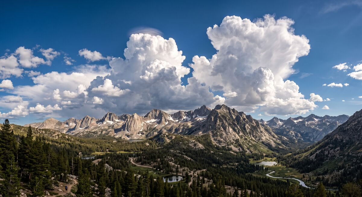
Confidence

Today through Monday: locate. Marked, exposed, verified. The drying, the wind ramp and the weekend warmth are all agreed on and physically obvious.

Tuesday through Thursday: pothole. I know the pattern — dry gusty northwest flow under PacNW troughing — and Reno says the same. What is not pinned down is the timing and the peak strength of the wind, which is the difference between elevated and critical. Re-read Tuesday morning before you commit hot work.

The 5th onward: old as-built. Right general layout, do not scale off it. Two independent sources disagree about whether next week gets any moisture at all, and the 88°F block sits at the far end of a 16-day run.

Live conditions and the GO/NO-GO call update all day on the crew weather page. Full model detail on the weather engine. Both free, no ads, no sign-in.

Short version: work the morning, strap the light stuff before the afternoon, and put Tuesday’s fire plan on paper today.

Horizontal bar chart of overnight-low forecast bias for eight global weather models at Truckee, California, over 120 scored days: ECMWF IFS minus 1.23 degrees, ECMWF AIFS plus 0.31, UKMO plus 0.50, CMA plus 2.10, GFS plus 2.27, JMA plus 5.15, ICON plus 5.51, GEM plus 5.88
5 min read
Half of Them Lie About the Overnight Low

Everybody has a favorite weather app and nobody checks whether it was right. So I scored eight global models against 120 days of Truckee weather. Daytime highs turn out to be a solved problem. Overnight lows are a mess, and the mess is worst in the season where it costs the most.

0 views
Read more

Every forecast app on your phone is quoting a model. Almost none of them tell you which one, and none of them tell you whether that model has been right lately in the place you actually stand. In a basin like Truckee that gap matters, because the terrain does things to the air at night that a global grid cannot see.

So I built the scoreboard. Eight global models, five variables each, checked every day against ERA5 reanalysis at 39.328 N, 120.183 W. As of this week that is 120 scored days, running 2026-05-01 through 2026-08-28. Here is what fell out of it.

Daytime Highs Are Solved. Stop Worrying About Them.

All eight models land inside 1.2°F on the daytime high. The spread across the entire ensemble is under 2°F, and RMSE runs 1.28 to 2.06. UKMO is the tightest at 1.28, ICON right behind at 1.35. ECMWF carries a steady 1.19°F cold bias, which sounds bad until you notice the word steady — a consistent bias is a correctable bias, and the engine corrects it.

Practical version: if all you need is tomorrow’s high, grab whatever app is closest to your thumb. They agree.

Overnight Lows Are Where It Falls Apart

This is the chart at the top of the post, and it is not close:

  • Trustworthy: ECMWF IFS (−1.23°F), ECMWF AIFS (+0.31), UKMO (+0.50)
  • Drifting: CMA (+2.10), GFS (+2.27)
  • Not usable: JMA (+5.15), ICON (+5.51), GEM (+5.88)

Positive means the model forecasts a warmer night than actually happened. That bottom group is running five to six degrees warm with RMSE near 6.5, which on a clear calm night is worse than just assuming normal conditions for the date. Three of the eight models are actively subtracting information.

If your app says 34°F tonight and it is quoting GEM, plan for 28°F.

UKMO Is the Trap

UKMO has the best temperature numbers in the whole set. It also has the worst precipitation detection: probability of detection 0.39, meaning it misses roughly six wet days in ten. ECMWF catches 90% of them.

That combination is genuinely dangerous, because skill on one variable reads like skill in general. It is not. A model can nail every temperature for a month and still not tell you it is going to rain on your open trench. Weight each model per variable or do not weight it at all.

Wind has the same shape. GFS runs about 3 mph hot, JMA 3.7 mph light, GEM 4 mph light. Four miles an hour is not a rounding error when it decides whether a lift or a crane works that day.

The Part That Actually Costs Money

I split the overnight-low error by season. Every model that runs warm at night runs warmer in spring:

  • UKMO: +3.30°F in spring, −0.48°F in summer
  • JMA: +6.81°F in spring
  • ICON: +6.23°F in spring
  • GFS: +3.72°F in spring

The physical story is a cold-air pool settling into the basin over leftover snowpack, and a global grid is too coarse to resolve it. The operational story is worse. Spring is exactly when you are making the frozen-ground call, deciding whether tomorrow is a dig day or a stand-around day, whether that pour survives the night. That is the season the models are least honest with you, and the season where being wrong is most expensive.

ERA5 Itself Runs Warm

One more layer, and it is the humbling one. I started archiving observations from the Truckee airport station and compared them to ERA5 over seven complete days. ERA5 came in 9.7°F warmer than the station on the overnight low.

Which means the table above flatters every model. Against what the basin actually feels at 4 a.m., UKMO is +5.8, ECMWF is +8.4, GEM is +17.1.

Seven days is a small sample and it is all summer, so I am treating the size of that number as a rough estimate and the ranking as solid. I am storing it as a measurement rather than folding it into a correction, because the engine already corrects against ERA5 and stacking the two would double-count. But the direction is unambiguous: reanalysis smooths terrain, and Truckee is terrain.

What I Do Not Know Yet

There is no winter in this dataset. The window opens May 1, so every cold-season conclusion above is extrapolated from spring and summer. Given that the spring split already shows the bias getting worse as you move toward the cold end of the year, I would expect winter to be worse still — but expecting is not measuring, and I am not going to pretend otherwise. Extending the window back through last winter is the next job.

Same caution on the whole exercise: 120 days is enough to see a five-degree systematic bias clearly. It is not enough to rank ECMWF against AIFS with confidence when they sit half a degree apart.

The Short Version

Highs, trust anybody. Lows, trust ECMWF or UKMO and nothing else. Rain, trust ECMWF and specifically do not trust UKMO. In spring, assume the night is colder than you were told.

All of this feeds the ensemble weighting on the Truckee weather engine, which is free and has no ads. The scoring re-runs nightly and the window rolls forward on its own, so these numbers move. I will post again when the winter sample lands.

Finished Pelican 1600 boom box build with two Alpine 6.5 inch component speakers and soft dome tweeters mounted in the lid, sitting on a welding table
3 min read
The Boom Box That Won't Die

I killed four Bluetooth speakers before I stopped buying them and built one. Alpine component speakers, a Rockford Fosgate amp, and a sealed AGM battery in a welded steel cradle, all living inside a Pelican 1600. Here are the three things I learned that matter more than the parts list.

0 views
Read more

So, a Bluetooth speaker is built for a backyard patio. Mine kept ending up in the back of a UTV, running a ten hour snow shift, or sharing a truck bed with a chainsaw and a jug of hydraulic fluid.

They died in that order. Four funerals was enough — I quit buying and started welding.

The Case Does the Heavy Lifting

The enclosure is a Pelican 1600. Crushproof, dustproof, watertight out of the box, the same case people use to fly camera bodies and rifles around the world. If it survives baggage handlers, it survives my crew. Mine gave up the watertight part on purpose. I'll get to why.

Inside is real car audio, not consumer parts. Alpine SPR-60C components — two 6.5 inch woofers, two silk soft dome tweeters, passive crossovers — mounted in the lid behind a welded bracket panel. A four channel Rockford Fosgate Prime amp drives them off a 12V sealed AGM battery sitting in a steel cradle I welded and bolted to the case floor. The entire interior is lined with Dynamat, and that part isn't optional. A bare Pelican case is a plastic drum. Line it or your bass turns into a rattle.

Open Pelican 1600 during the build: Rockford Fosgate Prime amplifier sitting on the left of the case floor, battery on the right held down by a welded steel cradle, with one of the louvered vents visible on the interior wall
Amp left, battery right in the welded cradle. Dry fit — not a wire in it yet. You can see one of the vent louvers on the inside wall.

Three Things I Learned

Heat kills amps, water doesn't. Everybody building for a jobsite worries about moisture getting in. The thing that actually cooks an amplifier is ten hours of running with nowhere for the heat to go. So I cut three louvered slots into the case side, angled so rain and snow shed off while air still moves across the amp. That's the watertight rating gone, and it's the difference between a build that lasts a season and one that lasts years.

Vibration is the real enemy. Forest service roads at 6,000 feet will shake a build apart faster than any weather. The battery is AGM specifically because it's sealed and vibration rated, and it rides on foam inside that welded cradle. A flooded battery bouncing loose in a case thrown into a truck bed is a bad day waiting to happen.

Put a voltmeter on it. Cheapest part in the whole build and the one I use most. A digital DC voltmeter on the side panel tells me exactly how much runtime is left instead of making me guess. Dual USB right next to it, 1A and 2.1A, because halfway through a long shift the crew's dead phones matter more than the music does.

The Small Stuff

Controls are marine grade illuminated rocker switches, the kind you'd find on a boat console. They're recessed into the side panel so the lid still closes flush and latches. Every wire run is labeled, fused, and dressed, because the version of me troubleshooting this thing in a parking lot in February won't remember what any of it was for.

It pairs as EXILE-BT. First time I fired it up in the shop and Spotify came through clean, I stood there grinning like an idiot for a solid minute.

Was It Worth It

About $850 in parts. That's real money, more than a stack of consumer speakers. But this one has been through jobsites, off grid camps, and a trip to the Dominican Republic, and I haven't replaced a single component. The math worked out a long time ago.

If you build one, don't skip the Dynamat and don't skip the vents. Everything else you can adapt to whatever case and parts you can get your hands on.

Full build breakdown with all 17 photos, the complete parts list, and the wiring detail is on the Pelican Boom Box build page.

Movie-poster style illustration of Godzilla rising from glowing red El Niño waters in the equatorial Pacific, pushing storm systems toward California
4 min read
GODZILLA EL NIÑO: The Numbers Just Got Real

NOAA's August update moved every number the wrong way. Niño 3.4 closed July at +1.4°C, Niño 1+2 at +2.9°C, and subsurface temperatures hit +10°C at depth. Then NOAA put a 69% chance on this exceeding every El Niño since 1950. The numbers just got real.

0 views
Read more

Third post in the Godzilla El Niño series. See the original post (June 27) and the July update.

We Said Pay Attention. The Ocean Just Screamed.

So, in June we read the SSTs and said a monster was loading up in the Pacific. In July NOAA confirmed it, and we flagged the August discussion as the next real checkpoint. That discussion landed Thursday. Not one number came back softer. Or better, depending on how you feel about powder.

This is no longer a forecast discussion. This is NOAA telling us the Pacific has rearranged itself in a way they've almost never seen, and there's a 69% chance this El Niño exceeds every event in their records going back to 1950. Not a small chance. Not an outlier scenario buried in the tail of a probability chart. The most likely outcome is now a historic event.

NOAA El Niño Status — August 13, 2026
NIÑO 3.4 (MONTHLY)
+1.4°C ↑
NIÑO 3 (MONTHLY)
+1.7°C ↑
NIÑO 1+2 (MONTHLY)
+2.9°C
SUBSURFACE (AT DEPTH)
+10°C
VERY STRONG (OND)
95%
HISTORIC EVENT (RONI)
69%
Source: NOAA CPC ENSO Diagnostic Discussion, 13 August 2026

Everything Moved in the Wrong Direction

Dark storm clouds over a snow-loaded Sierra ridgeline, wind stripping snow off the peaks above an empty chairlift
When a monster El Niño locks the jet stream onto the Sierra, the mountains just collect.

Here's how fast this escalated. In our July post the Niño 3.4 anomaly was +1.2°C. July closed at +1.4°C. Niño 3 came in at +1.7°C. Out east, the Niño 1+2 index near South America climbed from +2.7°C to +2.9°C, with eastern equatorial Pacific anomalies running past +2.0°C. This isn't one hot patch anymore. The whole eastern and central tropical Pacific is moving together.

The probability of a very strong event went from 81% to over 90% for the autumn and winter window. For October through December specifically, it's 95%. That's not a forecast that hedges. That's a forecast that's telling you to get ready.

Ten Degrees Under the Surface

But the number that stopped me cold is under the water. In July the equatorial upper-ocean heat content was running about +2.3°C — a big fuel tank already. NOAA's August data goes further: the equatorial subsurface temperature index climbed through July, and anomalies reached +10°C at depth. The thermocline has been shoved down hard, and warm water is now sitting where cold water belongs. The vertical structure of the Pacific has been rearranged.

In excavation, we have a saying: once the grade breaks, you're committed. The Pacific's grade broke months ago. The warm water is deep, it's massive, and there's no mechanism to turn it around before winter. This thing runs on its own fuel now.

NOAA El Niño Probabilities — August 13, 2026
Very strong · September–November93%
Very strong · October–December95%
Very strong · November–January90%
Historic RONI event · October–December69%
Source: NOAA Climate Prediction Center · August 13, 2026

The Atmosphere Locked In

Here's the part that turned this from serious to locked. A major El Niño doesn't run on warm water alone. It needs the atmosphere to couple with the ocean, to form a feedback loop where westerly winds push warm water east, the warm water drives more thunderstorms, and those thunderstorms weaken the trade winds even further. NOAA's August report confirms that coupling is now fully in place.

Low-level westerly wind anomalies now extend from the western Pacific into the east-central Pacific. Tropical convection has shifted east, away from Indonesia and into the central and eastern basin. The Southern Oscillation Index dropped to nearly two standard deviations below normal. The atmosphere isn't just responding to the ocean anymore. It's reinforcing it. It's like watching a loaded excavator on a slope: once it starts sliding, the weight feeds the motion.

What 69% Historic Means

NOAA uses RONI, the Relative Oceanic Niño Index — Niño 3.4 measured against the tropical ocean's own average instead of a fixed baseline. It exists because the whole tropical belt has warmed, which quietly inflates the traditional index. A three-month RONI of +2.5°C or higher in October through December would beat every El Niño NOAA has on record back to 1950 — past 1982-83, past 1997-98, past 2015-16. NOAA just put a 69% probability on exactly that.

That's not an edge case. That's the most likely bucket in the forecast. Weak and moderate outcomes have essentially disappeared from the late-year outlook.

What This Means for Tahoe and the Sierra

Illustration of the equatorial Pacific from space showing warm water flowing east through the Nino 3.4 region and storm systems aimed at California
The Niño 3.4 region is on fire. When SSTs push past +2.0°C, the jet stream aims directly at California.

When Niño 3.4 pushes past +2.0°C, the subtropical jet gets shoved south and locks onto California like a fire hose. In 1982-83, Norden near Donner Pass recorded nearly 804 inches. In 1997-98, Squaw Valley got 68 inches in a single 24-hour period. Those two peaked at +2.2°C and +2.4°C. We're sitting at +1.4°C in mid-August and El Niño doesn't peak until late fall. The runway in front of this thing is the part that gets my attention.

If NOAA's 69% scenario plays out and this thing peaks above +2.5°C on the RONI scale, we're looking at conditions that exceed the template for every big snow year in living memory. Five hundred inches at elevation would be conservative. Six hundred or more is on the table. The ski season could start in October and run through July.

I grew up on the Squaw Valley Ski Team and carried the Jamaican flag in Vancouver. I've skied everywhere. And I have never seen a setup this aggressive, with this much subsurface fuel, this far ahead of winter.

Get Ready

The next NOAA diagnostic discussion is scheduled for September 10. Season pass secured. Avalanche gear serviced. Real chains for the truck. Stock the pantry deep. If you're a backcountry skier, take the AIARE course, because a season like this is an avalanche season first and a powder season second.

I run a crew at 6,000 feet. I know what a big winter does to a schedule. I also know what a 600-inch winter looks like from a chairlift, and it's the reason I live here. This one's coming, and the Pacific just told us exactly how big.

Tracking this since June. Next update when NOAA's September 10 data drops. The monster isn't slowing down.

Sources & Data
Errol Kerr carrying the Jamaican flag into BC Place at the Vancouver 2010 opening ceremony
2 min read
The Offseason Is a Lie — Getting Ski Legs Back at Forty

Ski season's close and I haven't touched a gym all summer. Didn't need to — the jobsite handles the base. What starts now is the sharpening: the legs, the knees, the mobility work a big winter is going to demand.

0 views
Read more

Somebody on the crew asked me this week when I start training for ski season. I laughed, because the question assumes there's a version of my year where I stop. There isn't. The offseason is a lie. There's just the part of the year where the training doesn't look like training.

Back in the ski cross days it was structured — gym blocks, testing weeks, dryland camps, a coach with a clipboard telling me my vertical jump was down two centimeters and acting like somebody died. By the time I got to the start gate in Vancouver in 2010, I knew exactly what my body could do because we'd measured all of it. That's what a national team buys you: certainty.

Now my clipboard is a grade rod. And here's the thing nobody tells you about trench work at 6,000 feet: it's a better base program than most gym memberships. Ten hours of climbing in and out of a cab, checking grade in a hole, moving pipe, shoveling the corners the machine can't reach — none of it is cardio on paper, and all of it adds up.

My legs go into November stronger than they came out of April. The mountains don't care how you built the engine, just that it runs.

Errol carving a groomed run on a bluebird day in the green and yellow Jamaica kit, chairlift and rock outcrop behind
The goal every August: be ready when this is the office again.

But base isn't everything, and forty-year-old knees keep a ledger. So the deliberate work starts now, about ninety days out.

Weighted hikes up whatever ridge is closest. Step-ups and single-leg squats, because skiing is a one-leg-at-a-time sport no matter what it looks like. Ankle and hip mobility, which is the least glamorous thing I do and the reason I can still get low in a turn.

At this age the game isn't power — it's showing up to the first icy groomer with tissue that's ready for it. Your knees don't forgive a cold start the way they did at twenty-five.

Ski cross taught me the rule that still runs my life: you don't rise to the occasion, you sink to your preparation. That was true in a start gate with three guys who all wanted the same line, and it's true on a jobsite, and it'll be true on the first chair in November.

And there's a reason I'm starting the clock this week. Everything I've been tracking says this El Niño is still loading up offshore, and if it delivers even close to what the pattern suggests, this winter is going to be one you want legs for. Deep days don't wait for you to get fit. Ninety days. Clock's running.

Excavator pulling a boulder out of a trench cut through pavement, operator in hard hat and hi-vis vest in the cab
2 min read
The Rock Lottery — When the Plans Say Dirt and the Ground Says Granite

Somewhere in the first hour of every trench, the ground tells you what it actually thinks of your schedule. Up here it usually says it in granite. We call it the rock lottery — and everybody on the crew plays, whether they bought a ticket or not.

0 views
Read more

The plans said dirt. The plans always say dirt. Then partway into a trench this week the machine stopped mid-pull — not slowed, stopped — and everybody on the crew looked up at the same time, because we all know that sound. That's the rock lottery, and up here you play it every time you open the ground.

Here's the geology in one breath: Truckee sits on granite that's been rotting in place for a couple million years, and it doesn't rot evenly. Most of what we dig is decomposed granite — the flour-fine stuff that's currently eating my air filters — and it digs like heavy sand. But scattered through it are corestones: rounded chunks of intact granite the weathering never got to. There's no pattern to them. No plan sheet, no soils report, nothing tells you there's a boulder the size of a chest freezer sitting exactly at pipe grade. You find out when the bucket does.

The seat tells you first. The bucket's pulling a clean rhythm and then the stick loads up and the whole machine leans into it. New operators keep digging at it, and that's how sticks get bent and teeth end up somewhere in the spoil pile. The right move is the opposite: back off, work around it, expose the edges. You can't make a decision about a rock you can't see.

Once it's exposed, it's just math. If it weighs less than the machine wants to lift, you thumb it and walk it out — that's what's happening in the photo up top. Too big for that, and it's breaker time, or if spec allows, you over-excavate beside the trench and bury it below grade — dig the rock a grave and move on. What you never do is fight a boulder that outweighs your counterweight. The rock has all day. You don't.

John Deere mini excavator with KERR lettering loaded on a dump trailer on a dry August day
The 35G stays on the trailer on rock days. Right machine for a lot of things — a boulder fight is not one of them.

The crew part is my favorite. The second a big one starts showing, the size calls start flying. Everybody's a geologist until the thing actually comes out of the hole, and it's always bigger than the low guess and smaller than the loud one. Closest call wins nothing except being right, which on a crew is worth more than money.

Rock time is also why honest schedules up here carry padding. We get five months to do a year's worth of digging, and the lottery doesn't care. A boulder handled right costs you an hour. A boulder handled wrong costs you a stick, a schedule, or worse. Play it patient, and the ground usually lets you win.

CAT excavator lifting a boulder out of a trench cut through pavement on a dry August jobsite
2 min read
Dust Season — Keeping Iron Alive Through a Sierra Summer

Everyone asks how machines survive winter up here. Wrong question. Winter gets the headlines, but the season that quietly kills equipment in the Sierra is the one we're in right now — when decomposed granite grinds into flour-fine grit that eats filters, coolers, undercarriages, and pins.

0 views
Read more

So, it hasn't rained in Truckee in weeks, and everything on my sites — the iron, my truck, my lungs — wears the same coat of fine gray powder. Everybody's watching the winter that's coming. I get it. But snow mostly parks a machine. This powder kills them while they work. Dust season.

Most of what we dig up here is decomposed granite. Run a track machine across it in late July and it grinds down into a grit that gets into everything, and unlike valley topsoil, this stuff is basically lapping compound. Sharp, hard, doesn't dissolve, doesn't wash out, doesn't quit. Here's where it does its damage and what we do about it.

Air filters. At 6,000 feet your diesel is already down on air before dust ever shows up — I covered what altitude takes from a machine earlier this summer. A choked filter on top of thin air and you're paying for a derated machine at full rate. Watch the restriction indicator daily, and here's the part that surprises people: a slightly dirty filter actually filters better than a fresh one.

Don't pull it to eyeball it — every time you drop that filter you dump grit straight down the intake. And don't hit it with compressed air. You're not cleaning it, you're blowing holes in the media you can't see. Replace it when the indicator says so, not before, not after.

Cooling. Those same fines pack into radiator and oil cooler cores a few thousandths at a time until one 95-degree afternoon the machine derates on the far side of the site. Blow the cooling package out weekly — opposite the direction of normal airflow, in the morning while the cores are cool. Thin air already moves less heat. Don't give the mountain help.

Undercarriage. The most expensive consumable on a track machine, and abrasive fines are what eat it. Two habits pay for themselves: run track tension correct for the ground — tight tracks in abrasive fines chew through bushings and sprockets at double speed — and clean the packed material out of the frames at the end of shift, not the start. It sets up overnight like weak concrete.

Grease. Dust plus grease equals grinding paste, right in your pins. Wipe every zerk before the coupler touches it, then grease daily so fresh grease purges the contaminated stuff out of the joint. Thirty seconds a fitting. Cheapest insurance on the site.

Why this matters right now: if the models are right about this winter, every machine on the mountain needs to roll into November healthy, because there won't be a quiet week to fix anything until April. The machine that dies in February almost always started dying in July. Take care of it now, while the dying is still optional.

Black steel tongue box on a folding work stand in a garage, yellow flexible ducting connected to the side port
2 min read
Twenty Hours of Heat From a Tongue Box — The Diesel Heater Station Build

It's 90 degrees out and I'm going to tell you about a heater. Stay with me. Propane heat in an enclosed winter jobsite is a bad bet, so I built a self-contained diesel heater station — steel tongue box, LiFePO4 battery bank, 20-plus hours of heat on a single charge, about a grand in parts.

0 views
Read more

So, it's the middle of July, the lake is full of paddleboards, and I'm writing about a heater. There's a reason. If you read last week's post, you know NOAA just confirmed the El Niño everybody's been watching. The winter that's coming doesn't care what the thermometer says today, and winter gear built in January is gear built in a panic. July is when you build it right.

Here's the problem this thing solves. Winter jobsites up here drop below zero, and crews need heat somewhere — a conex, a cure tent, an enclosure over fresh concrete. The default answer is propane, and propane in an enclosed space is asking for trouble. It's a combustion source pumping moisture and worse into the air you're breathing, the bottles are heavy, and they sulk when it gets seriously cold. I wanted heat I could trust, move with one hand, and forget about for a full shift.

The heart of the build is an HCALORY TB-MAX diesel heater. These Chinese diesel heaters have been keeping truckers and vanlifers alive for years, and the design is solid: sealed combustion, so the burn air and exhaust never touch the air you're heating. It sips fuel and draws about 40 watts running — one to four amps at 12 volts, with a brief 12-amp spike at ignition. That low draw is what makes the rest of the build possible.

The heater lives inside a weatherproof steel tongue box with sealed flexible ducting out the side, so you park the box outside and duct warm, dry air to wherever it's needed. Power comes from two 120Ah LiFePO4 batteries in their own box — 240 amp-hours total. Lithium iron phosphate matters here: you can actually use 80 to 90 percent of the capacity without hurting the batteries, where lead acid taps out around half. Do the math on a 40-watt draw and the 20-plus hours I'm claiming is the conservative end — at that rate the pack's got days in it. Overnight concrete cure? Covered, with margin.

LiFePO4 battery box for the DIY diesel heater station showing voltage monitor reading 13.3 volts at 100 percent charge
The battery box holding 13.3 volts at full charge — 240Ah of LiFePO4 feeding a 40-watt draw. That's your 20-plus hours right there.

Everything connects with Anderson quick-disconnects, and the charging system rides in its own orange Apache case. That's the part most people skip and regret. Loose chargers and bare cable ends don't survive a winter of truck beds and snowbanks. Give every piece of the system its own sealed home and it'll still work in February.

Total build cost: $1,047.35. For that you get a heat source rated to 20 below, no cords to a generator, no propane bottles to babysit, and clean dry air instead of combustion moisture fogging up the enclosure. It's been battle-tested on real winter sites and it earns its spot on the trailer every single cold morning.

Full parts list, specs, and every build phase in photos are over in the DIY section. If the models are right about this winter, build yours now. The mountain doesn't wait for you to be ready.

Movie-poster style illustration of Godzilla rising from glowing red El Niño waters in the equatorial Pacific, pushing storm systems toward California
4 min read
GODZILLA EL NIÑO UPDATE: NOAA Confirms — The Monster Is Real

Three weeks ago we called it. NOAA just confirmed it. El Niño conditions are officially present. 97% chance it persists through spring 2027. 81% chance of very strong. Models peaking above the +2.0°C very-strong line by early winter. The monster is real, and it's stronger than we thought.

0 views
Read more

UPDATE to the original Godzilla El Niño post (June 27, 2026)

NOAA Put It in Writing

So, back in June the ocean was already telling on itself. SSTs climbing, warm water rolling east under the surface, all 24 models leaning the same way. We published the Godzilla El Niño post and told you to pay attention.

NOAA just made it official. They've issued a formal El Niño Advisory, meaning conditions aren't developing, they aren't emerging, they are present. Right now. The tropical Pacific has crossed the threshold and there's no ambiguity left. The monster is real.

NOAA El Niño Status — July 2026
ENSO ALERT STATUS
EL NIÑO ADVISORY
CURRENT SST ANOMALY
+1.2°C (Niño 3.4)
PROJECTED PEAK
+2.0°C+ Oct–Dec
MODELS IN AGREEMENT
24 of 24
PERSISTENCE PROBABILITY
97% thru Spring '27
UPPER-OCEAN HEAT (0-300M)
+2.3°C and climbing
Source: NOAA CPC ENSO Diagnostic Discussion, 9 July 2026

The Numbers Have Gone Vertical

Dark storm clouds over a snow-loaded Sierra ridgeline, wind stripping snow off the peaks above an empty chairlift
When a monster El Niño locks the jet stream onto the Sierra, the mountains just collect. History says 600+ inches.

When we wrote the original post, the chance of a very strong El Niño was 63%. Here's where the probabilities stand now:

NOAA El Niño Probabilities — July 2026 Update
Persists through Spring 202797%
Very Strong (Oct-Dec)81%
Source: NOAA Climate Prediction Center · July 2026
Official NOAA CPC ENSO Strength Probabilities chart issued July 2026, showing probability bars for El Niño strength categories across 9 overlapping 3-month seasons from JJA through FMA
Official NOAA CPC ENSO Strength Probabilities (issued July 2026). Dark red = very strong El Niño (Niño 3.4 ≥ +2.0°C). Near-100% El Niño probability in every seasonal window through spring 2027. Source: NOAA CPC ENSO Strength Probabilities

The Niño 3.4 SST anomaly is at +1.2°C above average and climbing. The easternmost Niño-1+2 index has already hit +2.7°C. All 24 IRI/Columbia forecasting models are in strong agreement: this event is strengthening, not fading. Weather.com is calling it one that could "rank among the largest events in historical record since 1950."

"Very strong" El Niño means the Niño 3.4 index exceeds +2.0°C above average. NOAA has only recorded a handful of events that strong since 1950. Models now project we cross that threshold in the October-December window, right when the winter storm track starts paying attention.

NOAA Niño region SST index time series showing anomalies climbing across all Niño monitoring regions in 2026
Niño region SST indices — anomalies climbing across all monitoring regions. The Niño 3.4 index at +1.2°C and accelerating. Source: NOAA CPC ENSO Diagnostic Discussion, July 2026

The Kelvin Wave: The Engine Under the Surface

Here's what most weather coverage misses. Beneath the surface, a downwelling Kelvin wave has spent months shoving warm water east across the equatorial Pacific, and the fuel gauge shows it: upper-ocean heat content is running about +2.3°C above average across the eastern half of the basin. That warm water is surfacing now, feeding the SST climb. The engine's running and nobody can shut it off.

NOAA equatorial upper-ocean heat content anomaly chart showing anomalies climbing to about +2.3 degrees C by July 2026
Equatorial upper-ocean heat content (0-300m) — the fuel tank. About +2.3°C above average and climbing again as the Kelvin wave's warm water surfaces. Source: NOAA CPC, July 2026

Every Model Agrees: This Is Going Up

Look at the forecast plume below. Every spaghetti line lives in El Niño territory through winter. The CFSv2 median peaks just above +2.0°C in the October-December window, over the very-strong line, with the warm end of the ensemble pushing +2.5°C. The NMME and IRI multi-model runs tell the same story: this event strengthens through fall and holds deep into 2027.

NCEP CFSv2 model forecast plume showing all ensemble members projecting El Niño strengthening into winter 2026-27 with Niño 3.4 anomalies peaking above +2.0 degrees C
CFSv2 model forecast plume — the full ensemble in El Niño territory, peaking above the +2.0°C very-strong line in October-December. Updated 6 July 2026. Source: NOAA CPC

The Big Three Might Get Company

Let's put this in context. The three biggest El Niños in the modern record peaked at +2.2°C (1982-83), +2.4°C (1997-98), and +2.6°C (2015-16). The July runs put this one's median right at the bottom of that club, with the warm end of the ensemble near +2.5°C. If the warm end verifies, this event pulls up a chair with those three.

And we're stacking this on top of the hottest ocean baseline in recorded history. The equatorial Pacific hit 26.99°C in April. Those model numbers are relative anomalies — the same reading means more actual heat than it did in 1997. The monster's swimming in a warmer ocean.

What This Means for Tahoe: 400-600+ Inches

Illustration of the equatorial Pacific from space showing warm water flowing east through the Nino 3.4 region and storm systems aimed at California
The Niño 3.4 region is on fire. When SSTs push past +2.0°C, the jet stream overwhelms everything and aims directly at California.

We said it in the original post: regular El Niños are a gamble for Tahoe. Monster El Niños deliver. With an 81% chance of very strong by the October-December window, we're firmly in monster territory. Here's what history tells us about seasons like this:

1982-83: Norden near Donner Pass recorded nearly 804 inches. Snowpack hit 15 feet by February. Atmospheric rivers stacked for weeks. It snowed every single weekend from January 15 to May 15.

1997-98: Snowpack exceeded 200% of average. Squaw Valley reported 68 inches in 24 hours on New Year's Day. Lake Tahoe rose 6.5 feet from runoff.

If the very-strong projections verify, those two seasons are the blueprint. We're talking about above-average precipitation, potential for 400-600+ inch snowfall seasons at elevation, extended atmospheric river events, storm cycles that stack for weeks, rain-on-snow at lake level, and pure powder at the peaks. Early-season storms could hit by late October. The ski season could run November through July.

What We're Watching Next

The August NOAA update is the next big checkpoint. If SSTs keep climbing at this rate through August, the October-December projections get locked in. We'll also be watching for the first atmospheric river setup of the fall. Historically, monster El Niños announce themselves with an early-season bomb before Halloween.

I carried the Jamaican flag at the 2010 Olympics. I've skied on every continent. I run heavy equipment at 6,000 feet for a living and ski 60+ days a year. I've been tracking this since March, and I've never seen models this aggressive, this unified, this early in the season.

The original Godzilla post has the full baseline data, the SST trajectory chart, and the historical snowfall comparisons. This update confirms what the ocean already told us: the monster is real, and it's bigger than we thought.

Get your season pass. Service your avalanche gear. Buy real tire chains. Stock the pantry. If you're in the backcountry, take the AIARE course. A 600-inch season is an avalanche season.

We'll keep tracking this. Next update when the August NOAA data drops (scheduled for August 13). Bookmark the page. The monster isn't slowing down.

Sources & Data
Skier in yellow pants and a green jacket airborne high above the treeline with Lake Tahoe stretching out below, deep blue sky overhead
2 min read
Ski Season Doesn't End — It Just Changes Clothes

Mid-July in Tahoe. The lake finally warmed up, the skis are waxed and racked, and every skier in town is pretending they don't miss winter. Here's the thing nobody tells you about ski racing — the season you watch in December got built in July.

0 views
Read more

So, the skis went into storage months ago and the whole town's acting like winter never happened. Bikes out, paddleboards on every Subaru, dust on the trailheads. That's the civilian version of the off-season, and there's nothing wrong with it. But racing taught me a different calendar, and I still run on it.

The Off-Season Myth

Ski cross is four people banging elbows down a course at highway speed. What decides those races isn't talent in December — it's what your legs did in July. Dryland season was the real season. Squats until your vision went sideways, trampoline work for air awareness, balance drills that made you feel like a toddler learning to walk.

By the time snow flew, the racing was mostly already decided. You were just finding out who did their summer homework.

Some summers we chased snow anyway — up on the glacier at dawn, lapping a salted course that turned to mashed potatoes by 11. Ski boots and sunscreen at the same time messes with your head the first time. You get used to it.

Training at 6,000 Feet, Then and Now

These days my off-season program looks different. Nobody writes it on a whiteboard and there's no trampoline. It's ten hours a day on a jobsite at 6,000 feet — in and out of trenches, humping pipe, walking grade all day in the thin air.

I used to pay a trainer to make me do step-ups with a weighted vest. Now the vest is high-vis and the step-ups are free. The altitude base I spent years building as a racer just quietly maintains itself, one shift at a time.

Warren Miller Line of Descent poster of Errol Kerr in a green jacket slashing a powder turn beneath a rock spire, with an inset portrait in a Squaw Valley Alpine Meadows helmet
The Warren Miller “Line of Descent” days. Every turn in that poster was bought with a summer of dryland nobody filmed.

The Photo Up Top

That shot of me floating over Lake Tahoe is a Keoki Flagg frame from 2009. People see a photo like that and think it's one perfect moment. It's not.

It's hundreds of reps, a photographer who knows the light, and legs that spent all summer getting ready to be that calm in the air. The moment is winter. The work is now.

Your July Homework

If you ski, here's the honest version: the season you'll have in January is being decided right now. Hike something steep. Ride the bike uphill, not just down. Do the boring single-leg stuff. And check your gear this month — boots, bindings, edges — while the shops are empty and the techs are bored.

Winter always comes back to Tahoe. The only question is whose legs show up ready.

PVC conduit runs sweeping into a pair of concrete pull boxes in an open trench at night, lit by a portable light tower
2 min read
The July Sprint — Five Months to Do a Year's Worth of Digging

Fourth of July weekend in Truckee. The lake traffic's backed up to the roundabout and everyone's summer is in full swing. For an excavation crew, the holiday means something different — the dig season's half spent, and everything still open in the ground is a promise you made to winter.

0 views
Read more

So, the Fourth just came through Truckee and did what it always does — doubled the population, tripled the boat traffic, and turned the grocery store into a contact sport. Great weekend. But if you dig holes for a living up here, the holiday is also a calendar alarm you can't snooze: the season is half gone.

The Season Math

Down in the valley, an excavation crew works more or less year-round. At 6,000 feet, the ground doesn't give you that. It stays locked up or soaked well into May, and the first real storm can land in October like it owns the place — because it does.

Call it five workable months, maybe six if the fall is kind. Whatever a valley outfit spreads across a year, we compress into that window. Every clean, dry, 75-degree day in July isn't just a nice day. It's inventory.

Holiday Week on a Crew

Here's the part nobody puts in the brochure: half the crew wants the Fourth off, and the ground couldn't care less about the calendar. So you rotate. Somebody takes the lake day with their kids, somebody covers, and next holiday it flips.

A crew that never gets a summer day with their family burns out by August, and a burned-out crew makes mistakes around open trenches. Keeping people fresh isn't soft — it's the cheapest safety program there is.

Night Moves

Some of the work only happens when the town is quiet. Utility crossings and conduit runs under pavement get done at night, under light towers, when the road can actually be closed without turning the whole grid into a parking lot. There's something clean about night work — no traffic, cool air, just the sweep of the conduit dropping into the pull box exactly the way the drawing said it should.

The Screen That Keeps Us Honest

The other half of the sprint is not wasting motion. Machine control has changed what a short season can hold. The screen in the cab shows cut and fill in real time against the design surface — no waiting on stakes, no re-checking grade three times, no digging it twice. When you've only got five months, the hours that screen saves aren't a convenience. They're the season.

Trimble CB460 grade control display in an equipment cab showing cut and fill numbers against a digital design surface, pine trees visible through the windshield
Cut left 0.97, cut right 0.93. The design surface rides along in the cab, and grade gets checked every second of the day.

By October the trenches will be closed, the pavement patched, and the machines staged for snow. Winter always collects up here. The whole job in July is making sure that when it does, you don't owe it anything.

CAT excavator ripping fractured rock with a toothed bucket on a high-mountain jobsite, jagged peaks in the background
2 min read
Running Heavy Equipment at 6,000 Feet — What the Thin Air Takes

Most equipment specs are written for sea level. Truckee is a mile up, and the mountain quietly skims power off every diesel, runs your coolers hotter, and gasses out anyone who isn't acclimated. Here's what altitude actually does to a machine and a crew, and how you work around it.

0 views
Read more

So, nobody warns you about this when you move your operation up into the Sierra — the mountain takes a cut off the top of everything. Your engine, your crew, your patience. Every machine I run sits around 6,000 feet, and the thin air doesn't care what the spec sheet promised down at sea level.

The Engine Math

A naturally aspirated diesel gives up roughly three percent of its power for every thousand feet of elevation. Run that math at 6,000 and you've handed back close to eighteen percent before you turn a bolt. That's the difference between a bucket that breaks rock and a bucket that polishes it.

The turbocharged machines claw most of it back — the turbo crams the thin air down to something the cylinders still recognize. The little naturally aspirated stuff just runs leaner and works harder for the same hole. You feel it in the hydraulics on a hot afternoon.

Heat Is the Other Half

Thin air cools worse than thick air. Same radiator, less air mass moving through it, so coolant and hydraulic temps climb faster than they ever did down in the valley. Up here I keep the coolers blown out clean and I watch the gauges in July like a hawk. A clogged cooler at sea level is an annoyance. A clogged cooler at 6,000 feet in the afternoon sun is a tow bill.

The Ground Fights Back

Then there's what you're digging into. The Sierra is granite, decomposed granite, and the occasional boulder the size of a chest freezer that the plans swore wasn't there. Teeth wear fast. You learn to read the ground by feel through the sticks — back off before you stall the machine, reposition, take a smaller bite. Patience saves more steel than horsepower does.

CAT excavator cutting a clean, straight trench on a jobsite, operator in the cab wearing a hard hat and hi-vis vest
A clean trench is all technique — read the ground, take the bite the machine can actually pull, and let the hydraulics breathe between passes.

Cold Mornings, Short Windows

We froze at the tail end of June this year. That tells you everything about the season up here. Block heaters earn their keep, you let the hydraulics warm before you ask the machine for anything real, and you respect the cold start.

The dig season is short, so when the ground's open, you move. Alarm at 5:30, truck by 6:15, boots on the jobsite by 7, off by 3:30 if the day cooperates.

The Crew Runs on Thin Air Too

Don't forget the people. Altitude pulls the water right out of you, and the sun up here is brutal because there's less atmosphere standing between you and it. New guys gas out by lunch their first week and figure they're out of shape. They're not. They just aren't acclimated yet. Water, shade, sunscreen, and a hard hat that actually stays put.

None of this is in the operator's manual. That book was written for sea level. Out here you learn the mountain's edits the hard way, then you build them into the plan. Respect the altitude and it'll let you work. Ignore it, and it'll cook a machine just to prove the point.

Movie-poster style illustration of Godzilla rising from glowing red El Nino waters in the equatorial Pacific, pushing storm systems toward the California coast
3 min read
GODZILLA EL NIÑO: The Monster Storm Season Coming to Lake Tahoe 2026-27

NOAA just issued an El Niño Advisory. SST anomalies are at +0.9°C and climbing. Models give a 63% chance this becomes a very strong event, the kind that only happens twice in a generation. The Pacific is loading up. Here's what the data says, what history tells us, and why I'm already waxing my skis.

0 views
Read more

The Setup

The Pacific Ocean is the hottest it's ever been measured. The equatorial Pacific hit 26.99°C in April 2026, blowing past the previous record. On June 11, NOAA issued an El Niño Advisory. Two weeks later the Niño 3.4 anomaly is at +0.9°C and still climbing. That's not a gradual warming. That's a rocket ship.

All 24 IRI/Columbia forecasting models agree El Niño will strengthen through the fall. NOAA puts the probability of El Niño during December 2026 through February 2027 at 96%. The chance of a very strong event: 63%. The CFSv2 forecast plume has the median peaking just above +2.0°C in the October-December window, with the warm end of the ensemble near +2.5°C. The previous record holders peaked at +2.6°C (2015) and +2.4°C (1997). If the warm end verifies, this event sits at the same table as both of them.

A downwelling Kelvin wave is moving east across the equatorial Pacific, dragging a deep pool of warm water with it — and NOAA's upper-ocean heat content charts are climbing right alongside the surface numbers. That's the engine no one can shut off. We're stacking a monster El Niño on top of the hottest ocean baseline in recorded history.

What It Means for Tahoe

Dark storm clouds over a snow-loaded Sierra ridgeline, wind stripping snow off the peaks above an empty chairlift
When the Pacific jet stream locks onto the Sierra, the mountains don't negotiate. They just collect.

I'll be honest: the correlation between regular El Niño and Tahoe snowfall is historically weak. Of 27 El Niño winters on record, only 15 produced above normal snow. But the two verified very strong events, the true monsters of 1982-83 and 1997-98, both delivered exceptional Sierra snow. When the SST anomaly pushes past +2.0°C, the jet stream overwhelms the geographic uncertainty and funnels moisture directly into California. Regular El Niños are a gamble for Tahoe. Monster El Niños deliver.

The Numbers

We just limped through 348 inches. Below average. Now look at what the monster years produced. In 1982-83, Norden near Donner Pass recorded nearly 804 inches. Snowpack hit 15 feet by the end of February. In 1997-98, snowpack exceeded 200% of average and Squaw Valley reported 68 inches in 24 hours on New Year's Day.

SST Trajectory

Illustration of the equatorial Pacific from space showing warm water flowing east through the Nino 3.4 region and storm systems aimed at California
Warm water piling east through the Niño 3.4 region — the classic El Niño pattern, aimed straight at California.

The Niño 3.4 anomaly was negative as recently as March. It crossed the +0.5°C El Niño line in June and hit +0.9°C by the last week of the month. That rate of change is aggressive.

The previous record El Niños peaked at +2.42°C (1997) and +2.57°C (2015). We're at +0.9°C in June with five months of strengthening ahead. Hold that curve through fall and we're knocking on the all-time record.

Ski Season Forecast

Skier launching off a rocky outcrop on a bluebird day with a chairlift and snowy peaks in the background
Bluebird day, rocks out, somebody sending it anyway. In a 700 inch season, all of this disappears.

If this event reaches +2.0°C, the historical analogs point to a 600 to 700+ inch season at Palisades Tahoe. Nearly double the average. Early season storms could hit by late October. We could be skiing into July. In 1982-83, it snowed every single weekend from January 15 to May 15.

Expect stacked atmospheric rivers, rain on snow events, 100 mph ridge winds, and avalanche cycles that run for days. Lake Tahoe rose 6.5 feet in 2016-17. A stronger event pushes that higher. This isn't just a big winter. It's a force of nature.

Get Ready Now

Season pass, gear check, real tire chains, a stocked pantry, and a roof rake. If you ski the backcountry, get your avalanche gear serviced and take the AIARE course. A 700 inch season is an avalanche season.

I carried the Jamaican flag at the 2010 Olympics. I've skied every type of snow this planet produces. I run a CAT 299 for a living and ski 60 plus days a year. When they start talking Kelvin waves, I start checking my boot liners.

The mountains looked tired by March. Now the ocean is running a fever nobody alive has seen: the warmest equatorial Pacific ever measured, a Kelvin wave feeding it from below, and every model on the board pointing the same way.

Respect the mountain. Get ready. See you out there.

This is a developing story. I'll be tracking the models, the SSTs, and the Kelvin wave all through the fall. Updates coming as the data evolves. If this thing stays on track, we're looking at a genuine Godzilla El Niño. Bookmark this page.

Frost-covered excavator and compact track loader at dawn on a snow-dusted Sierra jobsite
3 min read
Late June Freeze — When the Sierra Reminds You Who's Boss

The Sierra just canceled summer for a weekend. Wind Friday, snow Saturday, a hard freeze to finish it off. Here's the full forecast, what it changes on the jobsite and at home, and how we got three days' warning instead of a cold surprise.

0 views
Read more

So, it's June 24th and I'm writing about a freeze warning. Let that land for a second. Most of the country is sweating through triple digits right now, firing up the AC, complaining about humidity. Up here at 5,900 feet in Truckee we're about to watch the thermometer fall 47 degrees in three days — 77° midweek to 30° by Sunday morning. Thirty. Below freezing. In late June. If you've lived in the Sierra long enough, this doesn't surprise you. If you just moved here, welcome. The mountain doesn't read the calendar.

Live temperature overlay — watch the cold air mass slide over the Sierra crest in real time. Open full map

Here's what the models are showing. Friday brings the front door. Sustained winds out of the west-northwest climbing through the afternoon, gusts to 34 mph by evening. That's enough to blow tarps off a grade, send unsecured plywood sailing, and make any crane work a hard no. Saturday the upper-level trough digs in and drags cold Pacific air right over the crest. We're looking at up to a half inch of snow above 7,500 feet. Snow. On June 27th. The high stays right around 50, which means if you're working in a trench all day you're reaching for a hoodie by two o'clock. Then Sunday morning the bottom drops out. The snow shuts off, the sky clears, radiational cooling does its thing, and Truckee wakes up at 30°F.

The daily temperature swings this weekend are borderline absurd. We're talking 30 to 35 degree spreads between the overnight low and the afternoon high. You'll start the morning scraping frost off windshields and end the afternoon in a t-shirt. That kind of swing is hard on people, hard on equipment, and especially hard on fresh concrete.

For construction crews, this isn't a novelty forecast. This is a work-stopper if you're not paying attention. Concrete poured Thursday or Friday needs protection. If the surface temperature of a fresh pour drops below 40°F in the first 24 hours, you're looking at reduced strength, surface scaling, and potential microcracking that doesn't show up until months later. Blankets go on. Curing compounds go down. No exceptions.

Any exposed waterlines that haven't been buried and backfilled need to be drained or heat-traced by Friday afternoon, because a 30°F morning will freeze an exposed half-inch copper line before the sun gets to it. Fresh grading work is at risk too. Frost heave on an uncompacted subgrade can push your elevation a quarter inch overnight, and that quarter inch is the difference between passing and failing a grade check on Monday.

Live radar — track precipitation as the system moves through the northern Sierra.

Our crew runs a GO/NO-GO system for exactly this kind of event. Every morning the 8-model weather engine pulls forecasts from GFS, NAM, HRRR, ECMWF, and four other sources, stacks them against each other, and flags any day where conditions cross a threshold. Wind above 25 sustained is a yellow flag. Freezing temps on active pour work is a red flag. The system doesn't make the call for us, but it puts the data in front of the foreman before the crew leaves the yard. This weekend popped a red flag on Wednesday morning, three full days before the trough digs in. That's three days to cover pours, drain lines, and reschedule any wind-sensitive work. Three days because the models agreed early and the engine caught the convergence.

Crew Weather Status — This Weekend

Friday Jun 26
CAUTION
Gusts to 34 mph · High 62°F
No crane ops · Secure loose material
WIND
Saturday Jun 27
NO-GO
Gusts 36 mph · High 50°F · Low 37°F
Precip starting · Cover pours · Drain lines
WIND + COLD
Sunday Jun 28
NO-GO
Low 30°F · 0.5" snow · Hard freeze
No pours · Protect lines · Drain exposed pipe
FREEZE + SNOW

Status from the 8-model weather engine · Updated Jun 25, 2026. Live at errolkerr.com/weather

For the community, the playbook is simple but it matters. Bring the pets inside Saturday night. Cover any tomato plants, pepper starts, or anything else you optimistically put in the ground in early June thinking summer was here. It wasn't. Disconnect and drain garden hoses. If you have exposed exterior plumbing on the north side of the house, a couple wraps of pipe insulation and twenty minutes of work saves you a burst pipe and a Sunday morning you didn't plan for. And if you're driving over Donner Pass this weekend, check conditions before you go. Snow at elevation combined with gusts pushing 36 mph means chain controls aren't impossible, and I've seen CHP close the summit for less.

If you want to track this front in real time as it moves through, the full dashboard is live at errolkerr.com/weather. Eight models, hourly resolution, wind and temperature overlays, all updated every six hours. Built it from the cab of a truck on a jobsite because the existing forecasts weren't cutting it for field decisions, and events like this weekend prove exactly why.

The Sierra giveth and the Sierra taketh away. Last week we had 15 hours of daylight and 80 degree afternoons. This weekend we might see frost on the windshield and snow on the ridgeline. Same mountain. Same town. Different week. If you're not ready for that range, you're not ready for Truckee. Stay warm out there.

DIY mobile carpentry trailer at dusk, ramp open and interior lit — extension cords and ladders stowed on the wall
3 min read
The Shop That Drives: Eight Years With a DIY Carpentry Trailer

The best tool I own has a license plate. Eight years in, the whole shop still tows to the job every morning. Here's what I'd tell anyone converting a cargo trailer.

0 views
Read more

So, back in late 2017 I bought a plain 6x12 enclosed cargo trailer. White aluminum box, diamond-plate floor, three clearance lights, and one dome bulb bright enough to find your own hand and nothing else. I didn't want another pile of tools to load and unload every morning. I wanted a shop that drives to the site. So I built one, and eight years later it's cut every two-by-four on every job I've run since.

Here's the lesson that matters most, and it lands before you ever touch a saw: wait. That trailer sat in my driveway for three months before the first cut. Three sets of sketches, two material lists, one full rebuild of the plan. A cargo trailer punishes hasty decisions. Drill the wrong stud, mount a saw at the wrong height, run your wires in the wrong order, and you pay for it for the next decade. The patience up front is the build.

Then the heaviest thing goes in first. I dropped a loaded Kobalt tool chest into place before I framed a single wall, because once you build cabinetry around 280 pounds of steel you can't pull it out again without tearing the whole cabinet down. Set your anchor, square your bench height off it, and build everything else to that line.

One thing nobody warns you about: the interior plywood on these trailers won't hold a lag bolt. It's stapled to thin metal channels behind the wall. Find those channels with a stud finder, every sixteen inches, and cleat your framing into the steel. Skip that step and your nice new cabinet rips off the wall the first time you hit a pothole on the way to the grade.

Finished interior of the DIY mobile carpentry trailer — black Kobalt tool chest as the anchor, DeWalt sliding miter saw on its platform, lit marine switch panel, and red and blue parts bins
The finished interior — the Kobalt chest anchors the build, the DeWalt miter sits on its own platform, and the marine switch panel runs everything.

The phase I'm proudest of is the wiring, which is exactly where most trailer builds die. Somebody runs wires straight off a battery with no fuses, no labels, and no plan, then spends ten years wondering why nothing works. I did mine like a boat. Marine-grade tinned copper, every circuit on its own breaker and its own switch, and an eight-channel lit rocker panel so I can see at a glance what I left running. Tinned wire costs about double what regular automotive wire does and lasts about ten times as long. Trailers get damp. Spend the money.

Power runs two ways. Plug into shore power if the site has it, run off a deep-cycle battery if it doesn't. A shunt on the battery negative tells me exactly how much I have left instead of guessing, and guessing is what kills batteries. The saws sit on platforms aimed straight out the open ramp, so I can rip sixteen-foot stock without dragging anything outside. That single design choice drove the entire layout.

Three weeks of nights and weekends got me a finished shop on wheels. Eight years on, it's just part of the truck. I documented the whole thing end to end, every phase and every part and every mistake, over in the DIY section. Steal the whole build. That's what it's there for.

Prime Day week. Let me explain where the money actually goes when you click a link on this site. Short version: it funds the forecasts my crew bets a workday on.

0 views
Read more

So, it's Prime Day week and I'm sitting in the cab of my truck on a construction site outside Truckee, hotspotted off my phone, pushing code through a cellular connection that would make most developers cry. And I'm thinking about feedback loops.

Here's the deal. Every product on my deals page is something I actually use or have vetted for field work. The DeWalt impact driver. The Klein multimeter. The boots. When you click through and buy something, a small commission comes back to me. Standard affiliate setup. But here's where it gets interesting.

That commission doesn't go into a vacation fund. It goes straight back into building this platform. Better hosting. More API calls for the weather engine. More time I can spend tuning the 8-model ensemble that tells my crew whether tomorrow is a GO or a NO-GO. The weather system on this site runs real forecasts for real crews making real decisions about whether to put people on a grade in the Sierra.

I built the entire weather engine from places like this. Tailgates, truck cabs, hotel rooms after 10-hour days in the dirt. Same mentality I had training for the Olympics. You don't wait for perfect conditions. You work with what you have and you make it count.

So when I say every click matters, I mean it literally. A drill bit purchase funds a weather API call that might keep a crew off a ridge during a lightning cell. That's the loop. That's why I'm out here building this thing from a construction site instead of waiting for a desk and a fiber connection.

The platform doesn't care where the code comes from. It cares that the code is right.

Click something. Build something. That's how it works.

Sunset over an alpine lake in the Sierra Nevada — snow-patched granite peaks, pine forest, and a lakeside trail
3 min read
Solstice Week in Truckee: What the Models Called and What Showed Up

Solstice week's in the books. A ridge kept us warm and dry, a little moisture tried to stir up trouble midweek, and I graded the forecast against the sky every morning before work. Here's the report card — including the two models that cried wolf.

0 views
Read more

So, we just came through the longest stretch of daylight of the year, and for once the sky played along. If you were outside in Truckee this past week you already know the drill: warm afternoons, cold mornings, and a couple of afternoons where the clouds loaded up like they meant business, then quit before dinner.

I check the forecast ensemble every morning before the truck rolls. Here's how the week actually went, and how the models did against it.

The Setup

A broad ridge of high pressure parked itself over the Great Basin for most of the week. That's the classic late-June pattern up here. High pressure means sinking air, sinking air means clear skies and warming temperatures, and clear skies at 6,000 feet means the heat bleeds right back out overnight. Daytime highs ran in the upper 70s to low 80s in town. Mornings dropped into the high 30s and low 40s. That 40-degree daily swing is normal for us, and it catches flatlanders off guard every single summer.

Afternoon cumulus clouds building over the Sierra Nevada mountain ridgeline in summer
Afternoon cumulus building over the Sierra crest. When you see towers like this stacking up by 1 PM, that ridge is pumping moisture upslope.

Models vs Reality

The 8-model ensemble nailed the big picture days out. Every member agreed on the ridge, agreed on the warming trend, and agreed the valley would stay dry. When the models all shake hands like that, you can plan a week of work with confidence. We did.

Where they argued was the middle of the week. A few members tried to break out afternoon thunderstorms over the crest, pumping up CAPE values as a little moisture sneaked in from the south. Two models went all-in on storms. Three kept it bone dry. The rest split the difference with isolated afternoon cells.

What actually happened was a classic Sierra tease. The cumulus built tall and dark over the Carson Range one afternoon, we heard a couple of rumbles up high, and then the whole thing fell apart by dinner without dropping much on the valley floor. The members that hedged toward isolated cells got it right. The two models screaming severe over-cooked it, which is exactly what high-resolution models tend to do with mountain convection. They see the instability and assume the worst.

Why It Matters on the Grade

This isn't just weather-nerd stuff. When the models disagree on afternoon storms, that's a GO with a watch, not a NO-GO. We worked, we kept an eye on the sky, and we had a plan to pull off the high ground if a cell organized. It never did. Reading the spread between the models is how you avoid both burning a workday for a storm that never comes and getting caught flat-footed by one that does.

Looking Ahead

The ridge holds into early next week. Expect more of the same: warm, dry, and breezy in the afternoons. The one thing I'm watching is a weak disturbance the long-range members hint at toward the end of the month that could drag monsoon moisture north and bump our thunderstorm odds back up. Long range, low confidence, but it's on the board.

Enjoy the long days while they're here. They don't last.

VLOG 12 MIN

Errol Kerr and Crew Documentary — The Full 12 Minutes

Somebody put a camera on us during the ski cross years. Race results, mountain footage, and the crew that made all of it possible. Twelve minutes of what the grind actually looked like before the Olympics, before the flag, before any of it made sense to anyone but us.

0 views
Read more

So, this video has been sitting on my YouTube channel since December 2013. Twelve years. Two hundred and change views. I never promoted it, never shared it, never really talked about it. But it's one of the most honest pieces of footage from that entire chapter of my life, and I think it's time people saw it.

The documentary is about twelve minutes long and it covers me and my crew during the ski cross racing years. This was the period where I was grinding through the circuit, chasing FIS points, trying to qualify for international competition, and doing it all with basically no budget and no federation behind me. Just a crew of people who believed in the mission and were willing to show up.

What You're Looking At

The footage opens on the National Brotherhood of Skiers website. The NBS has spent decades putting Black athletes on the U.S. team and getting them to the Olympics. They run the largest continuously operating ski convention in America. Night parties, competitions, fundraisers, youth camp, the whole program. Their Olympic Scholarship Fund helped make it possible for athletes like me to compete when nobody else was writing checks.

That NBS connection wasn't a footnote. It was a lifeline. When you're a Black ski racer trying to put together a campaign with no money and no infrastructure, the people and organizations who step up are the difference between racing and watching from the couch. The Brotherhood stepped up.

The Race Sheet

There's a shot in the documentary of a race results board. Handwritten. Old school. And if you look close you can see it: KERR, E. Highlighted. That's what it looked like. You'd show up to a race, check the start list taped to the timing shack, find your name, and that was your whole world for the next ninety seconds. Everything you'd been training for, every gate you drilled, every hill you hiked because you couldn't afford a lift ticket, it all came down to what happened between the start wand and the finish beam.
I loved that part. The simplicity of it. You're either fast enough or you're not. The clock doesn't lie. The clock doesn't care about your story or your background or how hard you worked. It just measures. And on the days when the number next to your name was lower than everyone else's, nothing in the world felt better.

The Crew

The title of this documentary is "Errol Kerr and Crew" and that word matters. Crew. None of this happened alone. You see people in this footage, on the mountain, at the races, in the parking lots, and every single one of them was part of making it work. Coaches who donated their time. Friends who drove twelve hours to hand me a pair of skis because mine broke. My mom, Catherine, who held the whole operation together from the administrative side while I was out there trying not to crash into a fence at 60 miles per hour.

You don't race ski cross solo. It's a team sport disguised as an individual one. Somebody waxes the skis. Somebody films the runs so you can study your line. Somebody makes the phone calls to get you registered. Somebody picks you up when you yard sale into the B-net and can't feel your left knee. That's the crew. And this documentary catches a piece of that.

The Soundtrack

We cut the whole thing to Alter Bridge and Michael Franti. Two Alter Bridge tracks off the Blackbird album and a Michael Franti and Spearhead track from Yell Fire. That was the music of that era for me. Alter Bridge is heavy enough to match the intensity of racing but melodic enough to carry a story. Myles Kennedy's voice over footage of the mountains just works. And Franti brought the soul. The positivity. The "keep going" energy that you need when everything around you says quit.

Music matters in a project like this. It tells you what the filmmaker was feeling. And what I was feeling was: this is hard, this is beautiful, and I'm not stopping.

Why Post This Now

I'm sitting in Truckee in 2026. I run excavation crews for a living. Lindsay and I have a baby on the way. I'm a completely different person than the guy in this documentary. But I'm also exactly the same person. The guy who shows up early, works until the job is done, surrounds himself with good people, and doesn't quit when it gets hard.

Ski cross taught me that. The crew taught me that. And this little twelve-minute documentary that's been collecting dust on YouTube for over a decade is proof of it.

So hit play. Watch the whole thing. See what it looked like before the Olympics, before the flag, before any of it made sense to anyone but us. It's raw, it's real, and it's twelve minutes of my life that I'm proud of.

Two hundred views in twelve years. Let's fix that.

Errol Kerr carrying the Jamaican flag into BC Place Stadium behind the JAMAIQUE placard at the 2010 Vancouver Olympics Opening Ceremony
PHOTO ESSAY

Brooklyn Born, Tahoe Raised, Jamaica Bound

Born in Brooklyn. Raised in Lake Tahoe. Squaw Valley Ski Team. U.S. Ski Team. Then I walked away from all of it to represent Jamaica, the land of my father, at the 2010 Vancouver Olympics. Sole athlete. Flag bearer. Ninth in the world. There’s no golden ticket. You earn everything.

0 views
Read more

So, let me take you back. Born in Flatbush, Brooklyn. April 12, 1986. My parents met in Jamaica — my mom Catherine was on vacation, met my father, fell in love, got married on the island. Jamaica was in my blood before I took a breath.

But I wasn’t in Brooklyn long. Before I turned one, my mother moved us to California. Lake Tahoe. The Sierra Nevada. And that’s where everything starts.

I grew up on the mountain. Not visited. Not vacationed. Grew up. Snow wasn’t some novelty I discovered later. Snow was my whole childhood. While kids in Brooklyn were playing basketball on concrete, I was standing at the top of a mountain watching the sun come up over the ridge. Somebody put me on skis when I was four, and that was it. Game over. The closest thing to flying without leaving the ground.

Errol charging steep powder beneath a rock spire on a bluebird day
Charging through Sierra powder. This is what growing up in Tahoe looks like.

I joined the Squaw Valley Ski Team — Palisades Tahoe now — and that’s where I learned to race. Real racing. Gates, courses, the whole program. Same mountain as Daron Rahlves, Marco Sullivan, Travis Ganong. Squaw produced some of the best ski racers in the country, and I was right there in the mix. A Black kid on the ski team in the ’90s in Tahoe? I got the looks. But I wasn’t a tourist. I was a local. And the mountain doesn’t care what you look like. Gravity works the same on everybody.

I was also racing BMX and motocross, which sounds unrelated until you realize that reading terrain at speed and fighting for position in a pack is exactly what ski cross demands. I just didn’t know it yet.

The U.S. Ski Team

Then ski cross entered the picture. Four racers, one course, first to the bottom wins. No judges, no style points. Just racing. It combined everything — alpine technique from Squaw, terrain instincts from motocross, pack-racing mentality. The sport was built for me.

I made the U.S. Ski Team. My coach was Tyler Shepherd, who ran the U.S. skicross program. My rookie World Cup season, 2007-08: twelfth at Les Contamines. Eighth at Meiringen-Hasliberg. Fifth at X Games Buttermilk Mountain — in my first year. Ranked 24th in the world. Stars and stripes, World Cup starts, the whole dream.

Errol launching a massive aerial above Lake Tahoe with blue sky and snow-covered mountains below
Full send above Lake Tahoe. Photo by Keoki Flagg.

And then I walked away from it.

For the Land of My Father

My father was Jamaican. He died when I was twelve. That changes a kid. I’d been wanting to ski for Jamaica for nearly a decade before it finally happened.

So here’s the decision nobody understood: I was a ranked member of the United States Ski Team. The best program in the world. Nobody walks away from that.

I walked away from it.

I teamed up with coach Carlos Guisado and built Jamaica’s ski program from scratch. No federation. No funding. No coaching staff. No equipment warehouse. You know Cool Runnings? The fun part is Hollywood. The reality is a hundred phone calls, letters to people who don’t write back, and figuring out FIS certification for a country that’s never had a ski team.

I earned every FIS qualifying point on courses in the Alps and Japan, sleeping in budget hotels, running a three-person operation while the Americans and Austrians showed up with fifteen-person crews. Tenth at the Skicross World Championships in Inawashiro, Japan. For Jamaica. A country where it’s never snowed.

Vancouver 2010

February 12, 2010. BC Place Stadium, Vancouver. Sixty thousand people. The Opening Ceremony of the XXI Winter Olympic Games.

I was the sole athlete representing Jamaica. Every other country walks in with a delegation. Jamaica walks in with one guy. Me. And they hand me the flag.

Close-up of Errol Kerr carrying the Jamaican flag at the 2010 Vancouver Olympics Opening Ceremony
Carrying the Jamaican flag at the Vancouver 2010 Opening Ceremony. Green, black, and gold. My father’s colors.

Standing in that tunnel, waiting for them to call “Jamaica,” I lost it. Everything I’d fought for. Every door that got slammed. Leaving the U.S. Ski Team. My father, who never got to see any of it. All of it at once.

Then the announcer says it. “JAMAICA.” And you walk out.

Sixty thousand Canadians losing their minds for Jamaica. I walked slow. Moments like that don’t come back. You hold the flag high and you walk tall.

Nine days later. Cypress Mountain. The first ski cross event in Olympic history — the sport had never been in the Games before. Eight seconds in the start gate. Pure adrenaline and focus. Then the gate drops, everything goes quiet in your head, and your body takes over. React. Absorb. Attack.

I finished ninth. Out of thirty-three of the best ski cross racers on the planet. The best result by a Caribbean athlete at any Winter Olympics. Ever. A kid from Flatbush, Brooklyn, who grew up on the Squaw Valley Ski Team, made the U.S. Ski Team, walked away to represent his father’s island, and finished ninth in the world.

Errol mid-air during a ski jump above Lake Tahoe, fully committed Errol carving powder at sunrise, sun flaring over the ridge with the aerial tram tower behind him Skiers and snowboarders in American flag gear, flags in hand, charging down the hill at a Fourth of July ski event

The Mountain Doesn’t Stop Giving

I live in Truckee now. I run excavation crews — heavy equipment, underground utilities. Everything the mountain taught me goes straight into the work. Preparation. Composure under pressure. Respect for the terrain. The mountain can end you if you don’t respect it. A trench can do the same. First one there, last one to leave. That’s not a bumper sticker. That’s how you build something real.

I still instruct at Palisades Tahoe in the winters. The mountain that raised me as a racer, I give back to by putting the next generation of kids on snow. Lindsay and I are building our life here. A baby on the way. The same mountains that raised me, turned me into a racer, then an Olympian, then a foreman, and now a father.

Errol standing at the summit of Palisades Tahoe holding Volkl skis with the Sierra Nevada panorama behind him
Summit day at Palisades. The Sierra stretching out forever. This is why I stayed.

There’s no golden ticket. There never was. You earn everything — every turn, every race, every flag you carry, every trench you dig. The mountain doesn’t care where you came from. It cares if you show up.

I keep showing up.

Errol Kerr on the cover of SKI Magazine 2022 Gear Guide, carving a hard turn
Cover of SKI Magazine, 2022 Gear Guide.
VLOG SHORT

Snow Removal at Palisades Tahoe — When the Mountain Buries the Village

Three feet overnight isn't a snow day up here — it's a start time. KCRA Channel 3 filmed our crew last February, and the cameras caught maybe half of it. The other half runs while the Village sleeps.

0 views
Read more

So, a TV crew came up this past winter to do a story on snow removal at the Village and found out the guy running one of the loaders used to race ski cross for Jamaica at the Olympics. That guy's me. The KCRA segment aired February 24, 2026, and the video above is the full piece. But the real story is what happens out there every time the Sierra decides to bury us.

I work snow removal at Palisades Tahoe Village for Ruppert Inc. When a big storm rolls in, and up here that can mean two to four feet overnight, we go to 24/7 operations. There's no waiting until morning. There's no "we'll get to it tomorrow." The Village has to be open. Guests are arriving, employees need to get to work, and the storm doesn't run on anyone's schedule.

Snow-buried building at Palisades Tahoe Village with caution tape during heavy snowfall
Palisades Tahoe Village during a heavy storm cycle. This is what we wake up to before the loaders start rolling.

The operation runs loaders, plows, and hauling trucks around the clock during storm cycles. We push snow out of the pedestrian areas, clear the access roads, open up parking structures, and haul the excess out to designated snow storage areas. At 6,100 feet, the snow is heavy and it piles up fast. You're not just plowing a dusting off the sidewalk. You're moving walls of snow taller than the loader cab.

The nights are where the real work happens. Most of the heavy clearing runs between about 10 PM and 6 AM, when foot traffic is lowest and we can move freely through the Village without dodging pedestrians. You're out there in the dark, running under lights, snow still coming down, pushing load after load. The loaders are running constant cycles, and the hauling trucks are making trips out and back all night.

CAT track loader with a snow pusher and John Deere loader with a blower attachment staged at night at Palisades Tahoe Village
Night ops. The CAT with the pusher box and the John Deere with the blower, staged under the lights between rounds.

What people don't realize about snow removal at elevation is the volume. A three-foot storm across the Village footprint is thousands of cubic yards of snow that has to go somewhere. You can't just push it to the side and call it done. It stacks up. After a few storms the piles are 15, 20 feet tall and you're running out of room. That's when the hauling trucks earn their keep, moving snow off site so you have somewhere to put the next round.

Cleared parking lot at night at Palisades Tahoe Village with snow piles pushed to the edges
Middle of the night shift. The lot's clear, the piles are pushed to the edges, and there's still a machine working the stack in the back.

The cold is a factor too. We're regularly working in single digits, sometimes below zero with wind chill. Equipment gets sluggish. Hydraulics are slower to warm up. Your hands stop working right after a while even with good gloves. But the work doesn't stop. The storm doesn't stop, so we don't stop.

I've been doing snow removal up here for several seasons now, and every winter is different. Some years we get hammered early and it never lets up. Some years it's dry until January and then the sky opens up. But the job is the same every time: when the snow falls, we move it. Before the sun comes up, before the Village opens, before anyone walks out their front door, the crew has already been out there for hours making sure the place is passable.

Loader-mounted snowblower running at night in heavy snowfall beside a tall snowbank
Snowblower running at night. When the piles get too tall for the loaders to stack, we blow it out.

That KCRA piece was a good look at what we do. Most people see the finished product, the cleared walkways and the open roads. They don't see the 14-hour overnight shifts, the frozen equipment, or the crew grinding it out in a blizzard. Now they have a better idea. And yeah, the Olympian thing makes for a good headline. But the work is the work regardless of what you did before you got here. The mountain doesn't care about your resume. It just wants the snow moved.

Comments

Worker in hi-vis running a DeWalt SDS max rotary hammer with a spade bit into gravelly ground beside green utility-marking paint
4 min read
Compaction Testing: How to Know Your Backfill is Right

You can fill a trench in an hour and spend the rest of the week fixing it. Compaction is where that gets decided, and more often than not it comes down to water, not effort.

0 views
Read more

Compaction is the thing that separates a backfill job that holds up from one that settles, cracks the pavement, and turns into a callback six months later. I've seen crews dump material in a trench, run a plate compactor across the top, and call it good. That's not compaction. That's a warranty claim waiting to happen.

So here's what compaction actually means. You dig a trench, you put material back in, and that material is loose. Air voids everywhere between the particles. Compaction is you mechanically forcing those particles closer together, squeezing the air out, making the soil denser. Denser material is stronger material. It stays where you put it.

CAT excavator lifting a boulder out of a utility trench cut through old pavement
Opening a trench through old pavement means dealing with whatever's under it — this boulder came out before the pipe went in

The number you hear on every spec is 95% compaction. That comes from a lab test called a Proctor test. A geotech takes a sample of your backfill material, adds different amounts of water, compacts it in a mold with a standardized hammer, and gets two numbers: maximum dry density and the optimum moisture content to reach it. When the spec says 95%, it means the soil in your trench needs to hit at least 95% of the max density the lab got under controlled conditions. Miss it and you're digging it back up.

There are two versions of the Proctor test. Standard Proctor uses a lighter hammer and is typical for utility trench backfill. Modified Proctor uses a heavier hammer and produces a higher maximum density. Make sure you know which one the spec references. Hitting 95% of Modified Proctor is significantly harder than 95% of Standard Proctor for the same material.

Nuclear Density Gauge is the most common field test. The gauge contains a small radioactive source that emits gamma rays into the soil. A detector measures how many rays pass through versus how many are absorbed. Denser soil absorbs more radiation. The gauge gives you wet density, dry density, and moisture content in about 60 seconds. It's fast, accurate, and the industry standard. The catch is the paperwork. You can't just buy one — the source is tracked, it gets leak-tested every six months, and in California the license runs through the state's radiologic health program rather than the NRC directly. That's why the testing firm owns the gauge and you don't.

PVC conduit runs sweeping into a pair of concrete pull boxes in an open utility trench before backfill and compaction
Conduit runs in place before backfill — once these are bedded and covered, every lift of fill above them gets compacted to spec

Sand Cone Test is the manual alternative. You dig a small hole in the compacted lift, weigh the soil you removed, then fill the hole with calibrated sand from a jar and measure how much sand it took. The volume of sand equals the volume of the hole. Weight of soil divided by volume gives you density. It's simple, accurate, and doesn't need a radioactive source. The downside is that it takes 15 to 20 minutes per test, and you need a flat, clean surface to get a good seal with the base plate.

Plate Load Test is less common for trench work but shows up on large earthwork projects. A hydraulic jack applies load to a plate on the soil surface and measures deflection. It tells you the bearing capacity rather than density directly, but it gives a real-world measure of how the soil will perform under load.

The variable most crews underestimate is moisture content. Soil compacts best at its optimum moisture content, the number the Proctor test identifies. Too dry and the particles won't move together no matter how many passes you make with the compactor. Too wet and you're just pushing mud around. In Truckee, the native decomposed granite is usually dry enough that we need to add water. I run a hose into the trench between lifts and let the material soak for a few minutes before compacting. In spring, when snowmelt is running, the problem is the opposite. The material is too wet, and we have to let it dry out or swap it for imported granular fill.

Excavator thumb and coupler gripping a large boulder at the edge of a utility trench cut through pavement
Pulling boulders before the trench is clean enough for pipe — rock removal is the step before bedding, backfill, and compaction

Lift thickness is the other critical factor. A lift is a single layer of material that you compact before adding the next layer. For most trench backfill, the spec calls for 6 to 8 inch loose lifts compacted to about 4 to 6 inches. If you try to compact a 12-inch lift with a plate compactor, the bottom half won't reach density. The compaction energy dissipates before it gets to the bottom of the lift. Larger equipment like a sheepsfoot roller can handle 12-inch lifts, but you're not fitting a sheepsfoot in a 3-foot-wide trench.

I've seen compaction tests fail for three reasons, and it's almost always one of these: the lift was too thick, the moisture was wrong, or the operator didn't make enough passes. A jumping jack or plate compactor typically needs 3 to 5 passes over the same area to reach density. One pass isn't enough. I tell my crew to count their passes and make at least four on every lift. It takes an extra couple of minutes per lift, and it saves you from ripping the trench back open when the test fails.

When the testing firm shows up and your compaction fails, you have two options: add water and recompact, or remove the material and start the lift over. If it's a moisture issue, adding water and hitting it again usually works. If the lift was too thick, you're pulling material out. Either way, it's time and money. Get it right the first time.

Yellow submersible pump sitting in muddy water at the bottom of a shored trench, blue discharge hoses running out over the bank, CAT 320 excavator standing behind the cut
5 min read
Dewatering an Excavation: Pumps, Pits, and Keeping the Trench Dry

Water in the trench changes everything. You can't lay pipe in a swimming pool. You can't compact saturated soil. Here's how I deal with groundwater on the jobsite, from a single sump pump to full wellpoint systems.

0 views
Read more

So, every operator hits water eventually. You dig down four feet, five feet, six feet, and suddenly the bottom of the trench starts filling up. In Truckee the water table swings wildly — where you are, what month it is, how close you sit to the river or the creeks that feed it. I've dug trenches in July where the ground was bone dry at eight feet. Dug trenches in May where water was seeping in at three. You don't get to choose. You deal with what the ground gives you.

The simplest dewatering method is a sump pump in a pit. You dig the trench to grade, then dig a small pit at the low end, about two feet deeper and two feet wider than the trench. Water flows to the low point by gravity and collects in the pit. A submersible trash pump sits in the pit and pushes water out through a discharge hose. For low to moderate groundwater inflow, this is all you need. I keep a 2-inch and a 3-inch trash pump on the truck at all times during spring work. The 2-inch handles most seepage. The 3-inch is for when things get serious.

CAT 320E excavator cutting a shallow trench through wet ground, water already standing in the bottom of the cut
Water moving in while the trench is still being cut — the pit gets dug at the low end as soon as there's a low end, and the pump goes in right behind it

The key to sump pumping is keeping ahead of the water. If the pump can't keep up with the inflow, the water level in the trench rises, the bottom turns to soup, and you can't compact or lay pipe. I size the pump based on how fast the pit fills. A 2-foot by 2-foot by 2-foot pit holds about 60 gallons, so if it fills in 5 minutes, that's about 12 gallons a minute of inflow. A standard 2-inch trash pump moves 100 to 150 GPM, so it'll handle that with room to spare. If the pit fills in under a minute, you're looking at 60-plus GPM of inflow — and once hose runs and lift eat into pump capacity, that's when the 3-inch comes off the truck.

Wellpoint Systems are what you use when sump pumping isn't enough. A wellpoint system lowers the water table around the excavation before you dig. You drive a series of small-diameter well screens into the ground along the trench alignment, connect them with a header pipe, and attach the header to a vacuum pump. The pump pulls water out of the ground through the wellpoints, lowering the water table below your excavation depth. When you dig, the trench is dry.

Wellpoint installation is specialized work. The screens are typically 2 to 3 inches in diameter and 3 to 5 feet long, driven 10 to 15 feet deep depending on the required drawdown. Spacing depends on soil permeability. In sandy ground like the decomposed granite we see around Truckee, wellpoints every 3 to 6 feet will do the job. In silty soil the spacing gets tighter, not wider — the water moves slower, so each point only drains a small circle around itself. The header pipe connects all the wellpoints to a central pump, usually a diesel-powered vacuum unit that runs 24 hours until the excavation is complete and backfilled.

Submersible pump running in a round sump pit dug beside a timber-shored trench, black discharge hose snaking out across the mud, portable generator on the bank
The pit collects, the pump moves. It runs the whole time the trench is open

To size for flow, start with the permeability of the soil. Sandy gravel can transmit water at 1,000 gallons per day per square foot. Fine sand is closer to 100. Silt is 1 to 10. Clay is essentially zero, which is why you rarely need dewatering in clay. Multiply the permeability by the cross-sectional area of the excavation face that's below the water table, and you get the approximate inflow rate. It's not exact, but it gets you in the right ballpark for pump sizing.

Environmental Discharge is the part most crews don't think about until the inspector shows up. You can't just pump groundwater into the street. In California, construction dewatering discharge is regulated by the Regional Water Quality Control Board. If the water is clean groundwater with no contamination, you can usually discharge to the storm drain system with a permit. If the water has sediment, which it almost always does when you're pumping from a sump pit, you need to run it through a sediment control system before discharge. That can be as simple as a straw wattle filter or as complex as a settling tank and filter bag system.
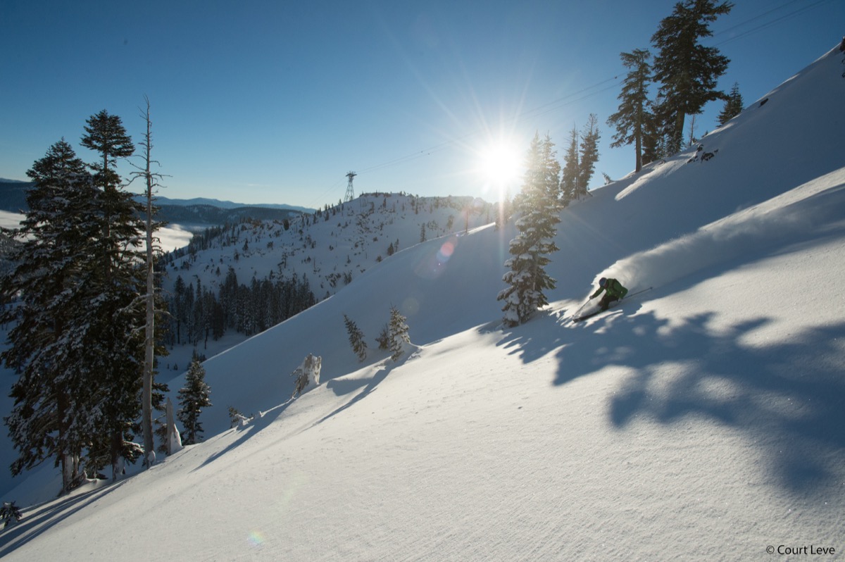
On our jobs, I run the discharge hose into a sediment bag or a straw bale check dam before the water reaches any drainage inlet. The goal is to keep sediment out of the storm drain. If you're on a site with a SWPPP, the dewatering plan should already be in the document. If it's not, you need to add one before you start pumping. The fines for discharging turbid water to a waterway in California can run into the thousands per day. It's cheaper to buy ten sediment bags than to pay one fine.

Worker in hi-vis and a hard hat standing shin-deep in brown water inside a timber-shored trench, shovel in hand, CAT 325 excavator and houses behind
This is what you're trying to avoid. Nobody's laying pipe in that

Timing matters too. If you know the water table is high, plan your dewatering before you dig. Set up wellpoints or have pumps staged and ready. Don't wait until the trench is full and the pipe crew is standing around. On one job near Donner Lake, we started wellpoints two days before excavation. By the time we cut the trench, the ground was dry enough to work in without any sump pumping at all. That two-day lead time saved us three days of fighting water during the pipe installation.

The other option is to rethink the schedule. If you're doing sewer work in an area with a seasonal water table, and you have any flexibility on timing, wait until late summer when the water table drops. In Truckee, the difference between May and August water table levels can be three feet or more. That three feet can be the difference between a dry trench and a full-time dewatering operation. I plan wet-area work for July and August whenever the schedule allows.

Dewatering isn't complicated in concept. Water goes in, pump takes it out. But managing it well — sizing the right equipment, staying ahead of the inflow, keeping the discharge clean, planning for it before you're standing in a flooded trench — is what separates a crew that handles groundwater from one that drowns in it.

Illustration: GPR operator scanning a jobsite at dusk, buried utilities glowing in APWA colors inside an open trench cutaway
3 min read
How to Read Utility Markings Before You Dig

Before any bucket touches dirt, you read the paint. The APWA color code system tells you exactly what's buried under your feet. Miss a marking, hit a line, and your day gets very expensive very fast.

0 views
Read more

Every excavation job starts the same way. Before I fire up the machine, before the crew even grabs a shovel, I walk the site and read the paint. Those spray-painted lines on the ground aren't decoration. They're a map of everything down there, and if you can't read them, you have no business running a bucket.

The system is called the APWA Uniform Color Code, and it's the same across the entire country. Every color means a specific utility. Learn them once and you'll never second-guess what you're digging over.

Conduit runs sweeping into a pair of concrete pull boxes in an open trench at night
Conduit run exposed in an open trench — knowing what's below before you dig keeps the crew safe

Red means electric. Power lines, conduit, cables. Hit a live electric line with a steel bucket and the best case is a blown fuse on a transformer. The worst case is someone doesn't go home. I treat every red mark like it's hot until the utility company confirms it's de-energized. No exceptions.

Yellow means gas. Natural gas, oil, petroleum, steam. A gas line strike can evacuate an entire block. On our jobs in Truckee, the gas lines are usually polyethylene pipe buried about 18 inches. You won't see it until your bucket is already through it. That's why you hand-dig within 24 inches of any yellow mark. Every time.

Illustration of a GPR unit scanning for buried utilities on a jobsite at dusk
When the paint isn't enough, we rent a ground penetrating radar unit through DirtPrep and verify what's down there before the bucket goes in

Blue means potable water. Drinking water mains and service lines. Reclaimed water, irrigation, and slurry lines get purple — you'll see it on landscape jobs. A water main break isn't as dangerous as gas or electric, but it'll flood your trench, shut down the street, and cost you a day of production plus the repair bill. On mountain jobs, water lines can be deeper than you expect because of frost depth requirements.

Green means sewer. Sanitary sewer, storm drain, drain lines. Sewer is usually the deepest utility in the trench, often six to eight feet or more. It runs by gravity, so the alignment follows the slope of the ground. Puncture a sewer main and you're dealing with a hazmat situation, plus the repair, plus the fine from the district.

Orange means telecom. Fiber optic, cable TV, communication lines, conduit. Telecom damage is expensive in a different way. A single fiber cut can knock out service for thousands of customers. The carriers will send you a bill that makes your eyes water. Fiber is fragile and often in shallow conduit, sometimes only 12 inches deep.

White means proposed excavation. This is your outline, your dig boundary. The white paint shows the locator where you plan to work so they know which utilities to mark. If you call 811 and they ask where you're digging, the white paint is the answer.

Pink means survey. Temporary survey markings, property lines, section corners. These are reference points, not utilities. But don't blast through a survey monument. Those are legal markers and replacing them requires a surveyor and a lot of paperwork.

Before every dig, you call 811. That's the law in every state. You call, you give them the address and the scope, and the utility companies send locators to mark their lines. It takes two to three business days in most areas. I've seen guys try to skip this step to save time. It never saves time. One unmarked gas line hit will cost you more than every 811 call you'll ever make combined.

What happens when you hit an unmarked line? First, you stop. Don't move the bucket, don't pull it out, don't try to patch it yourself. For gas, evacuate the area and call 911. For electric, stay on the machine and wait for the power company. For water and sewer, call the utility district. For telecom, call the carrier.

In every case, document everything. Photos, measurements, the 811 ticket number, the location of the markings relative to the strike. If the line wasn't marked or was marked in the wrong location, the locating company bears the liability, not you. But only if you followed the rules. No 811 ticket, no protection.

I've been running excavation in Truckee for years now, and I still walk every set of markings before the first cut. I've caught mismarks, missed lines, and markings that were three feet off. The five minutes it takes to walk the site and compare the marks to the plans has saved me from strikes that would have shut down the job. Read the paint. Every single time.

Five excavator digging buckets of increasing width lined up side by side on gravel at an equipment yard, excavator and loaders in the background
4 min read
Choosing the Right Excavator Bucket for the Job

Wrong bucket on the machine and you're fighting the dirt all day. Right bucket and the trench digs itself. Here's how I pick buckets for every phase of the job, from mass excavation down to final grade.

0 views
Read more

I've watched operators burn an entire shift fighting the wrong bucket. A 36-inch GP bucket on a trenching job where they needed an 18-inch. A smooth-edge cleanup bucket trying to rip through decomposed granite. The bucket is the business end of the machine. Pick wrong and the machine fights you on every cut.

The GP bucket, general purpose, is what most machines wear as their daily driver. All-rounder. Medium width, usually 24 to 36 inches on a mid-size excavator, with teeth for penetration and a curved profile for good rollback. General site work, loading trucks, digging footings, moving mixed material, the GP handles it. Not the best at anything but good enough at everything. On my JD 35G, the 24-inch GP lives on the machine about 60 percent of the time.

Excavator with a curved digging bucket loading out a large open excavation
The all-rounder at work — a general purpose digging bucket handling mass excavation on a big open cut

The trenching bucket is built for one thing: cutting a narrow, clean-walled trench. Usually 12 to 18 inches wide, deeper profile than a GP, with a flat bottom and straight sides. When I'm laying pipe, running conduit, or setting utilities, this is the bucket. The narrow width means less material to move, less spoil piled up on the side, and a tighter trench that's easier to backfill and compact. On utility work, a trenching bucket can double your production compared to digging the same trench with a GP.

Narrow trenching bucket on an excavator arm digging a utility trench in brown soil
A narrow trenching bucket cutting a clean utility trench — narrower than a GP, built for pipe and conduit work

The cleanup bucket, also called a ditch cleaning bucket or grading bucket, is the wide, flat, smooth-edge bucket you use for finish work. No teeth, just a bolt-on cutting edge. Widths run from 36 inches up to 60 inches or wider. This is what you use to grade the bottom of a trench to a precise elevation, clean out a ditch, or do final grading on a pad. The smooth edge gives you a flat, even cut. On GPS-controlled machines, a cleanup bucket paired with the design surface is how you hit grade to a tenth of a foot without a single grade stake.

Wide flat cleanup bucket on an excavator grading the bottom of an excavation
The cleanup bucket — wide, flat, no teeth. Built for finish grading and smoothing the bottom of an excavation to design elevation

The rock bucket is the heavy hitter. Reinforced sidewalls, heavy-duty teeth, sometimes ripper shanks on the back edge. When I'm digging in the Sierra granite, the decomposed stuff that turns into solid rock about four feet down, this is what goes on the machine. The teeth are heavier and sharper so they bite into rock instead of bouncing off it. A rock bucket weighs significantly more than a GP bucket of the same width, so you give up some lift at full reach, but you gain the ability to rip through material that would fold a standard bucket.

Heavy duty rock bucket with large pointed teeth on an excavator breaking through rocky ground on a mountain construction site
The rock bucket — reinforced sidewalls and heavy-duty teeth, ripping through solid rock on a mountain job

The V-bucket, or trapezoidal bucket, is purpose-built for digging V-shaped drainage ditches and channels. The angled sides match the designed slope ratio of the ditch, usually 2:1 or 3:1. Instead of cutting the ditch in multiple passes with a standard bucket, one pass with a V-bucket gives you the full profile. We use them on road drainage work and anywhere the plans call for a shaped swale.

Excavator cutting a drainage ditch across open ground with a ditching bucket
Ditch work in open ground — with a true V-bucket, the angled sides of the profile come out in a single pass

Bucket width drives production more than most operators realize. Go wider and you move more material per cycle, but you need more breakout force and the machine works harder. Go narrower and each cycle is smaller, but the machine cuts easier and you use less fuel. The sweet spot depends on the material. In soft clay, go wide. In rocky ground, go narrow. On a typical utility trench job, I match the bucket width to the pipe diameter plus clearance. Eight-inch pipe gets an 18-inch bucket. Twelve-inch pipe gets a 24-inch. No point digging a trench wider than you need to, because you just have to backfill and compact all that extra.

Quick-couplers changed the game. Before couplers, changing a bucket meant pulling pins with a hammer and a pry bar, 15 to 20 minutes of crawling around under a boom. Now I swap buckets in under a minute without leaving the cab. Hydraulic quick-couplers let you go from a trenching bucket to a cleanup bucket between cuts. That flexibility means I carry three or four buckets on the trailer and match the tool to each phase of the job. Mass excavation with the GP, trench with the trenching bucket, grade with the cleanup, all in the same shift.

One thing I see guys overlook is bucket maintenance. Teeth wear down and lose their self-sharpening profile. A dull tooth means the machine works harder for every cut, burns more fuel, and puts more stress on the linkage. I check teeth daily and replace them before they're worn to the adapter. Cutting edges on cleanup buckets take a beating too. A rolled or chipped edge means you can't hold grade. Replacing a cutting edge costs a couple hundred dollars. Re-grading a pad because your edge was shot costs a couple thousand.

Pick the right bucket, keep the teeth fresh, and the machine does the work. Fight the wrong one and you'll wonder why the job's behind schedule.

Illustration: GPS machine-control setup at elevation — Trimble TSC7 controller, RTK rover, and excavator on a Sierra Nevada jobsite
4 min read
Mountain Construction: Working at Elevation in the Sierra Nevada

Building at 6,000 feet is a different game. The air is thinner, the seasons are shorter, the weather turns on you without warning, and the ground has its own rules. Here's what the mountain teaches you about construction.

0 views
Read more

So, I've been building at altitude for years now. Running excavation jobs in Truckee at 5,800 to 6,200 feet, and the elevation touches everything. Equipment. Materials. People. Schedule. If you've only built at sea level, mountain construction will humble you fast. The rules are different up here, and the mountain doesn't care about your timeline.

Start with the iron. A diesel engine loses roughly three percent of its power for every thousand feet of elevation above sea level. At 6,000 feet, that's close to 18 percent. A 75-horsepower excavator at sea level is running about 62 horses up here. You feel it in the hydraulics. Breakout force drops. Cycle times slow down. The machine works harder for every bucket.

Newer Tier 4 engines with turbochargers compensate better than the older naturally aspirated stuff, but you still notice it. I plan for about 15 percent less production on any machine compared to its sea-level specs. If you're bidding a mountain job using flatland production rates, you're going to lose money.

CAT excavator lifting a boulder out of a trench cut through pavement
Sierra ground fights back — boulders come out of trenches that would be clean digging in the valley

The thin air hits the crew too. Workers coming up from Reno or Sacramento, even just from 4,500 feet, can feel the difference at 6,000. The first few days are the hardest. Guys get winded faster, dehydrate quicker, and fatigue hits earlier in the shift. I keep extra water on the jobsite and watch for signs of altitude sickness in new crew members. Headaches, nausea, dizziness. It's rare at 6,000 feet but it happens, especially when guys are working hard in the sun. Acclimation takes three to five days. By the second week, most people have adjusted.

Concrete is its own challenge at elevation. The lower air pressure means water evaporates faster from the surface, so plastic shrinkage cracking is a real concern. You have to cure more aggressively up here. Wet curing, curing compound, or both.

Temperature is the other factor. Truckee can see 90 degrees in July and freezing temps by September. Concrete needs to stay above 50 degrees for at least 48 hours to develop adequate strength. Pour too late in the season and you're running ground heaters and insulated blankets to protect the slab. I've seen October pours in Truckee where the crew was heating the ground for a week before the trucks arrived and heating the slab for a week after. That's expensive, but a frozen slab is more expensive.

Weather windows are everything. The building season in Truckee runs roughly May through November, and even that's optimistic. Snow can fly in October, and the ground might not thaw until late April. That gives you maybe six solid months to get your dirt work done, foundations poured, and the building dried in. Compare that to the Central Valley, where you can work 11 months out of 12. Every day of production matters more up here because there are fewer of them.

Summer isn't a free pass either. Afternoon thunderstorms roll in almost daily from mid-June through August. By 1 PM, the cumulus clouds start building over the Sierra crest. By 3 PM, you can have lightning, hail, and an inch of rain in 20 minutes. I run my crews hard in the morning because I know the afternoon might get taken from me. When I see the CAPE values climbing above 500 on the morning forecast, I mentally cut the workday to six hours and plan accordingly.

Frost depth drives foundation design. In Truckee, the code-required frost depth is 36 inches. That means every footing, every pier, every foundation wall has to extend at least 36 inches below finished grade to get below the frost line. In Sacramento, it's 12 inches. That difference means deeper excavation, more concrete, more rebar, more time, and more cost for every single structure. A simple deck footing that takes 30 minutes to dig and pour at sea level is a full afternoon up here.

Access is the invisible cost. Mountain roads are narrow, steep, and sometimes unpaved. Getting a concrete truck up a 15 percent grade on a dirt road in spring mud is an adventure. Getting a 50-ton excavator delivered on a lowboy trailer around a switchback with six feet of clearance is a puzzle.

I've had jobs where the access road was the first thing we built, just to get the equipment to the pad. And then in November, the road closes for snow season and your jobsite is locked until May. If you left material or equipment up there, it's sitting under eight feet of snow until spring.

Close-up of heavy tire chains on a loader tire beside a Ruppert Inc. plow blade
Chains on the loader — when the road up is ice or mud, traction is the whole game

Snow load is a design factor you don't think about at sea level. Truckee gets 200 to 400 inches of snow in a normal winter. Roofs up here are designed for 150 to 200 pounds per square foot of snow load. That means heavier framing, steeper pitches, and engineered trusses on everything. A roof design that works in Sacramento will collapse in Truckee. Period.

None of this means you can't build up here. Some of the most beautiful structures I've worked on are in the Sierra. But the mountain demands respect. Plan for less production, shorter seasons, deeper foundations, aggressive curing, and weather that changes faster than you can react. The crews that succeed are the ones that adapt to the mountain instead of fighting it.

Inside the cab of a motor grader running Trimble GPS machine control on a Truckee jobsite — display mounted at the windshield
4 min read
How to Set Up GPS Machine Control on an Excavator

A full walkthrough of GPS machine control setup on an excavator. Base station, RTK corrections, antennas and sensors on the machine, calibration, and what the operator actually sees on the in-cab display.

0 views
Read more

So, GPS machine control changed everything about how I run a grade. I still remember the first time I saw it work on a job. Watching the bucket track a design surface in real time on the in-cab screen, and thinking, this is going to make a lot of grade checkers nervous. It did.

But here's the thing nobody tells you: the system is only as good as the setup. Bad setup means you're chasing hundredths all day and blaming the satellites for your own mess. Here's how I set it up every morning before the bucket hits dirt.

It starts with the base station. The base is a GPS receiver that sits on a known survey point, a benchmark or a control point that's been shot in by a surveyor with a known coordinate and elevation. You set a tripod over that point, level it, plumb it, and power it on. The base locks onto satellites and starts broadcasting correction signals.

It knows exactly where it is, so it can calculate the error in the GPS signal and send that correction to the rover on the machine. Without the base, your GPS is only accurate to about three to ten feet. With it, you're down to about an inch. That correction is called RTK, real-time kinematic, and it's what makes machine control possible at construction-grade accuracy.

GPS base and rover equipment in open hard cases in the shop — antennas, receivers, and cables in foam
Where every setup starts — the GPS kit cased up in the shop. Antennas, receivers, cables, all of it checked before it rides out to the job.

The base broadcasts corrections over a radio link, usually UHF, to the rover on the machine. On a typical excavator setup, the GNSS antennas don't ride the boom — they mount up on the machine body, out of the way of the digging, and give the system position and heading. The boom, stick, and bucket each carry a sensor that reads its angle.

Those angles, plus the machine's measured-up geometry — boom length, stick length, bucket dimensions — let the system calculate exactly where the cutting edge is in three-dimensional space. Every time you move the stick or curl the bucket, the system recalculates. It's doing that math dozens of times per second.

Before you start digging, you run a calibration routine. This is where you check the system against a known point. You set the bucket tooth on a survey hub with a known elevation, tell the system to compare, and see what the offset is. If you're within a tenth, you're good. If not, you troubleshoot.

Common issues are a loose mount on the receiver, a bad satellite constellation that morning, multipath interference from nearby buildings or rock faces, or a base station that didn't initialize properly. I've seen guys skip calibration and end up half a foot off by lunch. Don't skip it.

The in-cab display is where it all comes together. On the Trimble system I run, the display shows a cross-section of the design surface and where your bucket is relative to it. There's a color-coded indicator: red means you're above grade and still have material to cut, blue means you've gone below grade and owe fill, and green means you're on grade within the tolerance you set.

Most finish grading work is set to a half-inch tolerance. Rough grading might be two inches. The display also shows your plan view, so you can see where you are on the site relative to the design, property lines, utilities, and any other layers the surveyor loaded into the model.

Close-up of a Trimble CB460 display in the cab showing a plan view with live cut numbers
Trimble CB460 with live numbers on screen — 0.97 of cut on the left side, 0.93 on the right. The operator sees grade without leaving the seat.

If you saw my vlog on the Cat 335 running Trimble GPS on a guided dig near Lake Tahoe, that's exactly this system in action. That Cat 335 ran dual GNSS antennas, a Trimble TD520 in the cab, and a design surface loaded for a commercial pad. Watching the operator work that machine was like watching someone play a video game, except the stakes are real and the tolerances are tight. The bucket held grade inside a half inch on a pad a hundred feet wide. No grade checker needed. No stakes to chase. Just the machine, the satellites, and the design.

Typical accuracy specs on a well-set-up RTK system are plus or minus one-tenth of a foot horizontal and plus or minus two-tenths of a foot vertical. In practice, with good satellite geometry, a clear sky, and a solid base station setup, I consistently see better than that. But accuracy degrades in certain conditions. Heavy tree canopy blocks satellite signals. Working in a narrow trench between tall buildings creates multipath errors. Rain and heavy cloud cover can weaken the correction link. And if your base station is more than about six miles from the machine, the correction quality starts to drop.

For most jobsite work, none of that is an issue. But when you're pushing the limits of the system, you need to know where those limits are.

One thing people don't talk about enough is maintaining the mounts. Those antenna and sensor mounts take a beating. The machine vibrates, the boom slams, dirt and debris hit everything. A loose mount means a moving receiver, and a moving receiver means your position is bouncing around even when the bucket is still.

I check the mounts every morning as part of my walkaround. If a bolt is loose or a bracket is cracked, it gets fixed before the machine starts. Ten minutes of maintenance saves you a day of chasing bad readings.

GPS machine control isn't magic. It's a well-engineered system that requires disciplined setup and regular calibration. But when it's running right, there's nothing faster or more accurate for moving dirt to a design grade. It cut my staking time to nearly zero, reduced rework by at least half, and let me run grades that pass the first time the surveyor shoots them. If you're running excavation and you're not on GPS, you're working harder than you need to.

Comments

Illustration: excavated pit with labeled bands of decomposed granite, red volcanic rock, and gray clay side by side, CAT excavator and granite peaks behind
4 min read
Soil Types in Sierra Nevada Excavation — What the Ground Tells You

What you actually encounter digging in the Sierra Nevada. Decomposed granite, volcanic rock, clay pockets, glacial till, and how soil type drives everything from bucket selection to production rates in Truckee excavation.

0 views
Read more

So, every time I put a bucket in the ground up here in the Sierra, the dirt tells me a story. It's never the same story twice. You can be digging clean decomposed granite one minute and hit a clay pocket or a boulder the size of a washing machine the next. What's down there decides your bucket, your pace, your compaction plan — and whether you make schedule or spend the day fighting the ground.

Decomposed granite — DG — is the most common material we dig in the Truckee area. It's exactly what the name says: granite that's broken down over millions of years into coarse, sandy, gritty material. Dry, it's dream dirt — cuts clean, doesn't stick to the bucket, and compacts beautifully with a plate compactor or a roller. The grains interlock and you get excellent density numbers without a lot of water or passes.

Wet is a different animal. DG turns into a heavy, soupy mess that sticks to everything and won't release from a smooth bucket. I run a toothed bucket in it almost exclusively — the teeth break it up and the material falls out cleaner than a smooth edge that just smears it.

Volcanic rock is the wildcard. The Sierra Nevada sits on volcanic and granitic geology, and depending on where you're digging you might hit basalt, andesite, or welded tuff. Some of it breaks up with a standard bucket if it's weathered enough. Some of it laughs at you.

I've hit ledges of andesite that stopped a 35,000-pound excavator cold. When you hit solid rock you're looking at a hydraulic breaker, a rock saw, or — if the project allows it — controlled blasting, none of them cheap or fast. The geotech report should tell you what's down there, but I've seen plenty that said "anticipated rippable rock" and then we hit solid ledge at four feet. The ground doesn't read geotech reports.

Clay pockets show up where you least expect them. The Truckee basin is mostly granitic, but clay hides in the low spots — near meadows and old lake beds — and the Martis Valley area is notorious for it. Clay is the opposite of DG in almost every way: it holds water, swells, shrinks, and has almost no bearing capacity when wet.

If you're putting a foundation on clay, you're overexcavating and replacing it with engineered fill. Period. In the trench, clay sticks to everything — the bucket, the teeth, the walls. You'll spend as much time cleaning your bucket as you do digging, so I switch to a clean-out bucket or a wider ditching bucket to move more volume and live with the sticking.

Glacial till is what the glaciers left behind when they carved these valleys — sand, gravel, cobbles, boulders, clay, and silt all jumbled together with no sorting. Digging it is unpredictable by definition. You might pull a bucket of clean gravel followed by a three-foot boulder wrapped in clay. I quote till work at about 60% of my normal DG production rate, and even that's optimistic if the boulders run dense.

Full-size CAT excavator lifting a large boulder out of an open trench
A boulder coming out of the trench — the ground doesn't warn you first

Elevation changes the ground itself. At 6,000 feet in Truckee, winter frost can drive 36 inches deep or more, and that frozen layer digs like concrete until it thaws. Even in late spring you'll hit frost pockets on north-facing slopes that never see direct sun.

The thaw cycle is the sneaky part — it leaves a wet, unstable layer between the frozen ground and the surface that fails slopes and collapses trench walls. I won't dig a trench on a north-facing slope in April without probing the thaw with a bar first. Bar stops at 18 inches? You're still frozen. Wait or plan for it.

Water table depth is the other elevation factor. In the Truckee basin it can be surprisingly shallow, especially in spring when snowmelt is recharging the aquifer. I've hit groundwater at three feet on sites where the geotech said eight — because the report was done in September and I'm digging in May.

When you hit water, everything changes. You need a dewatering plan — pumps, maybe a sump or a wellpoint system. You can't compact saturated soil, you can't hold a trench wall in saturated sand, and you definitely can't pour a footing in standing water. Know your water table before you break ground.

Soil drives your grade control too. DG holds a grade once it's compacted — cut it to a tenth with GPS and it stays where you put it. Clay moves: it shrinks when it dries and swells when it gets wet, so a grade you cut today might be a half inch off next week.

Till with cobbles is the hardest to cut. The edge bounces off rocks and the grade jumps around on the display, so in rocky till I'll cut rough grade with the machine, then check with a laser and a rod and hand-trim the last couple inches. Slower, but it's accurate.

Reading the ground is a skill that takes years. The color, the texture, the smell, the way it sounds when the bucket hits — all of it tells you something. Dark soil means organics you're going to overexcavate. Red or orange streaks mean iron, which means water's been moving through.

Smooth, shiny trench walls mean clay. Gray, gritty material that crumbles in your hand — that's your DG. Learn to read it and the ground tells you everything before the lab results come back.

Comments

Grading plan sheet rolled open on a truck hood — contour lines and ditch sections marked up with pencil and highlighter, excavators working behind
3 min read
How to Read a Grading Plan — Field Guide for Excavation Crews

Contour lines, cut and fill, slope ratios, bench marks, utility callouts. I read these every day in the dirt — this is how the sheet actually works.

0 views
Read more

So, every set of construction plans has a grading plan in it, and if you're running excavation you'd better know how to read one. Nobody teaches this well. Most guys learn it by osmosis, one stake at a time. Here's how I break it down with the plans rolled out on the hood of the truck.

First thing you look for is the bench mark. That's your reference point for every elevation on the sheet — a fixed, known point like a survey monument, a manhole rim, the top of a fire hydrant. Something that won't move. It'll have an elevation listed next to it, something like BM = 5,842.50, and every other number on the plan is relative to that point. Lose the bench mark or knock out the survey hub and you're flying blind. Protect your bench marks like they're made of gold.

GPS survey kit in open hard cases in the shop — Trimble antennas in foam, cables, grade rods and tripods on the wall
Where every setup starts — the GPS kit cased in the shop, grade rods on the wall. Every elevation on the plan runs through this gear

Contour lines are the curved lines that show you the shape of the ground. Each line represents a specific elevation. When the lines are close together, the ground is steep. When they spread apart, the ground is flat. Existing contour lines are usually dashed. Proposed contour lines, the ones you're building to, are solid. The interval between lines is noted in the legend, usually one foot or two feet depending on the scale. Read that legend before you start interpreting anything.

Cut and fill is where the money is. Cut means you're removing material. Fill means you're adding it. The engineer will often show cut areas with one hatch pattern and fill with another. Some plans use color, red for cut and blue for fill, or they'll just call out spot elevations and let you do the math. Existing grade minus proposed grade: positive number means cut, negative means fill. When I walk a site before we start, I'm doing that math in my head at every stake, building a picture of where the dirt's going to move and how much of it there is.

Slope ratios show up as numbers like 2:1 or 3:1. That's horizontal to vertical. A 2:1 slope means for every two feet you go out horizontally, the ground drops one foot vertically. Steeper slopes like 1.5:1 or 2:1 need compaction and might need erosion control. Flatter slopes like 4:1 are usually for areas that get mowed or driven on. If the plan calls for a 2:1 and you cut it at 1.5:1, that slope's going to fail, and it's going to be your problem.

Utility callouts are the lines and symbols that show you where the underground infrastructure goes. Water, sewer, storm drain, gas, electric, communications. Each one has its own line type. Solid, dashed, dot-dash, each means something different. The plan should have a legend telling you which is which. Pay attention to the invert elevations — that's the elevation at the bottom of the pipe, not the top. When you're digging a trench for a sewer line, the invert is what matters because that's what sets your grade for flow. Miss it by two inches and the pipe doesn't drain. Get it right and the inspector signs off the first time.

Illustration: gloved hands holding a Trimble TSC7 controller with a cut/fill heatmap on screen, RTK rover pole and excavator behind
GPS grade control has replaced a lot of the staking, but you still have to read the plan

Spot elevations are individual points on the plan with a specific elevation called out, like FF = 5,844.00 for a finished floor or TC = 5,843.25 for top of curb. These are your targets. When I'm running GPS on the machine, those spot elevations are loaded into the design surface and I can see them on my in-cab display in real time. But even without GPS, you need to know where those numbers are on the paper and how they relate to each other.

The last thing I check is the drainage pattern. Water flows downhill, and the grading plan should show you exactly where it's going. Look for the drainage arrows, the valley lines between high points, and the locations of catch basins, area drains, and outfalls. If the finish grade doesn't drain the way the plan shows, you're going to have standing water, erosion, and a callback. Grade for drainage first, everything else second.

Reading a grading plan isn't hard once you know what to look for. But you have to actually look. I've seen crews start cutting without reading the plan and end up three feet off because they assumed instead of checked. Don't assume. Find the bench mark, check the contours, run the cut/fill numbers, then start digging. The plan is the map. Treat it like one.

Comments

Operator's view from the cab at night — heavy snowfall burying a lit village entrance, hi-vis glove on the controls
3 min read
Mountain Weather and Construction: GO/NO-GO Calls

How we use an 8-model forecast ensemble to make daily GO/NO-GO calls on the jobsite. What triggers a weather hold, why mountain forecasts are different, and how we protect the crew and the grade.

0 views
Read more

So, every construction crew deals with weather. But running excavation in the mountains is a completely different game. Down at sea level you check the forecast, see rain, make a call. Up here at 6,000 feet the forecast might say 20% chance of showers and you end up under a full thunderstorm by 2 PM with zero warning from the morning sky. That's why we built a system for it. No more guessing.

We run an 8-model forecast ensemble that pulls data from the major weather models: GFS, ECMWF, NAM, HRRR, NBM, and a few others. Each model has strengths and blind spots. The GFS is good for broad patterns but misses mountain-scale detail. The HRRR updates every hour and handles convective storms better than anything else out there. The ECMWF is the best global model running but sometimes lags on fast-developing Sierra systems. By stacking them together and looking at where they agree and disagree, you get a much clearer picture than any single forecast gives you.

The GO/NO-GO call happens before the crew leaves the yard. I'm looking at precipitation probability, wind speeds, lightning risk, and ground conditions from the previous 48 hours.
Here's what triggers an automatic NO-GO: sustained winds over 35 mph, which is a crane and rigging safety issue and makes dust control impossible. Any lightning in the forecast within the work window. More than half an inch of rain expected during the shift, because at that point you're not grading, you're making mud. And if the ground is already saturated from recent storms, even a light shower can turn a jobsite into a skating rink for tracked equipment.

The tricky calls are the ones where the models disagree. Three models say dry, two say afternoon showers, three are somewhere in between. That's where experience matters more than data.

I look at the upper-level pattern. Is there a trough moving through? What's the freezing level doing? Is there moisture streaming in from the Pacific or are we under a ridge? If the HRRR is firing up convective cells over the Sierra crest by 10 AM in the model run, I take that seriously even if the GFS says clear skies. The HRRR sees what the bigger models miss at mountain scale.

We also watch soil temperature and recent precipitation totals. After a wet period, even a sunny day might be a NO-GO if the subgrade hasn't had time to dry. You can compact wet soil all day and it'll fail the density test every time. Better to wait a day and do it right than burn fuel and hours on work that won't pass inspection. The moisture content of the soil matters as much as what the sky is doing.

Whiteout snowfall burying a green building — truck mirror in the foreground reflecting a snow-covered loader
Some days the mountain makes the call for you

Mountain weather is different from valley weather for one simple reason: terrain forces air up. When moist air hits the Sierra, it rises, cools, and condenses. That's why Truckee can be sunny at 8 AM and getting hammered by 1 PM on a day the Sacramento forecast called partly cloudy. The mountains create their own weather. If you're not accounting for that in your planning, you're going to get caught.

The system we use gives the crew a morning briefing with a confidence rating. High confidence GO means every model agrees, skies are clear, ground is dry, we're running all day. Marginal GO means conditions are workable but we might need to pull early. Weather hold means we're watching conditions and will reassess by a certain time. Full NO-GO means the machines stay parked.

The crew knows the system, trusts it, and doesn't waste time arguing about weather at 6:15 in the morning. The data makes the call.

Ski racing taught me this. You don't send a racer down a course in conditions you haven't assessed. You inspect, you measure, you check the snow, the wind, the visibility, and then you make a call. Same discipline applies to running a jobsite. The forecast is your course inspection. Treat it like one and you'll keep your crew safe, your schedule on track, and your grade intact. Run your own GO/NO-GO check on the crew weather dashboard, or dig into the full 8-model Sierra weather platform for the raw data.

Comments

Lightning striking behind a dark storm cell over a Sierra ridge — CAT excavator, loader, and haul truck parked below among traffic cones
3 min read
Truckee Summer Storm Season: What Construction Crews Need to Know

Sierra Nevada summer thunderstorms are fast, violent, and unpredictable. CAPE values, afternoon instability, lightning safety, and when to pull crews off the grade.

0 views
Read more

So, if you run a crew in Truckee between June and September, summer thunderstorms are part of the job. They're not valley rain. They build fast, hit hard, drop lightning on ridgelines and open ground, and disappear in an hour — jobsite soaked, sky blue again like nothing happened. Knowing how they work isn't optional up here. It's a safety issue.

The thing driving Sierra summer storms is something called CAPE. Convective Available Potential Energy. Sounds like a weather nerd term and it is, but it matters on the jobsite. CAPE measures how much energy is loaded in the atmosphere for air to rise fast and build thunderstorms. Under 500 J/kg, you're usually fine. Stable air. Once it climbs above 1,000, storms can fire. Above 2,000 and you're looking at severe cells, heavy rain, hail, dangerous lightning. I check CAPE every morning. It's one of the first numbers I look at before the crew leaves the yard.

The pattern in Truckee is predictable in its general shape even if the specifics change daily. Morning starts clear and cool. The sun heats the ground, the ground heats the air above it, and that warm air starts rising. By late morning the cumulus clouds start building over the ridgelines. By early afternoon those clouds are towering, and if there's enough moisture and instability in the atmosphere, they go vertical and become cumulonimbus, full thunderstorm cells. The typical window for summer thunderstorms in the Truckee area is between noon and 5 PM, with the peak risk around 2 to 3 PM.

Afternoon cumulus clouds building over the Sierra Nevada mountain ridgeline in summer
Cumulus stacking up over the crest — the warning sign every foreman up here learns to read

Lightning is the primary danger for construction crews. When you're standing on open ground next to a steel excavator, you're the tallest conductive path in the area. OSHA doesn't have a specific lightning standard, but the National Weather Service 30-30 rule is the baseline: if the time between a flash and the thunder is 30 seconds or less, the storm is within six miles and you get off the ground. Wait 30 minutes after the last flash before going back. That's the rule and we follow it. No exceptions. No waiting to see if it passes. When I hear thunder, the crew's already moving to vehicles.

The tricky part in the Sierra is that storms can develop directly overhead with very little advance warning. In flat terrain you can see a storm building 30 miles away and watch it approach. In the mountains, a cell can form on the backside of a ridge and be on top of you before you've heard a single rumble. That's why the morning forecast matters so much. If the models show CAPE above 1,000 and the HRRR is firing convective cells in the afternoon run, I build that into the day's plan. We front-load the critical work. Grade checks, compaction tests, anything that needs people on the ground in open areas, that happens before noon. Afternoon work shifts to tasks that can be paused quickly or done near cover.

Rain itself is a separate problem. A summer thunderstorm in Truckee can dump half an inch in 20 minutes. That's enough to turn a freshly graded pad into a rutted mess if equipment is still tracking across it. Trenches fill with water. Slopes that were just compacted start sheeting runoff. SWPPP controls get tested in a hurry. If you have silt fencing and wattles in place, great. If you don't, you're going to have a sediment problem and a conversation with the inspector you don't want.

Flash flooding is real in the Sierra even in summer. The soil up here is a thin layer of decomposed granite over bedrock. DG drains fine in a normal rain, but a cloudburst outruns it — the ground can't take water in that fast, so it sheets downhill into whatever low point exists. If your trench is the low point, you've got a problem. We always check drainage paths before a storm window and make sure the site can handle a burst of heavy rain without trapping water where people are working.

The best thing you can do as a foreman is build storm awareness into the crew culture. Everyone should know the signs: towering cumulus that starts going dark on the bottom, a sudden wind shift, a drop in temperature, the smell of rain in the dry air. By the time you hear thunder it's already close. The guys who've been through a few Sierra summers know the drill. The new guys need to learn it fast. One close lightning strike on a jobsite is usually enough education for a lifetime, but I'd rather they learn from the briefing than from the bolt.

Comments

VLOG SHORT

Cat 335 Running Trimble GPS — Guided Dig in Lake Tahoe

A Caterpillar 335 running full Trimble GPS machine control on a guided dig in Lake Tahoe. Here's what a guided dig actually is, how the system works, and why it matters when you're cutting grade in the Sierra.

0 views
Read more

So, this is what it looks like when an excavator knows exactly where it is in three-dimensional space — down to about an inch — in real time while it digs. If you've never seen a guided dig before, watch the video, then let me walk you through what's actually happening in that cab.

A guided dig means the excavator is equipped with a GPS/GNSS machine control system that shows the operator exactly where the bucket teeth are relative to the design grade surface at all times. The in-cab display gives you a live cross-section of the ground, the design surface from the engineered plans, and your bucket position overlaid on top of it. You can see exactly how much material needs to come out, where you're cutting into grade, and where you still owe fill. No guessing. No eyeballing it. The machine tells you precisely where you are relative to where you need to be.

Close-up of a Trimble CB460 display in a machine cab showing a plan view with live cut numbers
A Trimble grade-control display in one of our machines — plan view, live cut numbers, no grade checker required

The way Trimble sets this up on an excavator like the 335 is with dual GNSS antennas mounted on the machine body, up out of the digging, while the boom, stick, and bucket carry angle sensors. The antennas talk to GPS and GLONASS satellites overhead, and a base station set up on a known survey point nearby sends real-time kinematic corrections — what we call RTK — to tighten the accuracy from a couple of feet down to about an inch. The system knows the exact geometry of the machine — boom length, stick length, bucket dimensions, all of it — so when you combine the satellite position, the RTK correction, and the angle sensors, the computer can calculate exactly where the tip of your bucket is at any given moment.

The in-cab display is a Trimble unit, usually a TD520 or similar, mounted right where you can see it without taking your eyes off the work for more than a second. It shows you a color-coded cut/fill map: red means you're above grade and still cutting, blue means you've dug below grade and owe fill. When the screen goes green you're on grade. That color feedback is instant. You move the bucket a quarter inch and the display updates. It's like having a grade checker standing in the trench with a laser level at all times, except this one never takes a break and never misreads the rod.

The Cat 335 is a solid mid-size excavator for this kind of work. You're looking at roughly 80,000 pounds operating weight, a reach that handles most utility trench depths and foundation work without issue, and enough power to move material in the kind of ground we deal with around Tahoe. And up here, the ground is no joke. You hit decomposed granite, you hit rock, you hit volcanic material that doesn't want to move. The 335 has the muscle to work through that while the GPS keeps every cut precise.

Inside the cab of a motor grader running Trimble grade control — display mounted at the windshield, lever banks and steering wheel in frame
Grade control from the operator's seat — the display sits right in your sightline, so your eyes barely leave the work

What a guided dig changes on the job is significant. Without GPS, you're relying on grade stakes set by a survey crew, a laser level in the trench, and a grade checker calling out readings while the operator adjusts. That works, and it's how we did it for decades, but it's slow. Every time you need a grade check the work stops. The surveyor has to come back out to re-stake if anything gets disturbed. And the margin for human error — misreading a cut sheet, pulling a measurement off the wrong benchmark — is always there.

With the guided dig, the operator is self-sufficient on grade. I can see the design surface on my screen, I can see my bucket position, and I can cut to within a tenth of a foot on the first pass. That means fewer re-digs, less over-excavation, less wasted material that has to be hauled off or backfilled, and faster production overall. On a job where you're moving thousands of yards of material, the savings in time and backfill costs add up fast. It also means less fuel burned because you're not making unnecessary passes, and less wear on the machine.

Running GPS at elevation around Lake Tahoe adds its own variables. The terrain is steep, the ground conditions change every fifty feet, and you're working at 6,000-plus feet where ridgelines and tree cover can eat into your sky view. But a clean base setup handles that. As long as the base sits on a known point with good sky visibility, the corrections stay tight and the system performs. I've run guided digs in conditions where you couldn't see the bottom of the trench from the cab and the GPS still had me within spec.

Full PPE on site as always. Hard hat, high-vis vest, steel toes, safety glasses. The GPS doesn't change the safety requirements, it just makes the finished product more precise. That's what a guided dig looks like in the field — the Cat 335, Trimble GPS, and a design surface the machine follows in real time. This is how modern excavation gets done. See the full fleet and specs on the equipment page, and browse the field-tested tools that run alongside the iron.

Comments

VLOG 4:42

Winter X-Games 2010: Ski Cross — Full Race Footage

Full ski cross race footage from the 2010 Winter X-Games in Aspen. Four riders, one course, no second chances. This is what competitive SX looked like before I carried the flag in Vancouver.

0 views
Read more

Dug this one out of the archive. Winter X-Games, Aspen, January 2010. Ski cross. Four of us in the gate and about ninety seconds to figure out who wants it more.

Ski cross is the only discipline where you race wheel to wheel. No time trials, no split screens. You're right there next to three other riders coming off the start, jockeying for position into the first turn, making decisions at 60 mph you can't take back. Contact happens. Crashes happen.

The course is built with rollers, jumps, banked turns, and flat sections designed to separate riders and punish anyone who isn't precise. You can be the fastest skier on the hill and still lose if your line is off by a foot going into a compression.

What people don't see on TV is how physical it is. SX is a full-body sport. Your legs are burning from absorbing terrain at speed, your core is locked in because any time you get loose you lose time, and your arms are driving the poles and managing balance through features that are throwing you around. A 90-second race run feels like a three-minute sprint when your quads are on fire at 9,000 feet in Aspen.

I was representing Jamaica at this point. Had been on the FIS circuit, qualified through the rankings, earned my spot. People always want the novelty angle on that, the Jamaican on snow. But there was nothing novelty about the training.

Errol Kerr carving a groomed run in the Jamaica green and yellow
The green and yellow on fresh corduroy — edge control is edge control, race day or not

I came up through the U.S. Ski Team development system, trained on the same mountains as the Americans, the Canadians, the Swiss. The flag was Jamaica but the preparation was world class. By the time I got to Aspen for X-Games I had hundreds of race starts behind me and I knew exactly where I stood in the field.

This footage is raw. You can hear the crowd, you can see the course, and you can watch how a ski cross heat actually unfolds from start to finish. The start is everything. If you're a half second late out of the gate you're chasing for the rest of the run, and in SX there's no catching up once someone has the inside line into the first bank. I studied those gates like I study grade stakes now. Every detail matters when the margin is that small.

Two weeks after this I was in Vancouver carrying the Jamaican flag in the opening ceremony. Finished ninth in the Olympic ski cross event. Not a medal, but top ten in the world in a discipline making its Olympic debut. I'll take that every day of the week.

Errol Kerr carrying the Jamaican flag into BC Place at the Vancouver 2010 opening ceremony
Into BC Place with the flag — Vancouver 2010

I keep this footage around because it reminds me that speed without control is just noise. Same lesson applies on a ski course at 60 mph and on a jobsite running a track loader at 6,000 feet. Read the terrain, hold your line, stay precise. The arena changed but the mentality didn't.

Comments

Illustration: annotated spec-card render of a CAT 299D XHP compact track loader parked on a graded pad at dusk, engineering callouts over snow-capped peaks
3 min read
The Longest Days: What 15 Hours of Daylight Does to a Dig Season

Mid-June in the Sierra means the sun is up before you are and it doesn't quit until after nine. What the longest days of the year look like when your office is a trench in Truckee.

0 views
Read more

So, the solstice is this week, which means Truckee is running on about fifteen hours of daylight right now. Sun comes up around 5:30, doesn't fully quit until after 8:30 at night. For most people that means longer evenings on the patio. For a construction crew it means the clock just got a whole lot more generous, and we're going to use every minute of it.

There's a window in the Sierra that only opens once a year. The ground is finally dry from snowmelt, the frost is out of the soil, permits are moving, and now the sun is giving you the most working light you'll get all season. Mid-June through mid-September is when everything real gets built up here. Miss it and you're scrambling against short days and early snow before you know what happened. So when the window is wide open like it is right now, you run.

My alarm goes off at 5:30. In the truck by 6:15, coffee in hand, running through the day's plan in my head. On site by 7:00, walking the grade before the full crew gets rolling, checking what the overnight temps did to the ground, making sure nothing shifted. From there it's a full sprint. Normal day we're wrapping up by 3:30. On a push, maybe 5:30 if the job demands it and the crew has the legs for it. People ask me how long my workday is and I tell them it depends on the job, not the clock.

Inside a motor grader cab — steering wheel, lever banks, and a Trimble grade-control display mounted at the windshield, operator visible in the mirror
The office for the next three months — grade control at the windshield and a full day of light through the glass.

The heat is real but different up here. We sit at almost 6,000 feet, so the air is thin and the UV is no joke even when the thermometer only reads 82. Sea-level guys visit a Truckee jobsite in July and can't figure out why they're cooked by noon. It's the altitude. The sun hits harder and the thin air doesn't cool you the same way.

Hydration isn't optional — it's infrastructure. I go through a gallon of water before lunch most days, and if a guy on the crew isn't drinking, I notice and I say something. Heatstroke at elevation sneaks up on you faster than people think.

But here's the thing about these long days that makes all of it worth it. You can actually see the progress. In winter, between the short light and the weather delays, a week of work might move the needle an inch on the schedule. In June, a single good day can change the shape of a jobsite.

Trenches get cut, pipe goes in the ground, backfill gets compacted, and by the time that 8:30 sunset rolls around you're standing on a site that looks fundamentally different than it did at sunrise. That feeling never gets old. Sixteen years of running equipment and I still get a kick out of looking back at a day's work and thinking yeah, we moved some earth today.

Illustration: annotated spec-card render of a John Deere 35G mini excavator at dusk — reach, dig-depth, and weight callouts over snow-capped peaks
The 35G, spec-card style — the small machine that carries a big share of the season.

The other thing the long days do is compress your personal life into these weird little pockets. Lindsay has figured out the rhythm by now. Dinner is late. Weeknight plans don't exist between June and October. Saturdays I try to protect but the job doesn't always cooperate.

It's the trade-off for living in a place where the off-season actually means something. When November hits and the snow flies, the machines get parked and the pace changes completely. But right now, in the thick of it, the days are long, the work is good, and the Sierra is letting us build.

I remember racing ski cross in June. The season was over, the competitive circuit was done, but we'd still be on snow somewhere in the southern hemisphere or up on a glacier doing camp turns and staying sharp. The mentality was the same: when conditions are right, you train. You don't waste good snow and you don't waste good weather. The mountain gives you a window, you use it. That lesson didn't come from a textbook. It came from showing up every day the conditions allowed and not quitting until they didn't.

So if you're driving through Truckee this week and you see a crew still out at five in the afternoon, that's not overtime. That's a push day, getting it done while conditions allow. The longest days are the most valuable days, and we've got about three months of them left before the Sierra starts reminding us who's really in charge. I plan to make every one of them count.

Comments

Two banks of Völkl skis stored flat on ceiling-mounted rails above the garage doors
10 Photos 2 min read
Garage Ski Storage Build: From Pile to System

Every ski family in Truckee has the same problem — a garage full of gear and no plan. How I built a ceiling-mounted ski rack system that actually works, and what I'd do differently.

0 views
Read more

So, if you live in the Sierra and you ski, your garage is a disaster. I know because mine was. Skis leaning against the water heater, poles tangled behind the snowblower, boots in a pile by the door where they'd freeze solid overnight. Every morning before first chair was a ten-minute excavation project just to find matching gear. Finally got tired of it and built something.

The goal was simple. Every pair of skis in the house up and out of the way, and the floor completely clear so I can still park and still get to the workbench without climbing over a yard sale of Völkls.

The racks are steel rails on strut hangers, mounted overhead in the dead space above the garage door tracks. Every garage has that space and almost nobody uses it. Everything is lagged into solid framing — not drywall, not toggle bolts. A loaded rack is heavy, and anything that lets go up there lands on something expensive. Pre-drilled, sank 3/8-inch lags, loaded it up. That rack isn't going anywhere.

Skis racked flat against the ceiling above both closed garage doors
Both banks from below — the skis live in space nothing else could use

Each pair rides flat across two rails, bindings down, edges separated so they don't chew each other up. The skis stay off the ground, dry, and out of reach of everything that moves down below.

The rails aren't the whole system either. Overhead mesh platforms took everything that used to colonize the floor — bins, boxes, the stuff you touch twice a year. Same rule up there: the ceiling works for a living, the floor is for machines.

Overhead storage platform, workbench, and track-drive snowblower in a cleared garage bay Open garage bay with overhead storage platforms, a snowblower staged by the door, and a snowy driveway outside Honda track-drive snowblower parked on a clear floor beneath overhead storage platforms

What I'd do differently next time: wider spacing between pairs. I packed them tight to maximize capacity and it works, but pulling a pair out of the middle is a two-hand operation. Another inch per slot would make the grab-and-go smoother. Also, I'd add a dedicated wax station. Right now I do edge work on the regular workbench, which means clearing tools every time. A fold-down table on the opposite wall would fix that.

Wide view of the garage with skis on ceiling racks, overhead platforms, workbench, and a golf simulator corner
One room, every season — skis on the ceiling, golf sim in the corner, snowblowers by the door

Total build time was about six hours across two weekends. Materials ran around $180 in rails, lags, and hardware. The most expensive part of the whole thing was the beer afterward. If you have a drill, a stud finder, and a level, you can do this in a day. No welding required, though I did think about fabbing the whole thing from scratch just because I could. Lindsay talked me out of it. She was right.

Black BMW X5 parked inside the garage with a Honda snowblower staged in front and overhead platforms above
Car fits, snowblower clears, nothing leaning on anything. That was the whole brief.

The real payoff is the morning routine. Walk in, grab skis, grab poles, grab boots, walk out. No digging, no untangling, no knocking over the snowblower. That alone was worth every lag bolt.

Workbench with wall-hung tool chest, drill rack, and stacked toolboxes beside the golf-sim enclosure Garage corner shelf with a jobsite radio and rotary laser above the bins Garage bay with one door open, cleared floor, and workbench and ladders along the back wall

Comments

John Deere mini excavator with KERR lettering loaded on a dump trailer in a dry high-desert yard
2 min read
Thin Air, Heavy Iron: Running Equipment at 6,000 Feet

Altitude doesn't care how new your machine is. What the thin Sierra air actually does to a diesel, and the field habits that keep you out of the shop.

0 views
Read more

People think a machine runs the same everywhere. It doesn't. Truckee sits at almost 6,000 feet, and every engine I've ever put to work up here gives back a little less than the spec sheet says. Thin air is the tax you pay for the view, and the dirt doesn't grade itself any easier because the scenery is nice.

Start with power. Less oxygen up here means less burn, and a naturally aspirated diesel loses roughly three percent of its output for every thousand feet of elevation. Do that math on a small loader or a mini ex and you're already down close to a fifth of the muscle the sticker promised before you ever touch a lever. Turbos claw most of it back by force-feeding air, but they work harder to do it, and harder means hotter. Keep that in your head when you're sizing a job or wondering why the machine feels lazy pushing up a grade.

Illustration: CAT 299D XHP compact track loader spec-card render with engineering callout labels, dusk light and snow-capped peaks behind
The 299D XHP — 110 horses on paper. Up here you never quite get all of them.

Then there's the cold, even in June. Summer mornings in the Sierra still drop into the 30s. Cold diesel is thick, cold hydraulic fluid is thicker, and dropping a stiff machine straight into a hard cycle is how you cook seals and shorten a pump's life.

Let it idle and come up to temp. Cycle the hydraulics with no load a few times until everything moves smooth and quiet. Five minutes of patience beats a five-figure pump every single time.

Cooling is the one that bites people. Thinner air carries less heat away, so your radiator is already at a disadvantage before Sierra dust and pollen pack the fins solid. Blow them out, then check them again that afternoon. A clogged cooler at altitude on a hot day is how you end up watching a machine steam in the middle of a dig instead of finishing it.

Same story with air filters out here. This dry, dusty ground eats them faster than anywhere I've ever worked, so carry spares and check them more than you think you need to.

Fuel and batteries close it out. With our temperature swings, condensation is real, so top the tank at the end of the day, not the start. Less empty space means less room for water to collect overnight in the bottom of your tank.

And a battery that limps through a cold morning is telling you it's done. Swap it before it strands you on the busy day, not after.

Illustration: John Deere 35G mini excavator spec-card render with engineering callout labels, dusk light and snow-capped peaks behind
The JD 35G — small diesel, no turbo to claw the power back. Watch the exhaust.

None of this is fancy. It's grease guns, clean filters, and giving the machine a minute before you ask it for everything. The altitude is going to take its cut no matter what you do. Your only job is to make sure you don't hand it any extra. Treat the iron right up here and it'll put down clean work all season long. Treat it like sea level and the mountain will find the weak point for you, usually at the worst possible time.

Comments

Illustration: CAT excavator parked on a high granite bench at sunrise, fog filling the valley below
2 min read
The Mountain Sets the Schedule

Up here the mountain sets the pace. What ski racing taught me about patience, timing, and waiting for the ground to say go.

0 views
Read more

Up here at 5,820 feet, you don't pick the day. The mountain picks it for you. June in Truckee is when the snow finally lets go and the ground turns workable, and every spring I get the same reminder. The calendar on the wall means nothing next to the one written in the dirt.

I learned this long before I ever ran a machine. Ski cross taught me that you can't force a start. You can be the strongest guy in the gate and still lose if you commit half a second before the course is ready for you. Timing beats power almost every time. The racers who lasted were the ones who knew how to wait for the right moment, then take it without hesitation.

Excavation runs on the same rule. You can't grade saturated ground. You can't trust a slope that's still holding meltwater. Push a job before conditions are right and the Sierra makes you do it twice. So you read the sky, you check the soil, and you let the work tell you when it's ready instead of the other way around. That isn't slacking. That's the discipline nobody puts in a highlight reel.

People mistake patience for sitting still. It isn't. Patience is staying ready while you wait. All winter, with the snow on the ground, I was in the shop welding, fixing what broke last season, getting gear set so the day the ground opened up we could move without scrambling. The waiting is where the real work hides. By the time conditions line up, you've either prepared or you haven't, and the mountain can tell the difference.

Errol Kerr carrying the Jamaican flag into BC Place at the Vancouver 2010 opening ceremony
Vancouver 2010 — years of staying ready for one walk into BC Place

There's a bigger version of this lesson coming for me. Lindsay and I have a boy on the way later this year, and if anything's going to arrive on its own schedule instead of mine, it's a kid. I can't rush that either. All I can do is be ready, the same way I get ready for dig season. Sharpen what I can control. Make peace with what I can't.

That's the trade you make living in the Sierra. The weather's the boss. It doesn't care about your timeline, your invoices, or your plans for the weekend. But if you respect it, if you learn to read it and move when it gives you a window, it'll let you build things that last. The structures that survive up here get built by people who waited for the right day and then didn't waste it.

So I'm not in a hurry. The ground's finally ready, the machines are running, and the season's open. I spent the winter getting set for exactly this. Now it's time to put down clean work while the window's good, because up here you never know how long it'll stay open.

Comments

Skier dropping into a steep rocky chute between snow-covered boulders on a bluebird day, groomed runs far below
1 min read
Still Climbing: What the Mountain Taught Me About the Long Game

The racing ended years ago. The discipline didn't. It shows up every morning I climb into the cab.

0 views
Read more

Some people know me from the 2010 Vancouver Olympics — Jamaican flag bearer, ninth in ski cross, the best Caribbean finish at a Winter Games. Others found me on the cover of Ski Magazine, or in the Warren Miller films. All of that still matters. None of it is the finish line.

What ski cross taught me is that speed without control is just noise. You read the terrain, you commit, and you hold your line when the course gets rough. That lesson followed me off the mountain and into the work I do now, running heavy equipment and building things that have to stand up to real weather and real load.

The Olympics gave me a stage. The films gave me a story. The cover gave me a moment. The discipline behind all of it is what I actually carry forward. Every day I get to point that same focus at a different kind of slope.

Skiers carrying their gear up a rocky ridgeline high above Lake Tahoe
Still climbing. If you want the good line, you hike for it.

I'm still the kid who moved to Truckee and decided the impossible was worth chasing. The gear has changed. The drive hasn't. If you've followed any part of this ride, thank you. The best chapters are the ones still being written, and I plan to keep building them one clean line at a time.

Comments

Stay in the Loop

Never Miss a Post

New content drops weekly. Field stories, project videos, photo dumps, and hard-won lessons from Truckee. Follow along on Instagram so you never miss a post.

Instagram

@errolkerr
2,800+ followers · Mountains, machines, and the work in between
Follow on Instagram →

File selected from your device. Send it to Errol via email or save it to your camera roll.

Email to Errol

Create Vlog Post

Upload your video to YouTube, then paste the URL here. This ensures your vlog works across all browsers and devices.

Paste a YouTube link below to preview
Auto-Generated Writeup

Enter a title and description above to generate a technical writeup.

Creator Access

Enter the 4-digit PIN to unlock uploads and post management.

Manage Posts

Delete this post?

Deleted Posts